Breaking the Curse

For the past six weeks or so we’ve been cursed with contrary winds. It seems we’d plan a paddle and the wind we experience was not what was predicted. It seemed as if the wind gods were playing havoc with us. We’ve been attributing this curse to Alan, one of our paddling buddies, since he was the one that was planning the paddles. We even devised a plan where we would send Alan off in one direction hoping he would serve as a decoy so the rest of us could paddle on calm water.

But on Thursday afternoon July 7, following a lovely paddle, we gathered at the Up and Under Pub where we shared a toast and declared the that we had broken the curse.

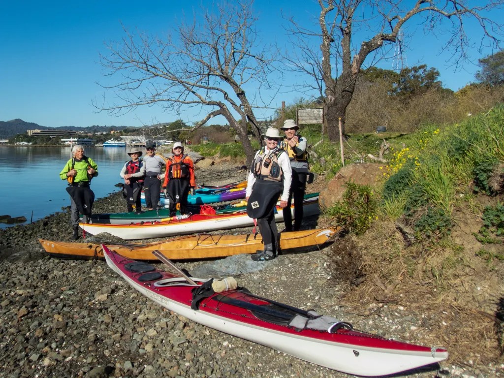
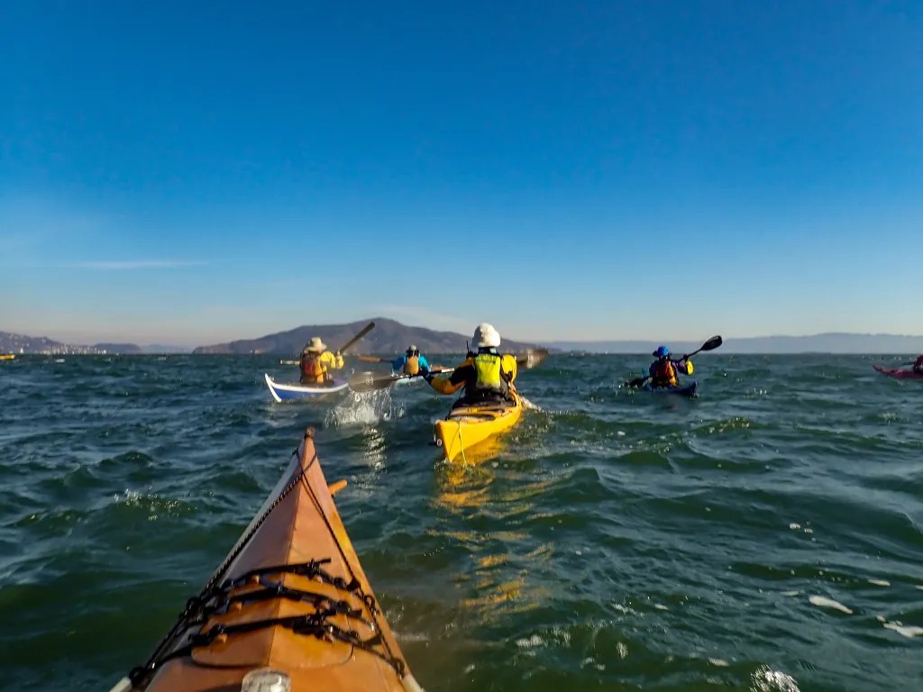
Six of us launched from Ferry Point that morning for a paddle around Brooks Island. We paddled in the counterclockwise direction, crossing the open water early in the event that the wind should come up later in the day.

Paddling along the south side of the jetty we encountered quite a bit of eel grass. We had this experience on a previous paddle at this location and it seems this year there is eel grass where we don’t recall seeing it in the past. Then, having spied the remains of the dead whale, we paddled close to take a look. Jaw bones are now exposed where a month ago it looked like a freshly beached whale.

We were also amazed at the number of pelicans we saw, wheeling overhead, diving and fishing. We stopped at Barbara and Jay Vincent Park for lunch, walking to the top of a knoll where we found some rocks on which to sit.

After lunch it was back on the water. The wind had picked up a bit and we were bracing for a slog into the wind. We crossed the channel heading to Brooks Island and admired an Osprey that was feeding its young in a nest on top of the dolphin (pilings) in mid-channel. Then the wind eased up and we had a pleasant paddle back to our launch side, again mystified with the number of pelicans that were about. You can see more photos in an online gallery.

Tomales: Marconi to Chicken Ranch

On June 26, seven of us launched our kayaks from Marconi Beach not knowing quite where we’d end up for lunch. Shortly after 9 a.m. we launched on flat calm water, paddling across to Hearts Desire Beach where one of our fellow BASK members was assisting at an Environmental Traveling Companions kayaking event.

From Hearts Desire we noodled southeast along the Point Reyes Peninsula, taking our time and exploring all the nooks and crannies and even some caves. Paddling through eel grass beds we saw hundreds of jelly fish. Since my Olympus TG5 camera is waterproof I popped it under the surface and started snapping pictures more or less at random. I was amazed I got something useable.

Paddling on, before you know it we were at Chicken Ranch Beach. It was just a few minutes after 11 a.m. and, though it was early, we decided it was lunch time. Our plan was to get an early start and get off the water before the wind came up.

Sure enough, as we were eating lunch the wind started to build and not as predicted. The prediction was for WSW winds 9 kts. What we had was coming straight down the bay. We launched into a stiff wind that was raising whitecaps. Fortunately, we did not have a great distance to travel so we slogged it out powering straight into the wind. We were back at our launch point at 12:30, having logged 5.8 miles. You can view more photos in an online gallery.

A Week at Loon Lake

Nestled high in the Sierra Nevada Mountains at 6,400 feet is a gorgeous lake, Loon Lake. Crystal clear water surrounded by forests, granite boulders, and patches of wildflowers. Twenty-eight miles up a windy road takes you off the main highway deep into the Sierra Nevada mountains not far from the Desolation Wilderness. We anticipated meeting a number of fellow kayakers, members of Bay Area Sea Kayakers (BASK), for a week of paddling, hiking, wildflower hunting, birdwatching, and camaraderie.

We arrived on Sunday evening, June 12, dropping off our boats near the boat ramp and finding campsite 44. We parked, popped the top up on the camper and joined one of our camp buddies, Eoin, who was preparing dinner for our cook group. The next morning, I put my drone in the air to capture a photo of our campsite.

June 13 – Rubicon Trail Hike

Monday we opted to explore the north end of the lake on foot, driving to the Rubicon Trail Staging Area and making our way partly around the lake. The Rubicon Trail is widely recognized as the premiere OHV route in the United States. As hikers, we decided to stay off the jeep trail and try to find a route that was hiker friendly. We ended up off-trail, making our way over bare rock, through thickets of trees and down through a bog. It was spectacular country but slow going as we bushwhacked. After a couple of hours, we managed to cover 2.5 miles.

June 14 – Paddle – North End of Lake

Tuesday morning we were up early to fire up the Dutch Oven and cook a breakfast of mushroom and brie breakfast strada, one of our favorite camping breakfasts. With breakfast out of the way we assembled at the boat ramp. Our route took us along the eastern shore of the lake, noodling along and poking into coves and inlets, passing a small waterfall at one point. We stopped at Pleasant Campground for lunch and then continued exploring the north end of the lake.

With the wind starting to build in the afternoon, we decided to make our way back to our launch point. We covered 10 miles in the five and half hours of our adventure.

June 15 – Paddle – South End of Lake

Having explored much of the north end of the lake, today we explored some of the islands at the south end of the lake, making our way north to a lovely lunch spot on a granite spit. We had fun doing some flatwater rock gardening in a group of rocks. I even managed to get the drone in the air to capture some aerial views, something that I’ve wanted to do for some time, but usually the logistics of paddling take priority over the logistics of flying a drone.

Again, the wind came up after lunch and we made haste back to camp, hugging the shore to avoid the brunt of the wind. We logged 6.9 miles over the course of our paddle.

June 16 – Loon Lake Trail

With two days of paddling behind us it was time for a hike. Our dog Carson had two days in the camper and it was time to give him some off-leash time. We followed the Loon Lake Trail along the east side of the lake, paralleling the route we had paddled two days before. This hike took us through some lovely forests, through glens of freshly sprouted bracken fern, over sections of bare granite rock with occasional views of the lake.

We stopped for lunch just shy of Pleasant Campground on a slab of granite with a view of the lake. There we watched the white caps on the lake and were glad we had done our paddling earlier in the week. We admired many wildflowers along the trail and covered 7.3 miles.

Please view more photos of the trip in an online gallery.

Whale on Brooks Island

May 31. Five of us launched our kayaks from the beach at Ferry Point for a paddle around Brooks Island. We were on the water at 10 a.m. after a quick safety talk and radio check. Our course took us from the beach to the end of the jetty at the end of the Richmond Shipping Channel. The plan was to negotiate the exposed leg of the paddle early before the wind and associated waves started to build. Once we were out of the shipping channel, we followed the jetty heading southeast. We were amazed by how much sea grass we encountered. Perhaps my previous experience was with higher tides and rougher water when the seagrass wasn’t so evident.

About halfway along the jetty we found a dead whale. This was cause to take photos, but to do so I had to ask one of my paddling buddies to open my back hatch get out my spare parts kit with spare batteries for my camera. My camera battery went dead shortly after launching. The island is off limits due to nesting birds, so we stayed in our boats.

With the whale well documented we continued on. Pelicans were quite plentiful, wheeling overhead and diving for fish. One pelican dove just a few feet away from my boat giving me the opportunity to capture a few photos at close range.

The water was starting to get a bit bouncy as we approached the southeast corner of the island, but nothing of concern. We landed at Barbara and Jay Vincent Park on the little beach facing the bay. The beach was a bit rocky with the low tide. After lunch we were back in our boats facing a stiff wind coming from the southwest. We decided to paddle straight into the wind which would place us on the leeward side of the jetty, hoping the jetty would provide us some protection. We battled the wind and the whitecaps and eventually found some relief.

Along the way we encountered the Brooks Island caretaker with what looked to be a load of recycling. He advised us not to land on the island due to the birds that were nesting. He also told us that one could land on designated areas from September through March when the birds are not nesting. We reported the dead whale, and continued on our journey. We were back on the beach where we had launched at 1:30 p.m. having logged 6.7 miles. You can view more photos in an online gallery.

BASK Meeting at China Camp

Sunday, May 15, provided us with a full day of activities with our kayaking club BASK (Bay Area Sea Kayakers) at China Camp State Park. We have a good relationship with Friends of China Camp, the non-profit that runs the park. As such we had access to the museum for a presentation prior to the museum opening to the public. China Camp is a beautiful spot on San Pablo Bay about an hour drive north of San Francisco. It is of interest historically and culturally. A Chinese shrimp-fishing village thrived here in the 1880s.

I arrived early since I had volunteered to record the presentation given by John Muir—a presentation on the history of China Camp. That video is now available on YouTube. Before the meeting, we unloaded our boats since we planned to paddle later in the day. The tide was quite low when we unloaded, as you can see in the photo. By afternoon the tide would be high enough to avoid getting stuck in the mud.

After the presentation we moved to a picnic area south of the main beach for brunch: bagels, lox, cream cheese, fruit, yogurt, and coffee. This being our first face-to-face general meeting in over two years, it was a treat to be able to sit down with fellow club members.

After brunch a number of us broke into pods to participate in a coastal cleanup. Each pod was assigned a section of shoreline between China Camp and Buck’s Landing. I was in the green pod, and our territory spanned Buckeye Point to Jake’s Island. Five us us set out to paddle to our area. As we rounded the point near Rat Rock, we found ourselves paddling straight into a stiff wind, with wind waves and white caps. We attempted to hug the coast to stay out of the direct force of the wind, but the wind soon took a toll on members of our pod. Three members opted to turn back rather than fight the wind and the waves.

Two of us continued on, powering into the wind and waves. I found it to be an exhilarating experience.

While paddling I was also trying to stay in contact with other club members via radio. Each time I’d pick up the radio, the wind would set me back, and then I’d have to struggle to catch up. Even so, we made it to Jake’s Island in good time. From there is was a fast ride back as we scoured the shoreline looking for debris. There was not much to see from the vantage point of a kayak.

We did pick up a pod member on a SUP and, with the higher vantage point, he was doing a better job spotting debris. What debris we did find required getting out of our boats and wading in the marsh, wary of stepping into a hole of boot-sucking mud. Most of the debris was higher up in the marsh and hard to reach from a boat.

Once we completed our cleanup, we rendezvoused with Ranger Scott to off-load our debris. We didn’t set any records for distance, having covered five miles, but even so, it was a fun day and an exhilarating paddle. More photos are available in an online gallery.

Around Angel Island

April 6. A paddle around Angel Island is always a great adventure. Our original plan was to paddle out the Golden Gate, but with a prediction for a sizeable swell we opted to stay in the bay. Seven of us were on the beach at Ferry Point ready to get on the water at 10:30 a.m. Our plan was to paddle around the island and find a spot for lunch. We had calm water and very little wind.

Since this paddle involves crossing shipping lanes, we kept our eyes open for ships, gathering at buoy #8 to make sure we had everybody together. One thing interesting about buoys and similar features is that as the current flows around the buoy, there is a spot on the downstream side where you can basically park your boat and escape the current.

After we gathered up we paddled to the island, compensating for the ebb current with a ferry angle that would keep us close to our intended destination. As we approached the island, we discussed breaking into two pods, one to stop at the immigration station and the second to paddle around the island in a clockwise direction. We left one paddler on the beach and the remaining six of us paddled around the island, returning to the Immigration Station about an hour and a half later.

Back at the Immigration Station, we landed and broke out our lunches. After lunch it was back on the water for the paddle to our launch point. A very pleasant day on the water. We logged 12.1 miles over the course of the day. More photos are available in my online gallery

Gone Paddling

I can’t seem to keep up with my own adventures. To get current, here are three kayak trips I’d like to share: February 4 from Point San Pablo Yacht Harbor, March 17 Windsurfer to Loch Lomond, and March 22 Loch Lomond to some islands.

Point San Pablo Yacht Harbor

On February 4, five of us launched Point San Pablo Yacht Harbor. The idea was to cover some miles as training for a club event we call the Gonzo, an endurance paddle that visits 15 islands in the Bay. Depending on the route you take, this can be 40 miles. No way am I going to paddle that distance, but I did want to stretch my endurance a bit so I joined this training paddle. Our plan was to paddle between The Brothers, then to an island near the San Rafael Bridge which will remain unnamed, then between the Marin Islands, through The Sisters and back. Our plans changed a bit after we reached the Marin Islands. It became clear that going for The Sisters would put us at a strong disadvantage with the current and wind to make it back to our launch. Just getting back to The Brothers took some effort as the current was starting to build. We managed to cover 9.8 miles with a moving speed of 3.8 mph. Check out more photos in my online gallery.

Windsurfer to Loch Lomond

On March 17 five of us launched from Windsurfer Beach. Our original plan was to paddle on Tomales Bay, but the predicted wind did not bode well for that paddle. My wife and I got an early start with the plan to beat the traffic across the Richmond San Rafael Bridge with a stop at the Bovine Bakery for breakfast. We were already on the road when the call was made to cancel the original plan. With a few quick phone calls, we were able to formulate a plan “B” to launch from Windsurfer Beach. No Bovine Bakery, but we did find Rustic Bakery which also has a delectable selection of goods, so that suited us for breakfast. We logged a healthy 8.3 miles with a moving speed of 3.2 mph. Check out more photos in my online gallery.

Loch Lomond and Islands

On March 22 eight of us gathered at Loch Lomond Marina for a paddle around several islands. Since our route included crossing shipping channels and dealing with currents, we had a briefing to discuss the route. Once on the water we paddled out to the Marin Islands. We found some very shallow water on the way to the islands, barely six inches of water in places. If the tide had been any lower we would not have been able to paddle this route. From the Marin Islands we headed to the island near the San Rafael Bridge that will remain unnamed, and from there it was back to our launch point. We logged 8.9 miles with a moving speed of 3.4 mph. Check out more photos in my online gallery.

Point San Pablo to Bullhead Flat

On the morning of March 1, six of us gathered at the beach at Point San Pablo Yacht Harbor with a plan to paddle across the bay to Bullhead Flat, a destination in China Camp State Park. Since currents, wind and shipping traffic are concerns, we spent some time discussing the plan before launching our boats. With a slight flood we expected the current to push us north, up the bay, so we set a ferry angle taking us more directly across the shipping channel with the current carrying us towards our destination.

We were on the water at 10 a.m. David turned his radio to channel 14 to notify Vessel Traffic Control (VTC) that a pod of six kayakers would be crossing the shipping channel. He was not able to raise VTC. We paddled on until we were outside of Point San Pablo where I was able to contact VTC on my radio. I reported our location, our destination, and the estimated time for our arrival across the shipping lanes. The red buoy marks the starboard (right) side of the shipping lane.

Once across we headed for The Sisters, a couple of islands off of Point San Pedro. Several of us decided to “thread Grendel’s Needle,” a gap in the rocks on the westernmost Sister. We had calm water paddling through the needle. With a stronger current and wind, there can be quite a surge of water.

We were a bit hesitant to paddle the needle since there was a flock of cormorants on top of the island, and we try our best to not disturb the birds when we are paddling. From The Sisters, we paddled north past McNears Beach, past the China Camp Village beach, and on to Bullhead Flat. There we pulled our boats out of the water and found a picnic table to use as we broke out our lunches.

After lunch, it was back on the water for the return trip. The current was now ebbing a bit, so we had the current working with us as we crossed the bay. Again, we set a ferry angle to compensate for the current. The gathering clouds caught my attention on the return paddle, and I thought they made for a lovely photo composition with the kayaks. I’ve posted an online gallery with more photos. You can see a track of our paddle below. We logged 8.3 miles for a very pleasant day on the bay

Lake Chabot

We were intrigued with an invitation to paddle on the “Jewel of the East Bay,” also known as Lake Chabot, earlier in February. Lake Chabot is an artificial lake in the Oakland Hills. The dam was built in 1874-1875 to create a reservoir that was the primary source for water in the East Bay. In 1976, the dam was designated as a California Historic Civil Engineering Landmark by the American Society of Civil Engineers. I grew up not far from Lake Chabot; over the years, I’ve hiked the trails around the lake, but this was my first venture on the lake in a kayak.

So on February 9 we strapped the kayaks on the top of the car and drove to Lake Chabot. It’s a bit of a walk from the parking area to the boat ramp, so we took our wheels with us to trundle the boats down to the ramp. Getting a permit to paddle requires a boat inspection. It took me three rounds of inspection to get enough sand out of the boat to satisfy the inspector. At issue is the risk of introducing invasive species that might hitch a ride from a previous waterway. A dry PFD is required as well. Fortunately our PFDs passed inspection. I’m not sure if we would have been allowed on the water with wet PDFs. There is a $4 fee per boat for the inspection. This is on top of the $5 parking fee and a $2 per kayak launching fee. Getting the boats to the water and permitted took a bit of time. We were on the water at 10:40 a.m. Our route took us around the lake in a counterclockwise direction.

We paddled in and around several wetlands. I was intrigued by the composition of my fellow kayakers paddling along the reeds. After circumnavigating the better part of the lake we stopped for lunch.

Along the way we observed a number of birds including a few hawks, egrets, and white pelicans. At the north end of the lake, we watched a turtle scurry through the water plants under our boats. We were off the water around 1:45 p.m. having logged 5.7 miles. I’ve posted a gallery of some 38 photos online.

Seven Celebrate Seventy

A friend of mine retired recently and he asked me if kayaking was a suitable sport for seniors. I’ll answer that question with a report on a recent paddle. On February 10, seven of us launched our kayaks from Windsurfer Beach, a little beach not far from the Larkspur Landing Ferry Terminal. The youngster in our group was celebrating his 70th birthday. The beach was a bit rocky given the tide, and it’s a short carry down the bank from the road.

We were on the water at 10 a.m. on February 10. The current was ebbing for our time on the water, with maximum ebb a little less than one knot at 11:40 a.m. at Point San Quentin. That meant we would be paddling upstream in the morning. We had a calm, sunny, beautiful day. We paddled out around Point San Quentin and turned north under the Richmond-San Rafael Bridge. Then it was north to the Marin Islands. The islands are part of the Marin Islands National Wildlife Refuge, which was established in 1992, named after a Coast Miwok man known as Chief Marin. Access to the islands is restricted, so we rounded the bigger of the two islands and headed west for Loch Lomond Marina.

We landed on the boat ramp and immediately moved our boats off the ramp so that we wouldn’t interfere with any boaters. No cake today, but plenty of chocolate treats including those provided by the birthday boy, Steve. After lunch we were back on the water making a direct line to Point San Quentin. The current was with us going back.

Once around the point we paddled back to our launch site passing San Quentin State Prison, the oldest prison in California. We logged 8.3 miles on an unseasonably warm day. Of course, part of the drill is getting the boats off the beach and on top of our cars–a total body workout. Not bad for seven septuagenarians.

Check out more photos in my online gallery.