Morro Bay

The central coast of California is not an area with which I have much familiarity, so when a fellow BASK (Bay Area Sea Kayakers) member announced a trip to Morro Bay we signed up, eager to paddle with knowledgeable friends. On January 6 we strapped our kayaks on top of our camper and hit the road. We had a campsite reserved at Morro Bay State Park.

No camping trip is complete without firing up the Dutch Oven. So one morning we cooked up a Hash Brown Crusted Quiche, one of our favorite recipes. Mind you, this fed us well for at least a couple of breakfasts.

Our launch site was about half a mile away at the kayak launch next to the Kayak Shack. Eight of us launched and paddled around the Morro Bay State Marine Preserve and up into Los Osos Creek. We paddled until we could go no further. We were hoping that we could connect with a channel that would take us to Chorro Creek, but that effort was futile. We observed plenty of bird life along the paddle. You can tell from the track that we spent a fair amount of time exploring the estuary. We logged 10.7 miles.

The following day, January 8, we were back on the water paddling to the south end of the bay and up Shark Inlet. When we ran out of water, we turned around and paddled north along the sand dunes, stopping on the dunes for lunch. After lunch we continued north exploring the main channel out to the ocean and came back along the waterfront of Morro Bay, watching sea lions and sea otters. We logged 9.6 miles.

After two days of paddling we decided it was time to exercise our legs and explore Montaña de Oro State Park. We enjoyed the walk along the bluffs. There were some powerful waves crashing on the rocks, not a good day to be in a kayak on the coast.

I was surprised to find California Poppies already blooming in early January. After a very pleasant hike we decided a late lunch was in order. Tognazzini’s was recommended by several of our fellow kayakers, so that was our destination. We split an order of whole crab, which was delicious. After lunch we discovered that there are two Tognazzini’s. Tognazzini’s Dockside Restaurant and Tognazzini’s Dockside Too. Tognazzini’s Dockside Too was playing live music. After lunch it was back to camp with a nice walk along the boardwalk and a view of the sunset from the top of the hill. You can view more photos online.

Starting the Year with a Splash

On January 2, I was on the water with fellow BASK members (Bay Area Sea Kayakers) for a paddle around Angel Island. Eleven of us assembled at Horseshoe Bay near the north end of the Golden Gate Bridge. After a brief safety talk and radio check, we were on the water at 10 a.m. We were looking to take advantage of the strong currents associated with the king tide. Our plan was to head south into the shipping channel to pick up the “express lane,” the flooding current for a ride to the island.

Paddling into the bay, we crossed a well-defined eddy line, the line separating the still water from the fast-moving current. Once we were onboard, it was a smooth ride to the island. We poked around the rocks near Point Blunt and landed at China Cove for lunch, hauling our boats up off what little beach was left to keep them secure from the rising tide.

After lunch we were back on the water. With a high tide of 7.4 feet, an afternoon low tide of -1.9 feet, and slack water at 12:40 p.m., we were looking for a fast ride back through Raccoon Strait. What we didn’t expect was some rough and turbulent water at the west end of Ayala Cove. We encountered a tide race just off the point with whirlpools, eddies and chaotic waves. The chaos resulted in collisions, capsizes, lost paddles and hats, and a bloody head wound. Four of our paddlers ended up in the water. Mind you these are experienced paddlers. While we were facilitating rescues, a few harbor porpoise were cavorting about.

I’m not sure how I managed to stay in my boat in the chaos. Crossing the turbulent water was like being in a washing machine. No chance for photos here. My hands were busy bracing with the paddle. I did capture a photo of one of our paddlers being assisted getting back in his boat. With everybody back in their boats, we made a quick stop on the island for first aid. Then it was time to finish our return trip.

A few of us rode through the tide rip at Yellow Bluff and made our way back to our launch; another pod stayed clear of the rip, riding the express lane in the deeper water before turning into Horseshoe Bay.

You can see more photos in my online gallery. Over the course of the paddle we logged 10.6 miles with an average speed of 3.6 mph. Here’s the track of our paddle.

Kayaking Baja

In early December we managed to get our kayaks out on the Sea of Cortez for a couple of paddles. We had traveled to Baja as part of a caravan of 11 campers on a trip led by Bob Wohlers and the Off-Road Safety Academy. Our first opportunity to paddle was at Bahia San Luis Gonzaga. We spent two nights camped on the beach, which afforded us one day to kayak. We had calm water and no wind. We paddled from our campsite on the beach out around an outcropping of rocks and to the point at the northeast end of the bay. We saw numerous birds including Frigate birds, but not much other marine life. Coming back from the point we noodled along the shore poking into all the little inlets we could find.

We logged 6.6 miles and had a very pleasant paddle. Here’s the track of our paddle.

Our second opportunity to paddle was on December 10. Anticipating wind we were anxious to get on the water early, launching at 9:45 a.m.

We spent the better part of two hours paddling along the beach, around the headlands and back. Sure enough, on the way back the wind came up, as you can see from the whitecaps in one of the photos. Fortunately, we only had to contend with the wind for the short distance back to our camp.

Here’s a short video captured with my GoPro camera while paddling.

Back from Baja

On December 1, we hit the road for a two-week trip to Baja California, returning home on December 15. A whirlwind tour with many stories to tell and photos to share. Rather than write one long blog post covering the entire trip, I’m writing several posts to cover various aspects of the trip. We’ll start with this YouTube video. Joann recreated the trip in Google Earth with slides for each stop along our trip. We’ve animated the map and video so take a moment to follow along.

After getting a late start we decided to scrap our original plan which would have taken us to Red Rock Canyon State Park. So where to spend the night? I have several apps on my phone I use for trip planning. I fired up The Dyrt and started looking at options. It seemed like whatever itinerary I dialed in, The Almond Tree Oasis was the suggested stop. There are not many options for boondocking, let alone camping on the route to Southern California. The Almond Tree Oasis suited our needs. In the morning we fired up the Dutch Oven and cooked up some Mushroom and Brie Breakfast Strata, one of our favorite breakfasts.


Joann preparing Breakfast Strata, aerial view of our camp at Joshua Tree Ranch LA.

The second night we camped near Lancaster at Joshua Tree Ranch Los Angeles, going from an RV camp with full services to boondocking in a lovely grove of Joshua Trees with no services whatsoever. We were happy to pay for the right to camp in this spot, having again relied on The Dyrt to find a site.

Then it was on to Ocotillo Wells SVRA where we joined up with 134 other Four Wheel Pop-Up Campers for their annual rally.

Treve explaining his lift system for popping up the top of the camper with kayaks on top; touring fellow camper’s rigs; Bob explaining radio operation.

It’s always fun to see how people have tricked out their rigs. Following the rally, we continued south to join Bob Wohlers and his Off-Road Safety Academy for a tour of Baja. We had 11 rigs in the caravan. Bob gave us all radios to use for the duration of the tour and with his guidance we managed to cross the border, negotiate our way through Mexicali and along the narrow highways and dirt roads of Baja. We spent one night at Pete’s Camp, two nights at Bahia San Luis Gonzaga, and two nights at Bahia de Los Angeles which was the southernmost point of the trip.

Camp at Gonzaga Bay; Cowpatty Cafe; rainbow at Playa La Gringa at Bahia de Los Angeles.

For the return trip we crossed the peninsula, driving up the Pacific side with overnight stops at Quinta Cristina near El Rosario and Punta Banda. Once back on the US side of the border we headed for Agua Caliente County Park, which I had located using another favorite app, iOverlander.

On the beach with our kayaks on the Sea of Cortez; sunset over Bahia de Los Angeles; camp at Quinta Cristina.

At this point in the trip, we were looking for water and electricity, having depleted our water supply and suffering from a dead battery in the camper. With a dying battery, we were without refrigeration and heat. We’ll be upgrading our camper soon, moving to Lithium (LiFePO4) batteries. We’ll also be replacing the shocks and adding airbags to the rear suspension to help balance the load. The camper is a big load for the Tacoma. Over the course of the 15 days we logged 2268 miles. You can find more photos from the trip online. I’ll be adding to these galleries as I work through the photos in the coming weeks.

Crossing Carquinez Strait

At the northeast corner of San Francisco Bay is Carquinez Strait. This is a narrow passage where the Sacramento and the San Joaquin Rivers empty into the Bay. On Saturday November 27 our kayaking club, Bay Area Sea Kayakers (BASK), hosted a paddle here. Not having much familiarity with this area I thought it would be fun to explore this area with a few paddlers that know the area well.

After a comprehensive safety talk and radio check nine of us we were on the water at 11 am launching from the boat ramp at the Martinez Marina. We paddled west staying clear of the shipping channel and taking advantage of the ebb current for a quick ride. Shortly after launching one of our party discovered that he was quite uncomfortable in his boat. He turned back leaving the eight of us to continue on. When it was time to cross the straight we held up to let a ship pass. Then it was across the straight to Glen Cove Waterfront Park where we found a nice beach to land. We had lunch in a grove of trees on a bluff overlooking the beach.

After lunch we were back on the water hugging the north shore to avoid the deeper water where the current was still ebbing. We even managed to find a few eddies going counter to the main current. We paddled along the Benicia waterfront admiring the waterfront homes and decrepit docks. When it was time to cross the shipping channel we again held up for a tanker and an escort of tug boats.

Then it was back across the straight and back to the marina. We were back at the boat ramp at 4 pm, finding a traffic jam of boats waiting to use the ramp. We managed to land and get our boats off the ramp without interfering with the traffic much. We logged 11.7 miles on an excellent paddle with great company. You can view the track of our course below. Click on the map to view a more detailed view. I was disappointed to discover the lens on my camera had acquired a smudge of sunblock which ruined most of my photos. A lesson to carry a lens wipe and to check the lens frequently. In any event, I did manage to salvage a number of images and you can view them online.

.

Picture Perfect Day

I have yet to master the art of capturing photos from a kayak. When I come back from a paddle, I’m often disappointed by how few of the photos meet my expectations. Invariably the photos are out of focus, blurry or have the wrong exposure. It’s a challenge to hold the camera steady with one hand while bobbing around in a tippy boat and holding onto the paddle with my free hand. And then the composition is always changing. I’ll see a potential opportunity forming and by the time I can get the camera in position the scene changes. Then while I’m trying to snap photos my paddling buddies are continuing on their journey. Time to put the paddle back in the water and catch up. And I’m always trying to position myself within the pod to take advantage of the light and composition. Glare on on the viewfinder is another issue, which means I’m more likely to just point and shoot and hope I get something. I like to capture candid moments on the water, water dripping off the paddle blades and the play of light and reflections and clouds. And then there’s the risk of getting water drops on the lens, or worse yet, a smudge of sunblock.

So this past week I decided it was time to master the art of kayaking photography. I use an Olympus TG-5 and on Thursday, November 4, I was determined to see if I couldn’t improve on the quality of the images.

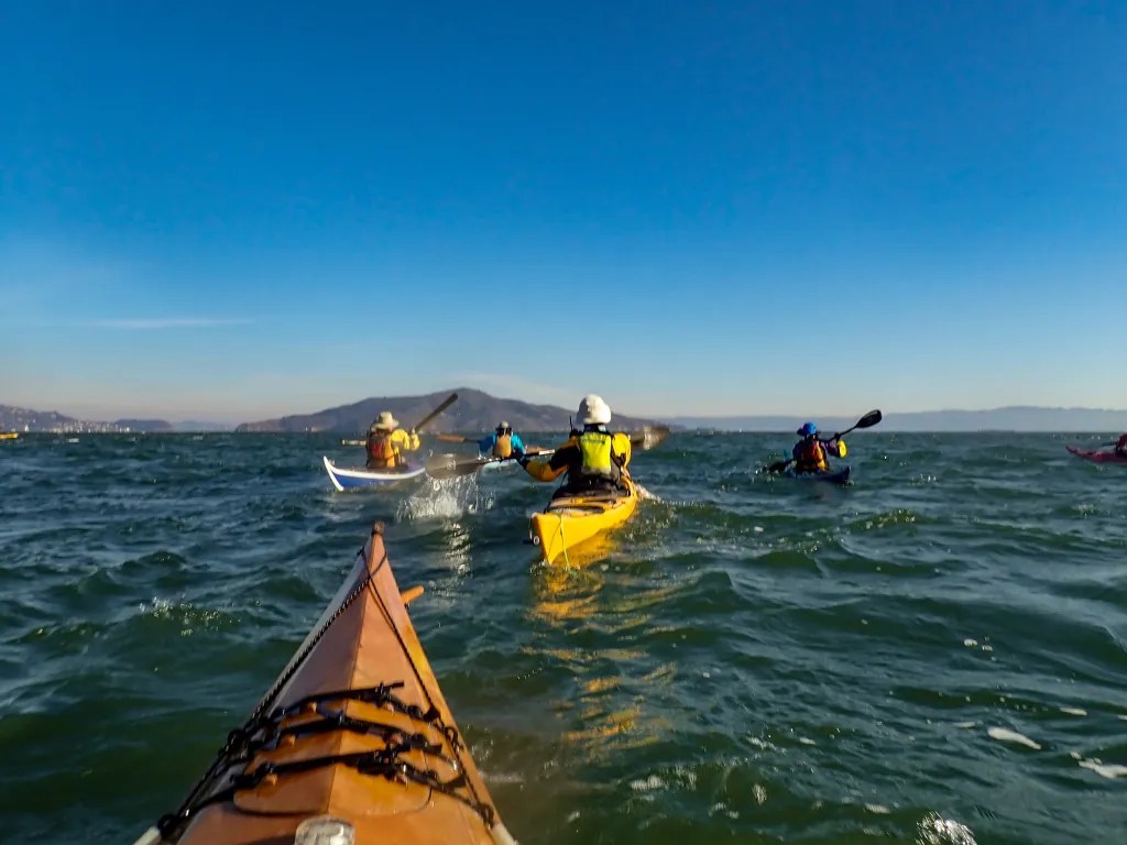
Our launch site was Point Isabel on the east side of San Francisco Bay. One of my paddling buddies suggested this put-in since it is a short drive and I can just sort of fall out of bed and be there. I pulled out of my driveway at 9:02 and parked at the launch site at 9:13. A welcome change from the previous week when I spent two ours getting to our launch site. Our paddle took us to the north end of the jetty on Brooks Island. We had calm water, no wind, and dramatic clouds against a blue sky. Great conditions for photography, with the water offering nice patterns and reflections.

We could see the skyline of San Francisco peeking through the clouds in the distance. We kept our distance going past Bird Rock so as not to disturb the birds.

We were paddling on a high tide, 6.8 feet at 11:40, and as we paddled along we noticed that there appeared to be gaps in the jetty. The tide was so high that it was flooding over the jetty with enough clearance to float our boats. You can see David, riding a little bit of a tide rip over the rocks. We paddled over the jetty and back and continued on to Ferry Point where we stopped for lunch. Then it was back on the water for the return trip. We paddled across the shipping channel and along the inside of the jetty to avoid any shipping traffic. We were back on the beach at Point Isabel at 2:00 having logged 8.5 miles. You can take a closer look at our track here or on the map below. On uploading the photos to my computer, I found that that I had some 424 images! Quite a chore to sort through. But I discovered that the habits I had developed for land-based landscape and architectural photography were hindering my ability to capture photos from a kayak. On land I tend to use a small aperture to maintain a good depth of field. On the water a wider aperture and a high shutter speed seem to work best. I was quite happy with a number of the images. Of the 424 images I captured, I marked 44 as keepers. You can view those photos here. Overall it was a picture perfect day.

Don’t Walk the Boat

Drakes Estero is one of my favorite places to paddle. It’s an estuary in the Point Reyes National Seashore and designated as part of the Phillip Burton Wilderness. A beautiful spot to paddle with lots to see. It’s closed March 1st to June 30th when harbor seals are birthing and, given the shallow water in some places, you want to pick a time when you’ll have enough water to paddle over the sandbars. This past week, on October 28, the timing seemed promising.

The first challenge was getting to our launch site. It’s 54 miles from my house to the launch site. During the morning rush hour it can be a challenge. I left my house at 7:40 and arrived at our launch site two hours later. Traffic was backed up crossing the San Rafael Bridge due to fog. As you can see, once we were on the water the fog had cleared and we had flat calm.

I’m including a screen shot of the tide graph, since we were hoping for a enough water to keep from walking our boats across a sandbar. High tide was 7:03 at 4.28 ft. Low tide was 11:17 at 3.71 ft.

We found the sandbar shortly before 11:00. If we hadn’t been distracted watching birds, we could have avoided the walk by skirting west around the bar. Approaching the beach, we began to feel the wave action from the ocean as waves entered the mouth of the estuary; we paddled through kelp beds and clear water feeling the gentle action of the dissipating offshore swell. Offshore a good swell was pounding the beach with rows of breaking waves.

Once across the bar, we climbed back in our boats and paddled to Sunshine Beach were we had a leisurely lunch. You can see the beach in the distance beyond the Janie’s wooden boat.

After lunch we paddled over to the inside of the Drakes Beach spit where one of our group had split off to admire the surf.

It is unusual to be on a paddle with three wooden boats, all built by their owners. Then it was back on the water for a pleasant paddle back to our launch site. As usual, what started as a calm day ended up with some wind, but not enough to hinder our progress. Over the course of the day we logged 8.3 miles and we saw dozens of harbor seals, pelicans, shore birds and even a couple of leopard sharks. You can take a closer look at our track here or below. If you click on the map, a satellite view shows the sandbars and channels in more detail. You can also view more photos here.

Mendo Madness 2021

Each year our kayaking club, BASK (Bay Area Sea Kayakers) takes over a number of camping sites at Van Damme State Park for a week of camping and kayaking.

This year’s adventure started Sunday morning, September 12. With our kayaks on top of our camper we hit the road. Before we got very far we discovered that our camping reservations didn’t start until Monday. What to do for Sunday night? We pulled off the road to consider the options and Joann booked us a night at the Seagull Inn. Hey, I’m not going to complain about breakfast being served.

After breakfast we drove the short distance north to Russian Gulch. The prediction was for high surf, but the beach at Russian Gulch is quite protected, so getting on the water was not a problem. In poking around the cove though, we decided it was too rough to venture out. After a very pleasant paddle on the cove we checked into our campsite. That’s our Four Wheel Pop-Up Camper with the kayas on top parked next to the trees.

In the morning we fired up the Dutch Oven. Here’s Joann serving up Hash Brown Crusted Goat Cheese and Scallion Quiche. Yum! With rough water predicted on the coast we opted for a paddle on the Big River, and we found a few BASK members happy to join us. We logged 12 miles paddling up the river and back. A very pleasant paddle in an enchanted forest.

Wednesday, September 15, we put on our hiking boots and hiked up Fern Canyon to the Pygmy Forest. Another enchanting trail up a canyon lined with ferns and redwoods. The hike in itself is worthy of a separate blog post so stay tuned.

On Thursday with the conditions on the coast continuing to look daunting, we opted to paddle on the Albion River. We managed to pull together a group of eight people to paddle up the river. That brings us to Friday, our last day in Mendocino and it was time to paddle the coast. Conditions were much calmer than earlier in the week so we launched from Van Damme Beach and poked around a few rocks and paddled through a few caves. Hard to condense a week’s worth of adventures into one short blog post so stay tuned. I’ll be posting separate stories with more details. You can view more photos of our adventures here.

Wind and Chocolate

August 5. I had planned a paddle that would originate from Ferry Point going to Point San Pablo Yacht Harbor. When I arrived at the parking lot at 9:15 I was surprised to see that none of my paddling buddies had unloaded their boats. The boats were still on cartops. Everyone was concerned with the wind. After a quick consultation we decided on an alternate plan, to launch from Point San Pablo Yacht Harbor and paddle to Point Pinole for lunch. Our thinking was that this might be more sheltered from the wind.

Eight of us were on the water at 10:40, paddling in some wind and chop with the wind and waves coming at us on the stern quarter. This was a good exercise in boat control, since my boat, a Pygmy Ronan, was tending to weather cock and I was constantly correcting for the wind. At noon we were breaking out lunch at Point Pinole, having traversed the 4.2 miles in an hour and 20 minutes.

During lunch Steve broke out a stash of chocolate. Mind you this was no ordinarily chocolate. A well-known Napa Valley restaurant is apparently about to launch their own chocolate brand. Steve managed to get his hands on some samples. We had a treat tasting five flights of chocolate starting with milk chocolate and moving on to some amazing 85% dark chocolate.

We were back on the water at 1 p.m., slogging into a headwind and choppy water. Our strategy was to head towards Riviera de Garbage, and hopefully find some protection from the wind in the wind shadow of the land. At 2:45, we found the boat ramp at Riviera de Garbage and stopped for a welcome break. It had taken us an hour and 45 minutes to cover the three miles. On the crossing we were entertained by pelicans fishing, dive-bombing for fish quite close to our boats. My efforts to photograph them were unsuccessful. From Riviera it was an easy paddle back to our launch site landing at 3:40.

Everybody agreed that the paddle was a good workout and we were back on the beach without an incident. We logged 9.8 miles over the course of our paddle. You can view more details on my GAIA GPS account, and you can view more photos here.

Hearts Desire to Pelican Point

July 15, 10:00 AM. We were climbing in our boats at Hearts Desire Beach. Four of us. Hearts Desire is a lovely beach on the Point Reyes Peninsula, part of the California State Park system. I chose Hearts Desire as our launch point because the weather prediction was for wind on Tomales Bay. Hearts Desire and the west side of Tomales Bay is protected from the prevailing wind, so it provides a good launch site when the launch sites on the east side of the bay are windy.

We were launching on a low tide, and while some beaches can be muddy at low tide, we found firm sand. Paddling north along the bay we stayed close to shore. We saw racoons foraging along the shore as well as Great Blue Herons, egrets and osprey. Overhead we had pelicans reeling about and, in the water, jellyfish. With the low water, the eelgrass would occasionally grace our our boats.

Our intended lunch stop was Tomales Beach about three miles from our launch site. When we got there we decided to continue on to a more secluded beach. There were a handful of campers on Tomales Beach. We landed at a beach just south of Pelican Point. True to it’s name, we saw several White Pelicans on the point and opted to land far enough south so as not to disturb them.

After lunch we returned to our boats. We were back at our launch site at 2:30, having logged 9.2 miles. You can see more details about the track here. A beautiful day on Tomales Bay, one of my favorite places to paddle. You can see more photos here.