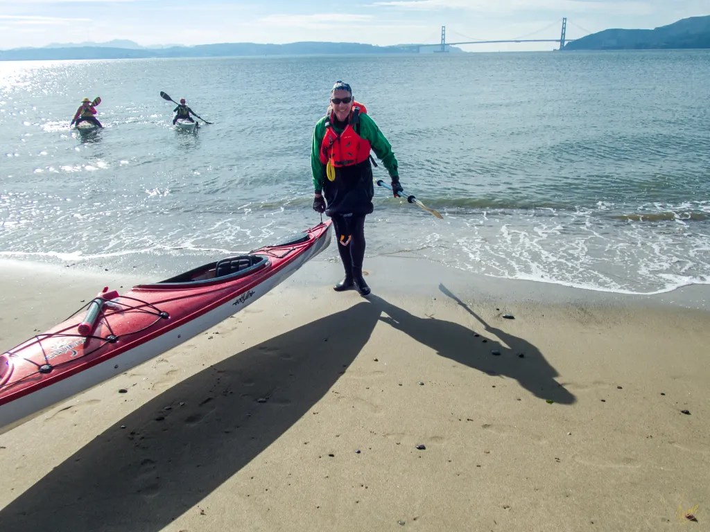
Today’s paddle takes us from Ferry Point in Richmond to Quary Beach on Angel Island. The plan was to take advantage of the currents, riding to the island on the end of the ebb tide and returning on the beginning of the flood. Our trip leader shared from her knowledge of the currents; as you approach Angel Islands the ebb current flows around both the north and south side of the island on its way out the Golden Gate. The trick is to pick a course that will keep you in a position so that you don’t get swept either way around the island. Slack water was at 11:14. After the usual briefing and safety check we were on the water at 9:25.
After launching off the beach we all held up to let the ferry pass, then we were out on the bay crossing to Angel Island on calm water with just a few bumps from passing ferries. Our intended course served us well. Once we were near the island we turned south, paddling around Quarry Point and landing on Quarry Beach at 11:45. Good timing for the day’s currents. We took advantage of the picnic tables on the bluff just above the beach.
After lunch we were back on the water heading back to our launch site. With the tide turning we were now paddling with the flood coming in the gate and we again chose a course to take advantage of the current, paddling back around the island to Point Simpton and then turning towards Richmond. On this leg we saw a few porpoises in the distance. As we crossed the open water, we started to experience some following seas. Nothing to alarm us, but it did require some skill to keep the boats on course.
We were back on the beach at 12:55 having logged 8.4 miles. More photos are available in an online gallery.
The plan was to launch our kayaks from Horseshoe Bay in Sausalito and to paddle to a beach near Point Blunt where we would land for lunch. After reviewing the paddle plan, a safety briefing and a radio check we were on the water at 10:30.
From Horseshoe Bay the nine of us paddled out in the clearing fog, with fog horns bellowing and ships horns bellowing. By paddling into the bay a bit, we were able to pick up a current to carry us towards Angel Island. Approaching the island, we found a patch of confused and lumpy water just off of Point Knoxx, not unusual for these waters. A peek around the Point suggested that our intended plan would involve a surf landing given the wind. The consensus of the group was to avoid the surf landing and to land at Fort Reynolds (West Garrison). The wind had come up more than we had anticipated, making conditions a bit more challenging.
After lunch we were back on the water. In order to avoid a long slog into the wind, we paddled across Raccoon Straight to Peninsula Point and then changed course for Sausalito. For this leg I was too busy paddling to pick up my camera. With part of our group apparently anxious to make a short path to Yellow Bluff, we had our work cut out paddling into the wind. A more efficient route would have been to paddle to the Sausalito coast before turning to Yellow Bluff. This was actually suggested as the preferred route, but pod dynamics being what they were, we worked a bit harder than we needed.
Once we were all gathered up inside of Yellow Bluff, we rounded the point and met the full force of wind blowing 20 knots or so. It was hard work covering the last quarter mile. We all felt like we had a good workout when we were back on the beach at 2:45, logging 8 miles. More photos are available in an online gallery
Our paddle today took us from Dunphy Park in Sausalito to China Cove on Angel Island. There were 12 of us, a large group for a weekday paddle. We assembled on the beach for a safety talk and radio check, and then we were on the water at 11. Slack water in Raccoon Straight was 12:30, with a high tide of 6.4 feet at 11:15. We try to plan our paddles to take advantage of the current. Being on the water a little before slack means we might be pushing against a slight current, and after lunch we would have the current with us for our return trip. My boat for the day was my Pygmy Ronan which handles the wind and chop of the Bay with aplomb, although we had little to challenge us in that regard.
At China Cove we decided to carry our boats well above the tide line lest the rising tide should carry our boats away. Here’s a photo of our group having lunch, along with a map that shows our track and a photo of a pod of kayakers preparing to land at China Cove.
Weather conditions were quite favorable. My drysuit and my usual insulating layer felt a bit warm initially and I was thinking I might have overdressed, but in the end my layering proved to be a good choice. We had calm water on the route to the island. On our return we had a bit of lumpy water as we crossed Raccoon Straight. By now the ebb had started and we had the current assisting us on the return trip, logging up to 6 MPH. We were back at our launch site at 2:30.
It turned to out to be a beautiful day on the Bay, with a great group of friends. For wildlife we saw pelicans, cormorants, a great blue heron, and the requisite harbor seals. We logged 7.8 miles. More photos are available in an online gallery.
Thursday morning, November 17. A chilly morning, and climbing into my wet, clammy dry suit seemed quite rude. Wet inside and out. I had been out the previous evening for a rolling clinic. The suit was wet on the outside from being upside down in the cold water of San Francisco Bay, and damp on the inside from condensation. I contemplated adding a layer of insulation but figured once I was on the water I would warm up.
Six of us assembled on the beach at Ferry Point. The predicted weather and tides were favorable for a paddle around Angel Island. After a quick safety talk and radio check we were on the water at 10 a.m. Shortly after leaving the protection of the Richmond Shipping Channel, we encountered a breeze and some wind waves out of the northwest. We watched several ferries zipping up and down the bay, and then we held up for a barge that was crossing our path in the shipping lane. We had a couple of harbor seals check us out also.
Our radios were handy for staying in touch and keeping the pod together in the midst of ship traffic. Once we were across the shipping lane we opted to continue our way around the island in a clockwise direction. We landed on Perles Beach a little after noon. Perles Beach faces the Golden Gate with a panoramic view that includes San Francisco as well.
There was just enough breeze to create a bit of a wind chill, so after a brief lunch we were happy to get back in our boats to continue our journey. Back on the water we continued around the island. After rounding Point Stewart, we paddled close to shore to check out the beach at Kayak Camp. One of the photos shows a fellow kayaker with his boat pointed to the trail that leads up from the beach to the campground. There was no trail visible from the water. The trail is presumably overgrown. Once we were back around to the eastern side of the island, we again held up for shipping traffic and then continued on our way back to Ferry Point.
We were back on the beach at 2:20 p.m. after a perfect paddle around Angel Island logging 12 miles. You can see more photos in an online gallery. Here’s the track of our paddle.
April 6. A paddle around Angel Island is always a great adventure. Our original plan was to paddle out the Golden Gate, but with a prediction for a sizeable swell we opted to stay in the bay. Seven of us were on the beach at Ferry Point ready to get on the water at 10:30 a.m. Our plan was to paddle around the island and find a spot for lunch. We had calm water and very little wind.
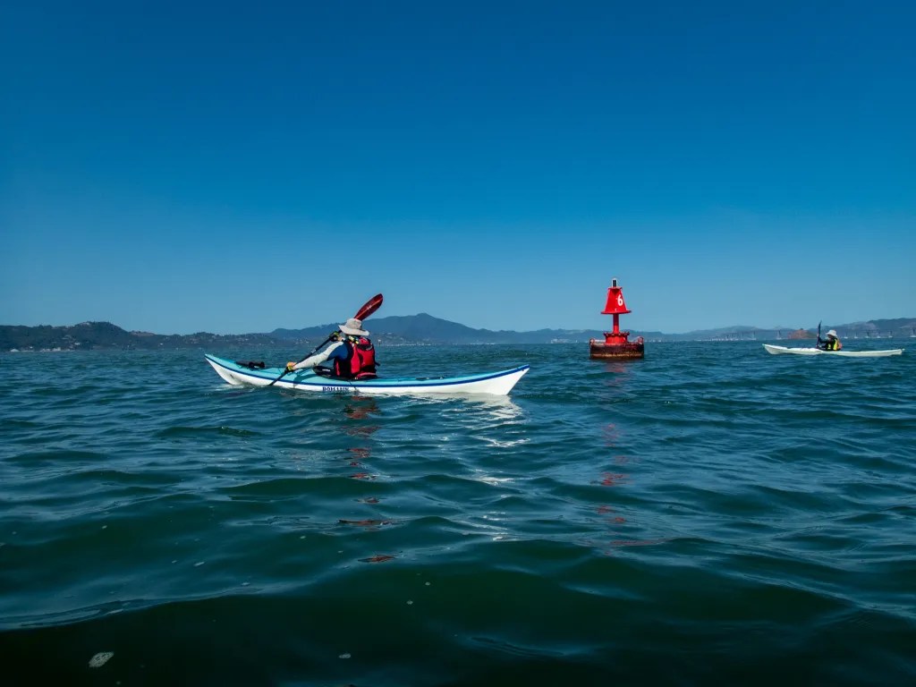
Since this paddle involves crossing shipping lanes, we kept our eyes open for ships, gathering at buoy #8 to make sure we had everybody together. One thing interesting about buoys and similar features is that as the current flows around the buoy, there is a spot on the downstream side where you can basically park your boat and escape the current.
After we gathered up we paddled to the island, compensating for the ebb current with a ferry angle that would keep us close to our intended destination. As we approached the island, we discussed breaking into two pods, one to stop at the immigration station and the second to paddle around the island in a clockwise direction. We left one paddler on the beach and the remaining six of us paddled around the island, returning to the Immigration Station about an hour and a half later.
Back at the Immigration Station, we landed and broke out our lunches. After lunch it was back on the water for the paddle to our launch point. A very pleasant day on the water. We logged 12.1 miles over the course of the day. More photos are available in my online gallery
On January 2, I was on the water with fellow BASK members (Bay Area Sea Kayakers) for a paddle around Angel Island. Eleven of us assembled at Horseshoe Bay near the north end of the Golden Gate Bridge. After a brief safety talk and radio check, we were on the water at 10 a.m. We were looking to take advantage of the strong currents associated with the king tide. Our plan was to head south into the shipping channel to pick up the “express lane,” the flooding current for a ride to the island.
Paddling into the bay, we crossed a well-defined eddy line, the line separating the still water from the fast-moving current. Once we were onboard, it was a smooth ride to the island. We poked around the rocks near Point Blunt and landed at China Cove for lunch, hauling our boats up off what little beach was left to keep them secure from the rising tide.
After lunch we were back on the water. With a high tide of 7.4 feet, an afternoon low tide of -1.9 feet, and slack water at 12:40 p.m., we were looking for a fast ride back through Raccoon Strait. What we didn’t expect was some rough and turbulent water at the west end of Ayala Cove. We encountered a tide race just off the point with whirlpools, eddies and chaotic waves. The chaos resulted in collisions, capsizes, lost paddles and hats, and a bloody head wound. Four of our paddlers ended up in the water. Mind you these are experienced paddlers. While we were facilitating rescues, a few harbor porpoise were cavorting about.
I’m not sure how I managed to stay in my boat in the chaos. Crossing the turbulent water was like being in a washing machine. No chance for photos here. My hands were busy bracing with the paddle. I did capture a photo of one of our paddlers being assisted getting back in his boat. With everybody back in their boats, we made a quick stop on the island for first aid. Then it was time to finish our return trip.
A few of us rode through the tide rip at Yellow Bluff and made our way back to our launch; another pod stayed clear of the rip, riding the express lane in the deeper water before turning into Horseshoe Bay.
You can see more photos in my online gallery. Over the course of the paddle we logged 10.6 miles with an average speed of 3.6 mph. Here’s the track of our paddle.
March 2, 2021. After returning from my desert sojourn visiting family and exploring the Eastern Sierra, it was time to get back on the water. This paddle took us from Ferry Point in Richmond and out around Angel Island with a stop at the West Garrison for brunch. We then continued around the island and back to our launch site.
A side note here about WordPress. I’ve had reports from those that subscribe and get the email version that the photos are distorted in the email, so I’m experimenting with different gallery settings. The photos above are presented in a Tiled Gallery format. Those below use the straight Gallery format. Please let me know if one of these formats works better.
West Garrison is on the west side of the island facing the Golden Gate Bridge. It was originally called Camp Reynolds, which was established in 1863 as concerns mounted over threats to the Bay Area from Confederate sympathizers and naval forces.
We were on the water at 8:30 a.m. which is early for us. We wanted to take advantage of the tides and currents. Our plan was to paddle to Ayala Cove for a stop but when we got to the West Garrison the water was flat calm and the beach looked inviting so we stopped and pulled out our snacks. You can see our boats on the beach with some pilings and the Golden Gate Bridge in the background. We were again on the water at 11:00 and back at our launch site shortly after noon, logging 11 miles and paddling on placid waters for the whole trip. Our trip leader, Jenn, looked quite spiffy in her new boat, black with a sparkling metal-flake finish, yellow trim and deck lines, and matching outfit. I’ve posted additional photos including some artistic representations of a couple of images. Click here to view.
Here’s the track of our paddle.
I’ve posted a number of blog entries about paddling to Angel Island. You can find additional posts by searching for “Angel Island” in the search box.
We gave a fitting send off to the year 2020 by putting our boats in the water and paddling around Angel Island on the last day of the year. The quality of light, the serene conditions and the reflections on the water prompted me to convert the images to black and white.
Four of us launched from Dunphy Park in Saualito, pushing off at 10:20, about the time for maximum flood. We paddled out to Point Knox and around the island counter-clockwise. We did feel a bit of the current as we approached Point Knox, with the current trying to push us up Racoon Strait. Once around the point though we had the current going with us and we made good time going around the island and landing at the Immigration Station.
We had a suitably social distance lunch while sitting on the ledges that were part of the historical display. You’ll note that one of our paddling buddies, Steve ended up half-way between “Acceptance” and “Rejection” in the “Realities” zone.
After lunch the current was beginning to ebb, so we had the current with us for an easy paddle down Racoon Strait. As we rounded Peninsula Point, back into Richardson Bay we hugged the shore admiring the expensive home on Belvedere Island. I was looking up at the homes on the cliff when with a crunch I found myself aground on a rock. Easy enough to get back on track, but a reminder to keep an eye on the water. Then it was across the bay back to our launch site, after some discussion about what landmark to aim for. Navigation from a low vantage point can be a challenge . We were back on the beach at 2:15, but only after breaking a paddle while landing. When getting out of the boat, I discovered that I was in a rocky hole, not a firm beach. I put my paddle down for balance, inadvertently wedging it between two rocks. Down I went and leaning on the paddle caused the shaft to snap.
So it goes. I’ve had a paddle on my shopping list for some time. Now I have an excuse to buy one. We logged 9.5 miles and I don’t recall ever having such an easy and pleasant paddle around the island. It was a very quiet day on the bay. Calm weather, and not much boat traffic. We did see a number of the usual bay residents including cormorants, gulls, pelicans and harbor seals. You can view more photos here, including both the black and white and color versions of the images above. Let me know what you think.
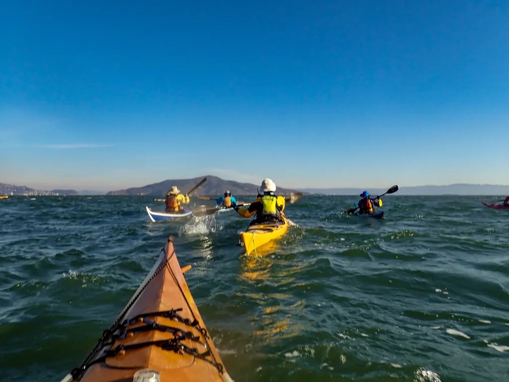
What happens when you have 53 paddlers from three kayaking clubs point their boats towards Angel Island? It’s a Paddlepalooza! Saturday, October 26, we were on the Horseshoe Bay dock at 9:30 AM for a safety talk. Horseshoe Bay is just inside the north end of the Golden Gate Bridge. It’s a popular launch site for kayaking. On Saturday the currents were favorable for a paddle around Angel Island, riding the flood towards Angel Island and after lunch riding the ebb back. A critical part of kayaking on San Francisco Bay is paying attention to the tides and currents. Following the safety talk we broke into eight pods. We were advised by Vessel Traffic Control and the Coast Guard that if we were to paddle in pods with good separation between the pods we would minimize the impact on shipping traffic and other recreational boaters.
Leaving Horseshoe Cove
Heading to Angel Island
Rounding the Island
Once we were on the water it was off to Angel Island at a leisurely pace, going around the island in the clockwise direction. While on the water we got to mix it up with members of other clubs. The three clubs involved were Bay Area Sea Kayakers (BASK), Western Sea Kayakers (WSK) and Sacramento Sea Kayakers (SAK).
Our support boat “Sea Scout”
Lunch on Quarry Beach
Johnathan explaining our route back
Our lunch destination was Quarry Beach, a protected beach on the southeast side of the Island. After lunch we assembled into new pods for another opportunity to make new friends, and we headed back rounding Point Blunt, the southern most point on the Island, and hugging the shore until we reached Point Knox. Then it was time to cross the open water back towards our launch point. On the crossing we found ourselves paddling into a headwind with enough wind to kick up a few waves, but with the ebb current we made good time on the crossing.
Paddling towards Point Blunt
Off the south side on the return
Things got more exciting as we approached Yellow Bluffs. This spot is famous for kicking up some wild water on the ebb, and true to form it was exploding today. Our strategy was to paddle north around the rough water, but this is not what happened. We stopped for one of our pod members who was having having trouble with his boat. By the time we got going again, we discovered that we were being sucked right into the rough water. It was a wild ride. I was too busy holding onto my paddle to even think about taking photos. I found myself surfing down waves, getting knocked left and right, and somehow I managed to stay in my boat. Paddle forward, surf the wave and keep paddling. Against the ebb it was slow progress. Eventually I made it to smooth water closer to shore where a number of paddlers were holding position while we regrouped.
My wife Joann managed to stay in her boat in the rough water also. Two paddlers capsized. One of them ended up riding the ebb current out towards the Golden Gate before eventually being picked up by a fishing boat.
The water at Yellow Bluff is a popular place for more experienced paddlers to play. Having “played” in it briefly I can see it would be fun to go back with some more experienced paddlers to improve my boat handling skills.
I did take more photos on the paddle. You can view those here. I also had a GoPro on my helmet. So stay tuned for some video footage. We logged 10.6 miles over the course of the day. You can see the map of our route above, or here.
Approaching the beach at the Angel Island Immigration Station.
We were a small group for the BASK Thursday Lunch Paddle on May 9. Just three of us with Danny, Susan and myself. With today being Thursday and too stormy to paddle it’s time to catch up on my blog. For last week’s paddle we launched from Paradise Cay under cloudy skies with a prediction for wind in the afternoon. The plan was to paddle along the East Side of the Tiburon Peninsula which would afford us some projection from the wind with a stop for lunch at a little beach just shy of Bluff Point. Our paddle took us along the shore and past the Center for Environmental Studies Estuary & Ocean Science Center (Romberg Tiburon Center) operated by San Francisco State University. This was a Naval Net Depot for maintaining submarine nets across the Golden Gate during World War II.
We were paddling along, chatting and riding an ebb current and before we knew it we were at Bluff Point staring at Angel Island which seemed to be offering us an invitation for lunch. Conditions in Raccoon Straight looked favorable so we crossed to Angel Island and landed on the beach at the Immigration Station. On our return the wind tried to tease us a bit, coming at us from various directions, deflected by the land masses. We hung close to the shore admiring the mansions and estates along the Tiburon Peninsula. Our paddle covered 9.4 miles. You can see more photos here and view a track of our paddle here.
Track of our paddle from Paradise Cay to Angel Island


You must be logged in to post a comment.