Joann’s First Paddle in Her NDK Pilgrim

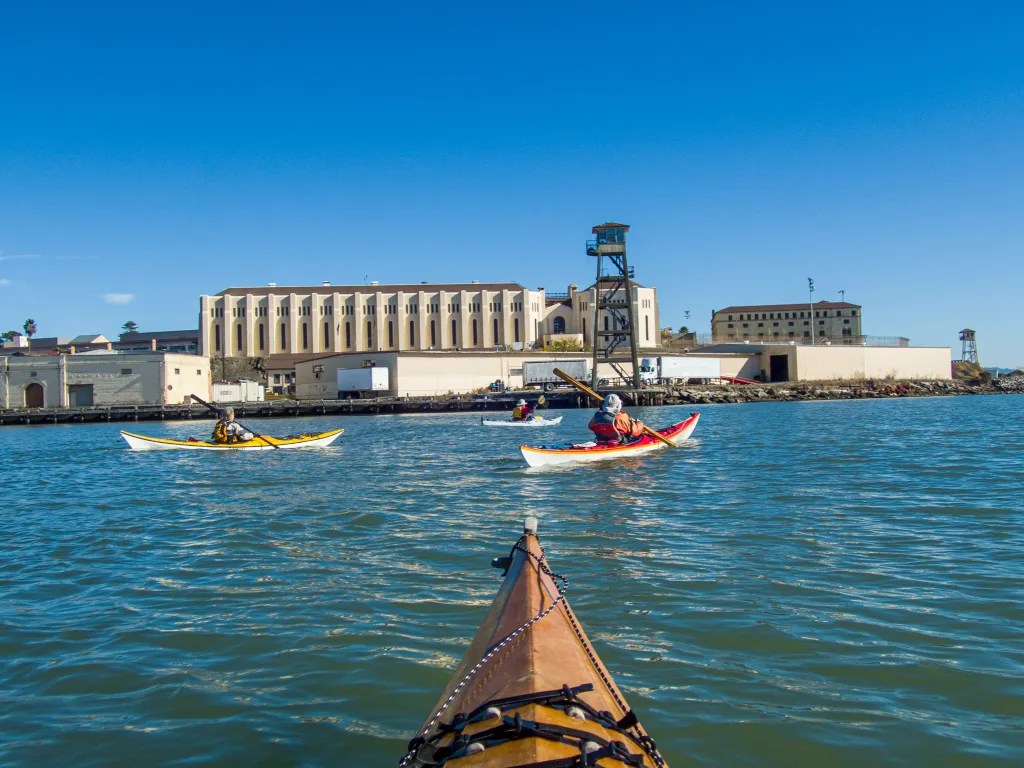
Joann has a new boat. Today she had it on the water for the first time. This boat, an NDK Pilgrim, has been on her wish list for a couple of years. Seven of us launched our boats from Ferry Point, on the water at 10:30. Here’s a photo of Joann heading out. The plan was to paddle inside the breakwater and over to Shimada Friendship Park.

Our plans changed. As we paddled along the breakwater, we noticed that with the high tide, we might be able to paddle over the rocks at a break. Here’s a photo of Joann paddling through the break. If you look closely, you can see the rocks just in front of her boat. I was a bit surprised she was willing to take her new carbon-Kevlar boat close to the rocks.

Once we were through the breakwater we decided to continue around Brooks Island, landing for lunch at Barbara and Jay Vincent Park.

Back on the water, we hugged the Richmond waterfront and made our way back to our launch point. We found ourselves facing a moderate headwind on our way back. Over the course of the day, we had a variety of conditions from calm to a bit of chop and wind, with the wind on various points. Great conditions for trying out a new boat. Joann reports that she is quite happy with the boat. It’s nimble and handles well.

NDK boats are not easy to come by. They are made in North Wales, designed by Nigel Dennis. Joann snapped this boat up in October when the local distributor posted a special sale price. The downside was waiting for several months for the opportunity to have the boat transported across country. The Pilgrim is designed for a small paddler under 140 pounds. At 15.75 feet long and 20″ wide, it’s sleek and nimble. It’s also easy to get on the cartop carrier at 38 pounds. I’m experiencing boat envy; it’s time to think about what my next boat may be.

After the Storm

Yesterday at 3:25 PM an email appeared in my inbox with the subject “Late notification: Paddle tomorrow…” Outside my window a heavy rain was pounding the house, and I was not of a mind to go outside. The weather prediction was for the weather to clear up, and looking at my calendar, paddling looked like a possibility. I decided to wait until morning to see if the weather, and my body, still in recovery from knee surgery were up for paddling.

I awoke to clearing clouds and a rainbow. I put my boat on top of the car and headed to Ferry Point. Part of my motivation was the possibility of some photo opportunities paddling on calm waters with blue sky and dramatic clouds. At 10:30 seven of us launched our boats and paddled out to the end of the breakwater and then made a turn to the south to paddle around Brooks Island.

At noon we landed at Barbara and Jay Vincent Park in Richmond where we broke out our lunches. After lunch we were back in the boats at 12:45 to continue our circumnavigation, staying close to the Richmond shore.

We were back at our launch site at 1:40, having logged a little over six miles on a glorious paddle. More photos are available in an online gallery.

Gone Paddling x 4

Here are four more paddling adventure which deserve to be documented. I consider this blog to be a diary of my adventures. If I don’t record the adventures, I may forget they ever happened. And for the past few years, as the new year turns over, I have turned my blog entries into a coffee table book.

So here are four paddles: 10/27 Richmond to Albany, 11/03 Eckley Pier, 11/10 Gallenas Creek, and 11/28 Windsurfer.


Richmond to Albany

On October 27 there were just two of us with two wooden Pygmy Boats. We launched from Ferry Point in Richmond, paddled out past the end of the breakwater and then past Brooks Island. We poked into the basin northeast of Caesar Chavez Park thinking we might find a spot to land, but we didn’t see much so we paddled to Albany Beach where we stopped for lunch.

After lunch we returned to our launch site by way of the Richmond waterfront, stopping to admire the Red Oak Victory. We logged 11 miles.

More photos are available in an online gallery.


Eckley Pier

November 3. Seven of us gathered at Eckley Pier for a paddle to Martinez. The pilings of several abandoned piers provide an obstacle course to practice boat control. I had my GoPro camera running to capture the action. It remains to be seen when that footage will be available. From Eckley Pier we paddled out towards the shipping channel to take advantage of the flooding current.

Once we reached the Martinez Marina, we hauled our boats up the boat ramp and off to the side to keep the ramp free for boaters. We logged 8.8 miles over the course of the day.


Gallenas Creek

November 10. Up the creek, Gallenas Creek. We launched from China Camp and took advantage of the high tide to paddle up the creek. When we could no longer make forward progress, we returned to the McInnis Canoe and Kayak Dock where we hauled out our boats and had lunch. Our course covered 10 miles.

More photos are available in an online gallery.


Windsurfer Beach

November 29. Loch Lomond to Windsurfer Beach. This paddle takes us under the Richmond San Rafael Bridge and past San Quentin State Prison. At lunch on Windsurfer Beach, we watched the ferries and a dredge. We paddled around the Marin Islands on the return leg, a total of 8.2 miles.

More photos are available in an online gallery.

Breaking the Curse

For the past six weeks or so we’ve been cursed with contrary winds. It seems we’d plan a paddle and the wind we experience was not what was predicted. It seemed as if the wind gods were playing havoc with us. We’ve been attributing this curse to Alan, one of our paddling buddies, since he was the one that was planning the paddles. We even devised a plan where we would send Alan off in one direction hoping he would serve as a decoy so the rest of us could paddle on calm water.

But on Thursday afternoon July 7, following a lovely paddle, we gathered at the Up and Under Pub where we shared a toast and declared the that we had broken the curse.

Six of us launched from Ferry Point that morning for a paddle around Brooks Island. We paddled in the counterclockwise direction, crossing the open water early in the event that the wind should come up later in the day.

Paddling along the south side of the jetty we encountered quite a bit of eel grass. We had this experience on a previous paddle at this location and it seems this year there is eel grass where we don’t recall seeing it in the past. Then, having spied the remains of the dead whale, we paddled close to take a look. Jaw bones are now exposed where a month ago it looked like a freshly beached whale.

We were also amazed at the number of pelicans we saw, wheeling overhead, diving and fishing. We stopped at Barbara and Jay Vincent Park for lunch, walking to the top of a knoll where we found some rocks on which to sit.

After lunch it was back on the water. The wind had picked up a bit and we were bracing for a slog into the wind. We crossed the channel heading to Brooks Island and admired an Osprey that was feeding its young in a nest on top of the dolphin (pilings) in mid-channel. Then the wind eased up and we had a pleasant paddle back to our launch side, again mystified with the number of pelicans that were about. You can see more photos in an online gallery.

Whale on Brooks Island

May 31. Five of us launched our kayaks from the beach at Ferry Point for a paddle around Brooks Island. We were on the water at 10 a.m. after a quick safety talk and radio check. Our course took us from the beach to the end of the jetty at the end of the Richmond Shipping Channel. The plan was to negotiate the exposed leg of the paddle early before the wind and associated waves started to build. Once we were out of the shipping channel, we followed the jetty heading southeast. We were amazed by how much sea grass we encountered. Perhaps my previous experience was with higher tides and rougher water when the seagrass wasn’t so evident.

About halfway along the jetty we found a dead whale. This was cause to take photos, but to do so I had to ask one of my paddling buddies to open my back hatch get out my spare parts kit with spare batteries for my camera. My camera battery went dead shortly after launching. The island is off limits due to nesting birds, so we stayed in our boats.

With the whale well documented we continued on. Pelicans were quite plentiful, wheeling overhead and diving for fish. One pelican dove just a few feet away from my boat giving me the opportunity to capture a few photos at close range.

The water was starting to get a bit bouncy as we approached the southeast corner of the island, but nothing of concern. We landed at Barbara and Jay Vincent Park on the little beach facing the bay. The beach was a bit rocky with the low tide. After lunch we were back in our boats facing a stiff wind coming from the southwest. We decided to paddle straight into the wind which would place us on the leeward side of the jetty, hoping the jetty would provide us some protection. We battled the wind and the whitecaps and eventually found some relief.

Along the way we encountered the Brooks Island caretaker with what looked to be a load of recycling. He advised us not to land on the island due to the birds that were nesting. He also told us that one could land on designated areas from September through March when the birds are not nesting. We reported the dead whale, and continued on our journey. We were back on the beach where we had launched at 1:30 p.m. having logged 6.7 miles. You can view more photos in an online gallery.

Angel Island 03/02/21

March 2, 2021. After returning from my desert sojourn visiting family and exploring the Eastern Sierra, it was time to get back on the water. This paddle took us from Ferry Point in Richmond and out around Angel Island with a stop at the West Garrison for brunch. We then continued around the island and back to our launch site.

A side note here about WordPress. I’ve had reports from those that subscribe and get the email version that the photos are distorted in the email, so I’m experimenting with different gallery settings. The photos above are presented in a Tiled Gallery format. Those below use the straight Gallery format. Please let me know if one of these formats works better.

West Garrison is on the west side of the island facing the Golden Gate Bridge. It was originally called Camp Reynolds, which was established in 1863 as concerns mounted over threats to the Bay Area from Confederate sympathizers and naval forces.

We were on the water at 8:30 a.m. which is early for us. We wanted to take advantage of the tides and currents. Our plan was to paddle to Ayala Cove for a stop but when we got to the West Garrison the water was flat calm and the beach looked inviting so we stopped and pulled out our snacks. You can see our boats on the beach with some pilings and the Golden Gate Bridge in the background. We were again on the water at 11:00 and back at our launch site shortly after noon, logging 11 miles and paddling on placid waters for the whole trip. Our trip leader, Jenn, looked quite spiffy in her new boat, black with a sparkling metal-flake finish, yellow trim and deck lines, and matching outfit. I’ve posted additional photos including some artistic representations of a couple of images. Click here to view.

Here’s the track of our paddle.

I’ve posted a number of blog entries about paddling to Angel Island. You can find additional posts by searching for “Angel Island” in the search box.

Surfing Ashby Shoal

January 7. Our intent was to enjoy a quiet paddle from Barbara and Jay Vincent Park in Richmond to Emeryville and back. We were on the water at 10:20 with an ebbing tide. It was a calm day with very little wind and no wave action. As we approached Emeryville, though, we could see waves breaking on Ashby Shoal.

We decided to go check it out. Once we got there we decided to play in the surf. I didn’t have much luck riding the waves. I just couldn’t get the momentum to get a good ride, but I did get in some bracing practice as the boat broached. One of our gang ended up out of his boat, and we proved that the T-rescue is an efficient way to get somebody back in the boat.

Part of our group stayed out of the surf zone, and we had a lesson in radio communication. Susan called Steve to find out what was going on. Steve was with me, standing by while I assisted Alan. Steve’s radio was off. He heard the call coming on my radio and tried to respond thinking his radio was on. I was busy helping Alan get back in his boat. Susan’s radio went dead before we were able to respond. The lesson here is to keep your radio charged and remember to turn it on if you want to communicate. After we got Alan back in his boat, it was a quick paddle into the Emeryville boat ramp where we found a little park for a socially distanced lunch.

After lunch it was back on the water for our paddle back to Richmond, with a short stop while Sharon pulled out her bird guide to identify birds. We logged 11.4 miles over the course of the paddle. More photos are available here.

Between Storms

Thursday, December 5, we had a lull between storms which gave us the opportunity to go paddling. We joined a few of our Bay Area Sea Kayaker (BASK) friends and launched from Ferry Point in Richmond. Our plan was to circumnavigate Brooks Island with a lunch stop along the way. From Ferry Point we headed southwest around the end of the breakwater that protects the Richmond harbor.

Once around the breakwater we headed east, passing Brooks Island, watching the harbor seals that were resting at Bird Rock and continuing to the Albany Bulb. We had hoped to land at a little beach on the Albany Bulb, but the tide was so low that there was no beach, only rocks. We decided to check Point Isabel, a short distance away, but before we got there we found a little pocket beach we dubbed Twin Towers Beach. There we landed and broke out our lunches.

Back on the water we headed towards the Richmond waterfront, paddling past the Red Oak Victory. The quiet water and soft lighting with clouds made for some interesting lighting effects for photography.

At one point I was mesmerized by the pattern of ripples forming behind the boat in front of me. Like dropping a pebble in a pond creating radiating concentric rings, each dip of the paddle would create such a pattern, with the rings drifting off behind the boat and alternating on the left and right; the rings expanding and merging together. It seems the still water and the particular quality of light created a dance. It was a subtle effect and not something I could capture with the camera.

As we neared Ferry Point on our return we speculated about the graffiti which reads “KEEPS” on the old Terminal One building. It seems this piece of real estate is destined to become luxury condominiums. Our paddle covered 8.8 miles. Please feel free to explore more photos here. Fellow BASK members will appreciate the gallery since I made a point of capturing “portraits” of paddlers, taking advantage of the soft light which I find ideal for this kind of photography. You can also view the track log here.

Gray Day on the Bay

Gray day on the bay

There were three of us on the April 4 BASK Thursday Lunch paddle. Smaller than our usual paddle. Rain was forecast. We launched under gray skies at 11:00 am from Ferry Point and paddled across the Richmond shipping channel pausing to let a tugboat go by. We then crossed the channel, rounded the end of the jetty and headed east around Brooks Island. We had calm waters for the most part with one foot wind waves and a bit of wind on the South side of Brooks Island with the wind from the Southwest. We saw a few rain squalls on the bay, but we kept dry. We ducked behind Bird Rock at one point thinking we were going to be hit by a squall, but the squall never hit us.

Once around Brooks Island we headed for a little beach inside the jetty at Barbara and Jay Vincent Park where we broke out our lunches.

Once back in our boats we paddled along the Richmond waterfront, past a car transport ship, the Glovis, and then along the waterfront past the Red Oak Victory, a World War II Victory Ship, and on to the Brickyard Cove where we stopped to chat with a friend that has a house on the water. Wildlife on the paddle included several Osprey, numerous shore birds and harbor seals. Our paddle covered 6.7 miles bringing us back to our original launch site. You can see more photos here and view a track of our here.

Back on the Water

On Thursday April 12, I manged to get back on the water to go paddling.  We were off to Africa in late February and upon returning home in mid-March I developed bronchitis which kept me off the water for a couple of weeks. Almost two months without a padding “fix!”

In any event,  my schedule permitted me to join my BASK friends for the Thursday Lunch paddle on April 12. Our journey took us from Ferry Point to Point Molate.  We paddled past the tanker pier at the Chevron facility in Richmond. Note the words on the superstructure of one of the tankers “Protect the Environment.” Seems a bit ironic. We had blue sky with puffy cumulus clouds and calm water. There were four of us and our paddle covered eight miles. You can view a track of the paddle here.  As we approached the San Rafael Bridge, I was struck by the graphic element of the bridge with the clouds and I thought it might make an interesting black and white image. What do you think?