Threading the Needle

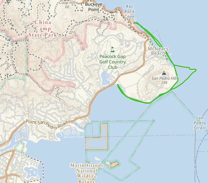
On July 13 it was time to get back on the water. We had a six week hiatus while playing grandparents and dealing with the challenges of social distancing and staying-at-home. With a prediction for afternoon winds we decided to get an early start. China Camp State Park was our chosen launch site and we were on the water at 9:40.

Our plan was to paddle south around Point San Pablo, check the wind and water and round the Marin Islands if conditions looked good. We were paddling on an ebb so we would have the current with us going south, and the wind with us on the return. Once we were on the water two small islands, The Sisters, looked inviting so we set course for the islands thinking we might “thread the needle,” passing through a narrow slot in the west Sister called Grendel’s Needle. Once we were through the slot, we headed back to Point San Pablo. We found that on crossing back we were experiencing the full fetch of the wind blowing from the southwest, giving us some steep wind waves up to three feet with a few whitecaps slapping us; not a place for an inexperienced paddler, but we found the challenge invigorating.

As we rounded the point, we left the rough water behind. I find when I’m paddling in challenging conditions I’m intent on keeping my hands on the paddle and practicing boat control. Putting the paddle down to take photos is not an option.

We took a quick reconnoiter of the Marin Islands and decided that rather than slog into the wind, we’d turn into a little beach near McNear Brick & Block, a brickyard that was established by George P. McNear and his son Erskine in 1898 which still operates today. You can see the chimneys of the brick works in one of the photos.

Once we landed, we pulled our boats out of the water and dipped into our lunches for a mid-morning snack. With the wind building though, we decided that it was prudent to get back on the water to begin our journey back around the point.

We were back at our launch point at noon. We finished our lunch and went back on the water to practice boat control drills and rescues. My Eskimo roll needs more practice.

Our paddle covered six miles, and we were glad to be off the water as we watched whitecaps build in the afternoon.

Yellow Bluff

Thursday, July 18 found me on the water gain with my BASK paddling buddies. Our launch site was the public boat ramp in Sausalito. Anticipating heavy traffic on the commute across the Richmond-San Rafael bridge I decided to get an early start, and to my surprise the traffic was light. I was way ahead of schedule.

The plan was to paddle to Angel Island. When I stepped out of the car though, I got caught by a gust of wind that nearly blew me off my feet. Not good conditions for paddling to the island. I decided I’d wait until my buddies showed up before unloading my boat. At 10 am there were four of us on the boat ramp, discussing plan “B,” which was to hug the Sausalito shoreline and paddle out to Yellow Bluff.

At 10:30 we were on the water, paddling north along the shore. We paddled past the yacht harbor, under the piers of The Spinnaker Restaurant, and passed the ferry dock. Once passed the Trident Restaurant we had a bit of a slog straight into a brisk wind, but only for about 20 minutes when we found ourselves in fairly protected water.

Yellow Bluffs is a popular spot for kayakers who want to play in some dynamic water. The tide, current, wind and swell can make for some lumpy water. Not a good spot for beginners, but fun for those that want to practice some more advanced skills. Conditions today were just moderately bumpy.

When I’m paddling in lumpy water, I’m not taking pictures. It’s time to keep both hands on the paddle. We paddled past the Bluff and on towards the Golden Gate Bridge. Then it was time to turn around and head for a little beach just north of Yellow Bluff where we landed for lunch. We found an abandoned kayak on the beach. Full of water and gravel.

Our return trip was a breeze, literally, since we had the wind behind us pushing us along. Paddling back past the tug boat Owatonna. Want to live on a tug boat? This one is for sale and outfitted for four people as a live-aboard. Then it was back to the boat launch. We were off the water at 2 pm, having paddled 6 miles. You can see more photos here and you can view a track of our paddle here.

Too Windy for the Gate

BASK Thursday Paddle April 25, 2019

Thursday, April 25, 9:45 am. I’m the first one to arrive at our intended launch site, Horseshoe Cove, just inside the North end of the Golden Gate Bridge. The weather prediction was for light winds and light current. When I step out of the car though, there’s a stiff wind blowing with the prediction for gusts to 25.

Our plan was to meet at Horseshoe Cove and paddle out the Golden Gate to Black Sand Beach near the Point Bonita Lighthouse for lunch. At 10:30 with several of us huddled discussing the weather we decide to go to “plan B,” which is to drive to Sausalito and launch from the public boat ramp next to Salito’s Crab House. We’re on the water by 11:30, six of us in five boats, one double and four singles.

We paddle along the shore, staying out of the wind with a little beach in mind just beyond the town of Sausalito, paddling in the direction of our original launch site. We paddle past the yacht harbor in relatively calm water, then along the Sausalito waterfront with diners on the decks of restaurants, past the ferry where we wave to the tourists and kids, and past multi-million dollar homes.

Sausalito is a popular tourist destination with many fine restaurants , shops and quaint inns. There’s also an annual Art fair which happens on the Labor Day weekend, also a number of houseboats. Richardson’s Bay has been a popular place for “anchor-outs,” but today we see few of the run-down looking boats. Tourists are out in shorts and t-shirts, many on rental bikes. I’m wearing a dry suit which is appropriate for wind and choppy water.

We find our lunch spot, but before landing several of us decide to go out to Point Cavallo to take a peek at the Golden Gate Bridge. As expected as we rounded Point Cavallo the wind hit us and we all agreed that we made the right decision to avoid going out the Golden Gate.

After lunch we paddled back to our launch point, having covered 5.6 miles. You can view more photos here and view a track of our paddle here.

Gray Day on the Bay

Gray day on the bay

There were three of us on the April 4 BASK Thursday Lunch paddle. Smaller than our usual paddle. Rain was forecast. We launched under gray skies at 11:00 am from Ferry Point and paddled across the Richmond shipping channel pausing to let a tugboat go by. We then crossed the channel, rounded the end of the jetty and headed east around Brooks Island. We had calm waters for the most part with one foot wind waves and a bit of wind on the South side of Brooks Island with the wind from the Southwest. We saw a few rain squalls on the bay, but we kept dry. We ducked behind Bird Rock at one point thinking we were going to be hit by a squall, but the squall never hit us.

Once around Brooks Island we headed for a little beach inside the jetty at Barbara and Jay Vincent Park where we broke out our lunches.

Once back in our boats we paddled along the Richmond waterfront, past a car transport ship, the Glovis, and then along the waterfront past the Red Oak Victory, a World War II Victory Ship, and on to the Brickyard Cove where we stopped to chat with a friend that has a house on the water. Wildlife on the paddle included several Osprey, numerous shore birds and harbor seals. Our paddle covered 6.7 miles bringing us back to our original launch site. You can see more photos here and view a track of our here.

Lunch at the Albany Bulb

On Thursday, December 6, I managed to sneak away from my usual work routine for a paddle with some of my BASK buddies. We launched from Ferry Point in Richmond and paddled inside the breakwater of Brooks Island. 

Then after letting some shipping traffic pass we crossed the channel and paddled through a break in the breakwater.

It’s only possible to paddle through the break on a very high tide.  High tide was 6.5 feet at 10:30 am, perfect for us to take a short cut. Once we were through the breakwater we paddled on the inside of Bird Island, where we were entertained by harbor seals and birds.

Once we were passed Brooks Island we set a course for the tip of the Albany Bulb landing at the end of the bulb under the watchful eye of the dragon, a public art sculpture. One of our members managed to stumble on a rock in the shallow water and banged his head on his boat. 

After lunch we explored the artwork on the bulb. 

When we got ready to launch our boats again, what had been a sandy beach was now rocks. Our boats were left high and dry with the receding tide. We ended up carrying our boats a short distance to a better launch point and paddled back by way of the Richmond Inner Harbor to check out the new ferry terminal.

Lunch on Angel Island 8/23

On Thursday August 23 with my work docket managed, I strapped my kayak on the top of my truck and headed to Sausalito to join fellow Bay Area Sea Kayakers (BASK) for a jaunt to Angel Island. We had a cool “Fogust” day with favorable currents and wind. We launched from the public boat ramp next to Salitos Crab House. You wouldn’t know there is a public boat ramp here without some local knowledge; and while it’s a convenient spot to launch on a weekday morning, I can imagine it would be a challenge on the weekend with the town full of tourists.

We launched at 10:30, Paddled down Richardson Bay to Peninsula Point where we poked our heads out into Raccoon Straight to see what was in store for us. Conditions looked promising, so we headed across the straight towards the West Garrison. As we crossed Raccoon Straight it became apparent that the current was carrying us east so we altered our course for Ayala Cove where we landed and had lunch.

After lunch we were back in our boats and we made a course for the Corinthian Yacht Club. Once we were across the straight and close to the Yacht Club we paddled along the shore admiring the houses clinging to the cliffs. We had an easy paddle out and back, on what can be a bit of a challenge if the wind and currents are contrary. We were back at our launch site at 2:30 in the afternoon having covered not quite seven miles.  You can view more photos here and you can view the track of our route here

Back on the Water

On Thursday April 12, I manged to get back on the water to go paddling.  We were off to Africa in late February and upon returning home in mid-March I developed bronchitis which kept me off the water for a couple of weeks. Almost two months without a padding “fix!”

In any event,  my schedule permitted me to join my BASK friends for the Thursday Lunch paddle on April 12. Our journey took us from Ferry Point to Point Molate.  We paddled past the tanker pier at the Chevron facility in Richmond. Note the words on the superstructure of one of the tankers “Protect the Environment.” Seems a bit ironic. We had blue sky with puffy cumulus clouds and calm water. There were four of us and our paddle covered eight miles. You can view a track of the paddle here.  As we approached the San Rafael Bridge, I was struck by the graphic element of the bridge with the clouds and I thought it might make an interesting black and white image. What do you think?


BASK Skills Clinic 2017: Day 9

September 2 found me on the water again with fellow BASK Skills Clinic students and our amazing crew of instructors. With a heat wave baking the San Francisco Bay Area, playing on (and in) the water was the place to be. Following our intro day and four weekends of skills training, this was an optional day.  We opted to spend the morning practicing paddle strokes and rescues. I typically wear a dry suit when paddling on the Bay, since the typical weather pattern is a cool wind and cool water. With temperatures approaching 100 degrees though, I opted to wear my short Farmer John and a t-shirt. Along with the spray skirt and PDF I was quite comfortable in the boat, and in the water. After spending the morning on drills, somebody suggested we paddle to Treasure Island, and off we went. Here’s a link to our track if you want to see our route. We have one more adventure left in the skills clinic; that’s an overnight kayak camping trip on September 23. Stay tuned.

Gray Day on the Bay

There were just two of us today, Danny and myself, for the BASK Thursday Lunch Paddle.  We launched from China Camp State Park Beach in a light rain with little wind, and headed south around Point San Pedro, past the quarry, paddling inside the pilings to avoid the stronger incoming current  further out.  We ended up at a little beach just off of San Pedro Road near the brick kilns. There we found a couple chairs and a table and broke our our lunches. A cool breeze and the overcast created a bit of a chill, so we were happy to get back in our boats to paddle back to our launch point. Back on the beach we were intrigued by a couple of guys that were arranging pebbles in various locations and taking photographs of them; reminiscent of an Andy Goldsworthy installation.  You can follow a track of our paddle here and more photos here.

Wind in the Rigging

Being a sea kayak, my boat doesn’t have much rigging, just a few deck lines. And today as we rounded Brooks Island a gust of wind hit, creating a howling sound as it raced over the deck. Earlier, at our appointed time of 10:30 the five of us were contemplating the weather. Small craft warnings (isn’t a kayak a small craft?), steady wind of 17 knots with gusts to 25. We decided we’d launch at Ferry Point and paddle along the Richmond waterfront, protected from the northwest wind. With the wind at our backs we paddled up the shipping channel, and across to Brooks Island where we followed the shore. We rounded brooks Island, and it became clear that we had two options, paddle back to the Richmond waterfront against a strong wind, or paddle along the south side of Brooks Island and the breakwater hoping to find a little protection from the wind. Paddling along Brooks Island was a chore, but not too intimidating. We eyed several beaches hoping for a place to stop for lunch, but Brooks Island being a nature reserve, is off limits to visitors, so we continued paddling. After rounding the jetty we headed for fellow kayaker’s house in Brickyard cove, having lunch on Gordon’s new deck, overlooking the yacht harbor.  As we were finishing lunch we noticed that one of our boats had taken off on adventure of it’s own, so we promptly jumped back in our boats, rounded up the rogue boat and paddled back to our launch point. Overall we paddled seven miles, starting out with a wind which eased up a bit as the day went on. More photos here and you can view a track of our paddle here.

%d bloggers like this: