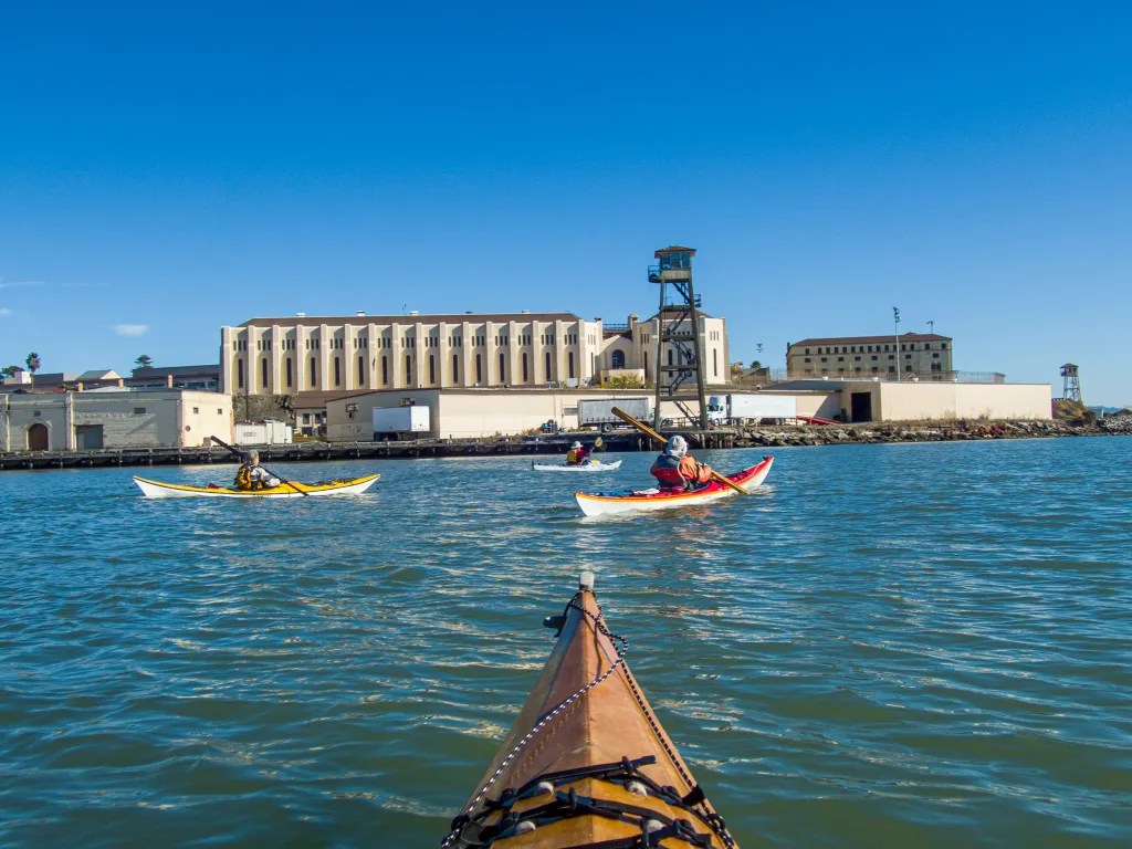
Gone Paddling x 4

Here are four more paddling adventure which deserve to be documented. I consider this blog to be a diary of my adventures. If I don’t record the adventures, I may forget they ever happened. And for the past few years, as the new year turns over, I have turned my blog entries into a coffee table book.

So here are four paddles: 10/27 Richmond to Albany, 11/03 Eckley Pier, 11/10 Gallenas Creek, and 11/28 Windsurfer.


Richmond to Albany

On October 27 there were just two of us with two wooden Pygmy Boats. We launched from Ferry Point in Richmond, paddled out past the end of the breakwater and then past Brooks Island. We poked into the basin northeast of Caesar Chavez Park thinking we might find a spot to land, but we didn’t see much so we paddled to Albany Beach where we stopped for lunch.

After lunch we returned to our launch site by way of the Richmond waterfront, stopping to admire the Red Oak Victory. We logged 11 miles.

More photos are available in an online gallery.


Eckley Pier

November 3. Seven of us gathered at Eckley Pier for a paddle to Martinez. The pilings of several abandoned piers provide an obstacle course to practice boat control. I had my GoPro camera running to capture the action. It remains to be seen when that footage will be available. From Eckley Pier we paddled out towards the shipping channel to take advantage of the flooding current.

Once we reached the Martinez Marina, we hauled our boats up the boat ramp and off to the side to keep the ramp free for boaters. We logged 8.8 miles over the course of the day.


Gallenas Creek

November 10. Up the creek, Gallenas Creek. We launched from China Camp and took advantage of the high tide to paddle up the creek. When we could no longer make forward progress, we returned to the McInnis Canoe and Kayak Dock where we hauled out our boats and had lunch. Our course covered 10 miles.

More photos are available in an online gallery.


Windsurfer Beach

November 29. Loch Lomond to Windsurfer Beach. This paddle takes us under the Richmond San Rafael Bridge and past San Quentin State Prison. At lunch on Windsurfer Beach, we watched the ferries and a dredge. We paddled around the Marin Islands on the return leg, a total of 8.2 miles.

More photos are available in an online gallery.

Martinez to Eckley

On September 29 I joined nine other BASK members for a paddle from Martinez to Eckley Pier. We launched from the boat ramp at the Martinez Marina at 10:30 a.m. Once we were out of the Marina, we turned west where we hit a bit of bumpy water. We had the current with us and the wind against us resulting in some wind waves splashing over our decks. Then it was on to the obstacle course of old pilings which are always fun to paddle through, creating an opportunity to practice boat control. Slack water was about noon, so we had little current to contend with as we meandered through the pilings.

We arrived at Eckley Pier at noon, broke out our lunches and watched the train go by as we ate. Then it was back on the water and back through the maze of pilings. Now we had the wind at our back and the current starting to flood so it was a little more challenging to paddle the maze. Some opted to paddle in the open water. With the current pushing us back up the river it was a quick paddle back to Martinez. We were back at the boat ramp at 2 p.m., having logged 9.2 miles.

More photos are available in an online gallery.

Here’s the track of our paddle.

Crossing Carquinez Strait

At the northeast corner of San Francisco Bay is Carquinez Strait. This is a narrow passage where the Sacramento and the San Joaquin Rivers empty into the Bay. On Saturday November 27 our kayaking club, Bay Area Sea Kayakers (BASK), hosted a paddle here. Not having much familiarity with this area I thought it would be fun to explore this area with a few paddlers that know the area well.

After a comprehensive safety talk and radio check nine of us we were on the water at 11 am launching from the boat ramp at the Martinez Marina. We paddled west staying clear of the shipping channel and taking advantage of the ebb current for a quick ride. Shortly after launching one of our party discovered that he was quite uncomfortable in his boat. He turned back leaving the eight of us to continue on. When it was time to cross the straight we held up to let a ship pass. Then it was across the straight to Glen Cove Waterfront Park where we found a nice beach to land. We had lunch in a grove of trees on a bluff overlooking the beach.

After lunch we were back on the water hugging the north shore to avoid the deeper water where the current was still ebbing. We even managed to find a few eddies going counter to the main current. We paddled along the Benicia waterfront admiring the waterfront homes and decrepit docks. When it was time to cross the shipping channel we again held up for a tanker and an escort of tug boats.

Then it was back across the straight and back to the marina. We were back at the boat ramp at 4 pm, finding a traffic jam of boats waiting to use the ramp. We managed to land and get our boats off the ramp without interfering with the traffic much. We logged 11.7 miles on an excellent paddle with great company. You can view the track of our course below. Click on the map to view a more detailed view. I was disappointed to discover the lens on my camera had acquired a smudge of sunblock which ruined most of my photos. A lesson to carry a lens wipe and to check the lens frequently. In any event, I did manage to salvage a number of images and you can view them online.

.

%d bloggers like this: