Exploring Baja: A 21-Day Camping Adventure

Our Baja trip began in March 13 when we hopped in the camper and started our drive to Loreto. The highlights of the trip included spending a couple of days in the desert to photograph the cirios and cactus and a six day kayaking trip out of Loreto. Those events are covered in separate blog posts. For this post I’m going to describe some of the other highlights of the trip.

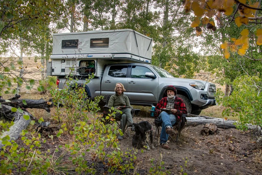
We spent our first night at Kern River Campground just east of
Bakersfield. The highlight here was breakfast. We fired up the Dutch oven and cooked up a mushroom and brie breakfast strata, one of our favorite camping meals. Needless to say, the leftovers provided us with breakfast on several days.

From the Kern River we moved on to Anza Borrego Desert State Park where we spent two nights in the Tamarisk Grove campground. Most of the spring wildflowers were gone, but we did find a few cactus in bloom.

From Anza Borrego we headed south and crossed the border at Tecate, an easy border crossing, although we did have to walk across the street to the bank to pay for our tourist cards (Forma Migratoria Multiple, FMM) since the credit card reader at the immigration office was out of order.

We passed through Guadalupe about noon so we stopped for lunch at Tacos del Valle for some delicious tacos, our first meal in Baja.

We reached Fidel’s Palapas, just south of San Quintin, about 5:00 PM, our intended stop for the night. Fidel promptly appeared to collect 300 pesos. Fidel’s has hot showers, running water and electrical hookups, although we didn’t make use of the water or electrical.

From Fidel’s we headed to Cataviña where we spent two nights in the Cactus Wonderland. From there it was on to San Ignacio where we spent one night at Paraiso Misional, our favorite place to camp in San Ignacio. It’s a lovely spot in the shade of palm trees, with hot showers. Then on to Loreto where we had two days to explore the town, having some fabulous food, dining with live music at Baja Haay and enjoying the vibe of the town.

From Loreto we embarked on our six day kayaking tour exploring some of the islands, poking along the coast, paddling, snorkeling and doing a bit of hiking. Before leaving Loreto on our return trip we made a stop at a water vendor to fill our water tank.

We were happy to find that one of our favorite restaurants, Nomadico’s, was open. We stopped for a delicious lunch. Joann had a yellowtail tostada and I had a scallop tostada with a pineapple coconut smoothie. On our last night in Baja we camped at Guadalupe RV park and took advantage of the hot showers. We crossed the boarder again at Tecate, camping at Sycamore Flat Campground in the Angeles National Forest. From there we checked out the Antelope Valley Poppy Reserve. The flower display was past its prime, but we did find a few clusters of flowers. Then it was on to Colonel Allensworth State Historic Park before making the final leg home. We were back home on the afternoon of April 2 having logged 2820 miles over the course of our 21 days.

More photos are available in an online gallery.

Camping in Cactus Wonderland

After a night on the beach at Fidel’s Palapas just south of San Quintín, we were on the road shortly after 10:00. About noon as we were contemplating lunch, we found Restaurant El Sacrificio. One thing I like about traveling in Baja is discovering places to eat.

North of the border it’s franchises surrounded by acres of asphalt with young kids behind the counter. When you order a Big Mac, you know exactly what to expect. Here it’s small family-run establishments by the side of the road with the charm of rural Baja, with posters about the Baja races and local treats. The food always seems to be delicious. We were the only guests for lunch. Excellent food and the opportunity to practice my broken Spanish. After lunch we were back on the road.

Shortly before reaching the town of Cataviña we pulled off onto a dirt road and explored possibilities to camp. We had camped here three years ago on our previous trip.

I wanted to return to spend a couple days exploring the desert. One of the apps we use for navigation, iOverlander, suggested that there were several locations suitable for camping. We explored a couple of dirt roads before settling on a spot. It was just short of 3:00 when we parked the rig.

This would give me two sunsets and two sunrises for photography. Temperatures were also more pleasant in the morning and evening, running about 65 degrees at sunrise. By mid-afternoon the temperature was 85 in the shade and 95 inside the camper. During the heat of the day we pulled out our journals and books and hunkered down in the shade.

Sunset provided some interesting photo opportunities with the cactus and cirios silhouetted against the western sky. Sunrise was not near as interesting. About 20 minutes before sunrise there was a faint glow of color which only lasted about five minutes, and I was not inspired to do much with the early morning light.

We did see a number of cactus in bloom as well as a few ocotillo with their spray of red flowers looking like flames on the tips of their thorny branches.

With the dark night sky, I was inspired to try my hand at astrophotography to see if I could capture part of the Milky Way. I think the resulting image of the cirios silhouetted by a cloud of stars is quite interesting. You can view more photos in an online gallery.

Back from Bishop

Our adventures recently took us over the Sierra to visit family and celebrate birthdays. We left Bishop on the afternoon on July 29 for our return trip, with a stop at Donna the Dog Lady to pick up our dog Carson. Carson spent the night there since we were involved in some activities where Carson was not welcome.

With daytime temperatures of 100 degrees, we were hoping to gain elevation and find some trees for shade. Green Creek near Bridgeport seemed to offer a good bet for the night. We turned off onto Green Creek Road and followed the well-graded dirt road for a little over six miles, finding a level spot to park the rig for the night at 7900 feet. Carson was happy to wander around camp off-leash. Having set up camp, we discovered that the mosquitos were quite abundant, so we did our best to cover any exposed skin and break out the repellent.

Green Creek is a gorgeous spot with Jeffrey pines, aspen and willows. The California Department of Fish and Game maintains the Green Creek Wildlife Area, a 720-acre protected area that includes habitat for mule deer migration and fawning. It’s also home to black bear, beaver, bald eagle, grouse, mountain quail and various waterfowl. We decided to camp outside of the wildlife area, which is marked with signs.

I wandered around our camp in the evening and again in the morning with my camera, in this case an iPhone 14. I was intrigued by the lush green vegetation, the aspen trees and the wildflowers. We saw lupine, penstemon, and prickly poppies. Once the mosquitos became annoying, it was nice to take refuge in the camper with its screened windows that still offer a view.

Back from Baja

We arrived home on the afternoon of March 28 having logged 3012 miles over the course of 23 days: three of us, Joann, me and our dog Carson. We were a little concerned about taking our dog, but Baja turned out to be quite dog friendly. Along the way we had some amazing adventures, and I captured many photos to sort through and share.

Before we could obtain our Mexican Tourist Cards (FMMs) we had to make a stop in San Diego to renew our passports. If you are planning on traveling to Mexico, check your passport. You need to have at least three months on your passport to apply for an FMM. We discovered this just a few weeks before our trip and we had to scramble to get our passports renewed.

On the trip south we decided to take a quick detour to Anza Borrego to check out the wildflowers. We were not disappointed.

Our traveling rig consists of a pop-up Four Wheel Camper on our Toyota Tacoma. The camper is outfitted with a refrigerator, heater and cooktop. There is no toilet or shower on board, but we’re comfortable taking a shovel out in the woods (or desert) if we are boondocking or taking advantage of facilities including showers in established campgrounds. We also have the rig set up to carry two kayaks.

For planning both prior to the trip and on the road, we used the app iOvelander for locating facilities and Maps.Me for route planning. We discovered a hack that let us import the iOverlander pins into Maps.Me, which proved to be quite useful when we were offline without cell phone signal or Wi-Fi. We also found the Baja California Road and Recreation Atlas from Benchmark Maps useful, as well as Google Maps when we had a cell phone signal.

And of course, sharing travel information with fellow travelers is also fun and informative.

Some of the highlights along the trip included a fabulous lunch with a bottle of wine at Encuentro Guadalupe shortly after crossing the border, camping in the cactus gardens near Catavina, and whale watching in San Ignacio Lagoon.

We had our share of fabulous sunsets and sunrises and we managed to get our kayaks on the water at Bahia Conception and Gonzaga Bay.

Over the course of the trip, we spent 23 nights in our camper. On a couple nights, we were happy to have the camper as protection from fierce winds. The southern-most point in our trip was Playa Coyote on Bahia Conception. Three weeks is just not enough time to see much of Baja. We’re already thinking about our next trip.

Bahía Concepción

Today we arrived at Playa Santipac. At the gate we paid 200 pesos for one night thinking we would move on the next day, but we ended up spending two nights. The campground was fairly busy, but we did find a suitable site with a palapa about 1/2 mile down the beach.

Playa Santipac is a popular spot for big rigs but also suitable for smaller rigs and tents. We had fun visiting with fellow campers who were walking along the beach, many of them from Canada and other northern locations that come down to Baja for several weeks or more. One of the joys of traveling is hearing people’s stories. Everybody on the road seems to be quite friendly and happy to share information.

There is no running water at the campsites, but vendors drive along the beach in the morning and provide you with a blue barrel with as much water as you wish for a small fee. There are also vendors selling fresh fish and a variety of other things. We bought water to use for washing since we wanted to conserve the water we had on board for drinking and cooking. We also bought some fresh halibut which served us for a couple of dinners as well as a hammock and some carrot cake.

We did manage to get our boats on the water, paddling out from the beach and around several islands. In one of the photos, you can see Joann in the little wooden boat with a line of RVs on the beach in the background. The beach at our campsite was quite shallow at low tide, so we ended up dragging the boats until we had enough water to paddle. If I had been paying attention, I would have given priority to a campsite further west where the beach wasn’t quite so shallow.

After a few days of dry camping, it was nice to have a shower even if it was just pouring a bucket of cold water over my head. For lunch we walked down the beach to Armando’s, a rustic shack on the beach with delicious seafood tacos.

After a couple of days at Playa Santipac we moved on to Playa Coyote. This is a popular spot. We pulled into the campground at 10:30 in the morning and found the last open site. We were surprised to discover that the campers next to us were kayakers, fellow members of BASK (Bay Area Sea Kayakers). We pooled our resources for dinner. I fired up the Dutch Oven and baked up some Halibut. In the morning we paddled together around Isle Coyote. It was a gorgeous day to be on the water and the flat calm gave us the opportunity to look below the surface. We saw many sting rays.

And talking about sting rays, I managed to step on one. Ouch! Before we launched our kayaks, I was tossing the ball for Carson and the ball went in the water. Carson wouldn’t go in the water to get it, and while the water was only six inches deep, I forgot to do the sting ray shuffle. Fortunately, I was wearing sandals and after a little first aid I was on the water paddling. I think I was quite lucky, since sting ray wounds can be very painful.

While we did have thoughts of driving further south to Loreto, Playa Coyote was such an idyllic spot we decided to spend time there rather than adding more miles to our trip.

More photos of Bahia Conception are available in an online gallery.

Cataviña: Cactus Wonderland

We wanted to spend two nights in the vicinity of Cataviña. The Cirios and cactus here are fascinating and, along with the rock formations, I thought this would be rich with photo opportunities. I figured two nights would give us opportunity to experience two sunsets and two sunrises and time to explore the cave paintings.

There are plenty of places to boondock in the desert here. We picked a spot that iOverlander identified as “Cactus Wonderland.” We found one other camper here, but we simply drove around to the other side of a rock outcrop and found a quiet spot to camp.

The next morning we walked to the cave paintings. Rather than walk on the highway, we decided to follow a dirt road that appeared to parallel the highway. This worked for a while until we started heading away from the highway. Using a GPS track on my phone from a previous trip, we were able to make our way over some rocks and head in the direction of the cave. Going over the rocks we encountered a rattlesnake hidden in the rocks. He let his presence be known with an alarming rattle.

We kept our distance and continued on to the cave. The cave is a bit of a climb up from the road and the parking area. We were happy to spend a few minutes in the cool respite of the cave since we were feeling the heat of the desert on the hike. As the crow flies, the walk to the cave was just over a mile. We managed to turn that into a 4-mile round trip hike with our meanderings.

True to expectations, this area provided many fascinating photo opportunities. The Cirios or Boojum trees, sometimes called Doctor Seus trees, were quite interesting and fanciful. More photos are available in an online gallery.

Mendo Madness

We were hardly back from Scotland when it was time to pack up the kayaks to head for Mendocino. On September 20 we pointed our rig to Van Damme State Park to join our kayaking club for our annual Mendo Madness. Each year our kayak club takes over a good part of the campground for a week of paddling and socializing. There were about 70 of us, which makes for plenty of paddling opportunities with skill levels ranging from novice to expert, a great opportunity to get on the water with friends and to advance our skills.

On Wednesday we paddled up the Albion River. It’s such a peaceful feeling paddling on the quiet river past the redwood trees, with a variety of wildlife to view. We saw plenty of birds, but no seals or river otters.

On Thursday conditions were perfect to paddle on the coast, so we joined a group of experienced paddlers, launched from Russian Gulch, and paddled south exploring caves, tunnels and other features on the Mendocino Headlands. I had a GoPro camera mounted on my helmet, so stay tuned for some video of our paddling through caves and tunnels.

Our club has occasionally been referred to an eating club with a kayaking disorder. True to form there was an abundance of food with two pizza ovens and charcoal grills going. We came prepared to cook our own meals, but who wants to cook when you can simply nosh while sharing stories with friends. Friday night was Bourbon and Brine, hosted by two club members who are very creative mixing drinks suitable for the occasion. They were assisted by a half-dozen bartenders.

On Sunday, September 25, we broke camp to head for home. Passing through Cloverdale at noon gave us a good reason to stop for burgers, fries, and shakes at Pick’s Drive in. Great burgers.

More photos are available in an online gallery.

Back from Baja

On December 1, we hit the road for a two-week trip to Baja California, returning home on December 15. A whirlwind tour with many stories to tell and photos to share. Rather than write one long blog post covering the entire trip, I’m writing several posts to cover various aspects of the trip. We’ll start with this YouTube video. Joann recreated the trip in Google Earth with slides for each stop along our trip. We’ve animated the map and video so take a moment to follow along.

After getting a late start we decided to scrap our original plan which would have taken us to Red Rock Canyon State Park. So where to spend the night? I have several apps on my phone I use for trip planning. I fired up The Dyrt and started looking at options. It seemed like whatever itinerary I dialed in, The Almond Tree Oasis was the suggested stop. There are not many options for boondocking, let alone camping on the route to Southern California. The Almond Tree Oasis suited our needs. In the morning we fired up the Dutch Oven and cooked up some Mushroom and Brie Breakfast Strata, one of our favorite breakfasts.


Joann preparing Breakfast Strata, aerial view of our camp at Joshua Tree Ranch LA.

The second night we camped near Lancaster at Joshua Tree Ranch Los Angeles, going from an RV camp with full services to boondocking in a lovely grove of Joshua Trees with no services whatsoever. We were happy to pay for the right to camp in this spot, having again relied on The Dyrt to find a site.

Then it was on to Ocotillo Wells SVRA where we joined up with 134 other Four Wheel Pop-Up Campers for their annual rally.

Treve explaining his lift system for popping up the top of the camper with kayaks on top; touring fellow camper’s rigs; Bob explaining radio operation.

It’s always fun to see how people have tricked out their rigs. Following the rally, we continued south to join Bob Wohlers and his Off-Road Safety Academy for a tour of Baja. We had 11 rigs in the caravan. Bob gave us all radios to use for the duration of the tour and with his guidance we managed to cross the border, negotiate our way through Mexicali and along the narrow highways and dirt roads of Baja. We spent one night at Pete’s Camp, two nights at Bahia San Luis Gonzaga, and two nights at Bahia de Los Angeles which was the southernmost point of the trip.

Camp at Gonzaga Bay; Cowpatty Cafe; rainbow at Playa La Gringa at Bahia de Los Angeles.

For the return trip we crossed the peninsula, driving up the Pacific side with overnight stops at Quinta Cristina near El Rosario and Punta Banda. Once back on the US side of the border we headed for Agua Caliente County Park, which I had located using another favorite app, iOverlander.

On the beach with our kayaks on the Sea of Cortez; sunset over Bahia de Los Angeles; camp at Quinta Cristina.

At this point in the trip, we were looking for water and electricity, having depleted our water supply and suffering from a dead battery in the camper. With a dying battery, we were without refrigeration and heat. We’ll be upgrading our camper soon, moving to Lithium (LiFePO4) batteries. We’ll also be replacing the shocks and adding airbags to the rear suspension to help balance the load. The camper is a big load for the Tacoma. Over the course of the 15 days we logged 2268 miles. You can find more photos from the trip online. I’ll be adding to these galleries as I work through the photos in the coming weeks.

Fall Color Review

So here it is late November and I’ve finally made it through the photos from our Eastern Sierra fall color trip. On September 27, having spent several days with family in Big Pine, it was time to go hunt for fall color. We left Big Pine in the morning, and that night we camped at the Bishop Creek Campground. We were lucky to have some relatively clear air since smoke from wildfires had been plaguing us off and on at lower elevations. Bishop Creek is always a good prospect for fall color.

Here we are with our Four Wheel Pop-up Camper rig parked for the night in a very pretty aspen grove. In the morning we drove up to North Lake and did a short hike to a location I had scouted for a view overlooking the lake. Then it was off to Rock Creek. We made a quick stop at Mosquito Flat trailhead. We did a short hike and, while it was a lovely hike, I was not inspired to take many photos. We moved on to Sagehen Summit Road. Here the aspen were a little past prime but with plenty of photo opportunities.

I found a grove of aspen with a panoply of colors from green to yellow to black. This is my favorite image from this trip and it’s available in my art store. With the sun about to set, we drove the short distance to Mono Lake where we set up camp in the dispersed camping area near Mono Mills.

The next morning we were off to Virginia Lakes, where we did a three mile hike to Frog Lakes. Most of the aspen here were past prime, but we did find fall color in the willows.

From Virginia Lakes we took the Dunderberg Meadows Road, pulling off in mid-afternoon to set up camp. Here I put the drone in the air, you can see the image looking west over the trees. We found some lovely aspen groves along the Dunderberg Meadow Road and made a note to include this drive on future trips. Before heading back to the pavement we took a detour to explore Green Creek and discovered some very nice camping opportunities. Then it was back to the the pavement on US 395 and up and over Sonora Pass for the drive home. We’ve made many stops near Sonora Pass on previous trips, and on this trip we did not stop for photos. You can view more photos from the trip here.

The Mojave Road

The Mojave Desert is a huge swath of land in the Southwest corner of the United States, much of it located in California. It occupies close to 48,000 square miles and is noted for the Joshua Trees that grow only in this desert. The Mojave Road runs across part of the Mojave Desert and through the Mojave National Preserve, a unit of the National Park System. The road was originally a trail for Native Americans stringing together a series of watering holes and providing a route for trade between desert and coastal dwellers. Later it became a route for Spanish missionaries, explorers, and settlers from the 18th to 19th centuries. Today it’s an iconic four-wheel drive road. We spent four days driving the road with a caravan of Four Wheel Pop-Up Campers.

For part of the tour, I had a GoPro camera on the dashboard of our truck. Here’s four days of touring condensed into 10 minutes. Make sure to watch the water crossing at 8:52.

Our tour started at 7:30 a.m. on October 8 in the parking lot of the Avi Resort in Bullhead City. There we met our tour guide, Bob Wohler of the Off-Road Safety Academy. Bob gave us a briefing and provided a radio for each truck to use for communication while touring.

Once we were off the pavement, we stopped to air down our tires. I’ve driven off-road periodically for over 20 years and this was the biggest eye-opener on the trip for me. Less air in the tires gives a much smoother ride. As Bob would say, sympathy for the passengers, sympathy for the equipment, and sympathy for the environment. Our tour passed a number of interest points, the first being Fort Piute. Then it was on to our campsite for the night at School Bus Camp, noted for an abandoned school bus that marked the location until a few years ago when it was removed.

There are numerous points of interest along the road, including a tin can into which you can drop a penny for good luck, the Mojave Mailbox where you can sign your name and leave a comment, and a collection of gnomes and frogs. You just have to see it to believe it. The terrain ranges from sandy flats to rocky road to a dry soda lakebed, traveling through some magnificent Joshua Tree forests along the way. The road has worn down at several points so that you are driving in a canyon so narrow that the vegetation is brushing against the sides of your vehicle.

Once across the soda lake you arrive at a pile of rocks. Bob had instructed us to pick up a rock earlier in the trip, and this is where the rocks are deposited—at Travelers Monument. There is actually a monument buried under this pile of rocks. If you scramble to the top of the pile you can read the plaque. We were sworn to secrecy regarding the words so you’ll just have to plan a visit to read it yourself.

A highlight of the trip was the lava tube, and also the water crossing at the end. We ended up driving the last section of the road from east to west because we helped some travelers who got their vehicle stuck in the sand. Time was an issue, so we took a detour to Afton Canyon Campground for our last night. The next morning two rigs decided to cross the Mojave River with Bob’s coaching.

More photos are available here, and I’ve made a few select images available as fine art prints in my art store.

We logged 180 miles on the tour, some of it on side trips off the Mojave Road. Elevation ranged from 500 feet at the start of the tour to 5,700 feet at the high point.