Starting the New Year with a Splash

Once again, we started the new year by going kayaking. This year it was a paddle sponsored by California Canoe and Kayak (CCK). They offered to provide boats for any of us that wanted to invite friends, so we invited two friends. You can see Kristina here on the dock getting help adjusting the foot pegs.

You can also see Kathryn getting outfitted with a sit-on-top kayak. Not having any experience in a kayak, a sit-on-top seemed to be appropriate given its stability. Now it’s time to get on the water. A couple of us enthusiastic paddlers thought it would be appropriate to assist Kristina in a “seal launch,” guiding her boat as we pushed it off the low dock. Not a good idea; she went bottom side up as soon as her boat hit the water. To stay right side up for this kind of launch you need to be able to use the paddle as a brace, not a technique a novice paddler would know.

Kristina, being dressed in a wetsuit and a good sport, was back in her boat and on the water with a smile. Kathryn found her boat a bit slow compared to the more experienced paddlers in touring boats. When some more energetic BASK members offered to give her a tow, she was happy to accept.

Our destination was the Tidewater Boating Center about 2-1/2 miles from our launch site at Brooklyn Basin. Once we reached the boating center, we got out of our boats for snacks and a break. A couple of experienced paddlers were eager to give some instruction on technique for an efficient forward stroke, something that’s quite valuable for covering distances in a kayak.

After the break we climbed in our boats and headed back to our launch site. Our route took us under three bridges, and we had the opportunity to watch the Park Street Bridge open to let a few sailboats through. You can see Kathryn under the bridge. If you look closely, you can see that she is being towed by another paddler. We returned to our launch site where we enjoyed an extravagant potluck meal. A great way to start the new year. Our paddle covered 4.7 miles.

More photos are available in an on-line gallery.

Gone Paddling x 4

Here are four more paddling adventure which deserve to be documented. I consider this blog to be a diary of my adventures. If I don’t record the adventures, I may forget they ever happened. And for the past few years, as the new year turns over, I have turned my blog entries into a coffee table book.

So here are four paddles: 10/27 Richmond to Albany, 11/03 Eckley Pier, 11/10 Gallenas Creek, and 11/28 Windsurfer.


Richmond to Albany

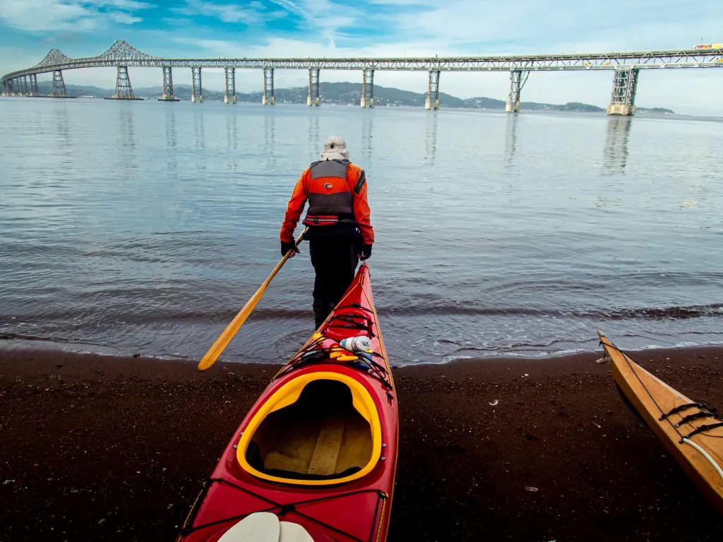
On October 27 there were just two of us with two wooden Pygmy Boats. We launched from Ferry Point in Richmond, paddled out past the end of the breakwater and then past Brooks Island. We poked into the basin northeast of Caesar Chavez Park thinking we might find a spot to land, but we didn’t see much so we paddled to Albany Beach where we stopped for lunch.

After lunch we returned to our launch site by way of the Richmond waterfront, stopping to admire the Red Oak Victory. We logged 11 miles.

More photos are available in an online gallery.


Eckley Pier

November 3. Seven of us gathered at Eckley Pier for a paddle to Martinez. The pilings of several abandoned piers provide an obstacle course to practice boat control. I had my GoPro camera running to capture the action. It remains to be seen when that footage will be available. From Eckley Pier we paddled out towards the shipping channel to take advantage of the flooding current.

Once we reached the Martinez Marina, we hauled our boats up the boat ramp and off to the side to keep the ramp free for boaters. We logged 8.8 miles over the course of the day.


Gallenas Creek

November 10. Up the creek, Gallenas Creek. We launched from China Camp and took advantage of the high tide to paddle up the creek. When we could no longer make forward progress, we returned to the McInnis Canoe and Kayak Dock where we hauled out our boats and had lunch. Our course covered 10 miles.

More photos are available in an online gallery.


Windsurfer Beach

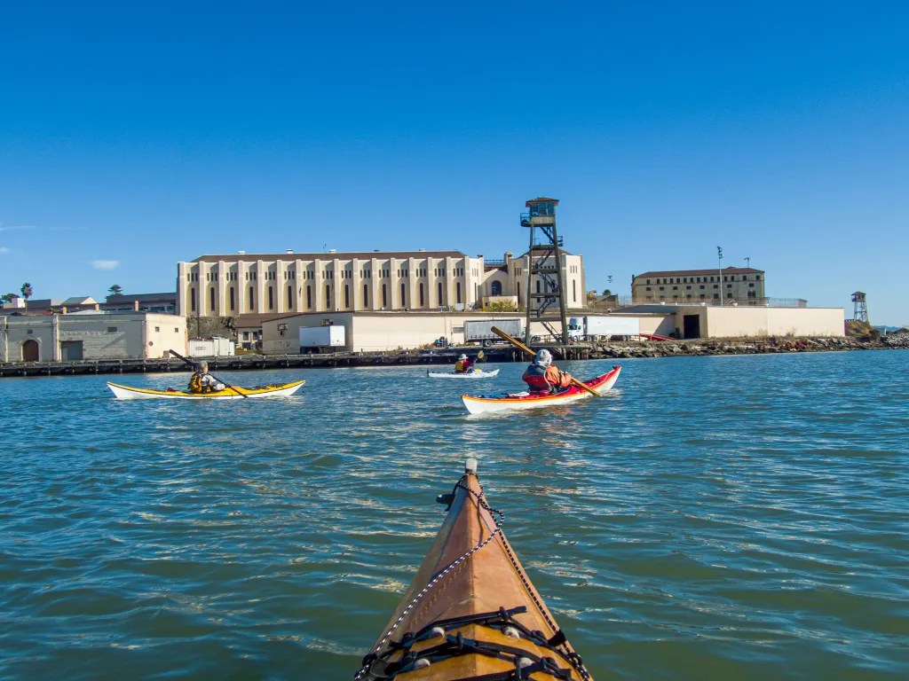
November 29. Loch Lomond to Windsurfer Beach. This paddle takes us under the Richmond San Rafael Bridge and past San Quentin State Prison. At lunch on Windsurfer Beach, we watched the ferries and a dredge. We paddled around the Marin Islands on the return leg, a total of 8.2 miles.

More photos are available in an online gallery.

Four Islands

There are 18 islands in San Francisco Bay. On December 15, we visited four of them, The Sisters and the Marin Islands, all off limits. Our adventure started at China Camp Village Beach. Four of us were on the water at 10 a.m. We paddled out to The Sisters where we “threaded the needle,” Grendel’s Needle, a narrow slot in the rock on the west side of the west Sister. With the ebb current, it was simply a matter of lining your boat up with the slot and letting the current woosh you through. From The Sisters it was an easy paddle with the current to reach the Marin Islands.

We adjusted our ferry angle to compensate for the current which would have caused us to overshoot our goal without correcting. Sometimes you have to paddle in what seems like the wrong direction to compensate for the current. The islands which constitute the Marin Islands National Wildlife Refuge are named after the Coast Miwok man known as Chief Marin. We recently learned that not only are the islands protected, but much of the water to the north of the islands is also protected.

Once around the islands we headed for Loch Lomond Yacht harbor where we took advantage of the new kayak dock to disembark from our kayaks. After lunch we made our way back to China Camp, taking the most direct route. We logged 8.5 miles over the course of the day, landing back on the beach shortly before 2 p.m. It was another very pleasant day on the water.

More photos are available in an online gallery.

Angel Island

Thursday morning, November 17. A chilly morning, and climbing into my wet, clammy dry suit seemed quite rude. Wet inside and out. I had been out the previous evening for a rolling clinic. The suit was wet on the outside from being upside down in the cold water of San Francisco Bay, and damp on the inside from condensation. I contemplated adding a layer of insulation but figured once I was on the water I would warm up.

Six of us assembled on the beach at Ferry Point. The predicted weather and tides were favorable for a paddle around Angel Island. After a quick safety talk and radio check we were on the water at 10 a.m. Shortly after leaving the protection of the Richmond Shipping Channel, we encountered a breeze and some wind waves out of the northwest. We watched several ferries zipping up and down the bay, and then we held up for a barge that was crossing our path in the shipping lane. We had a couple of harbor seals check us out also.

Our radios were handy for staying in touch and keeping the pod together in the midst of ship traffic. Once we were across the shipping lane we opted to continue our way around the island in a clockwise direction. We landed on Perles Beach a little after noon. Perles Beach faces the Golden Gate with a panoramic view that includes San Francisco as well.

There was just enough breeze to create a bit of a wind chill, so after a brief lunch we were happy to get back in our boats to continue our journey. Back on the water we continued around the island. After rounding Point Stewart, we paddled close to shore to check out the beach at Kayak Camp. One of the photos shows a fellow kayaker with his boat pointed to the trail that leads up from the beach to the campground. There was no trail visible from the water. The trail is presumably overgrown. Once we were back around to the eastern side of the island, we again held up for shipping traffic and then continued on our way back to Ferry Point.

We were back on the beach at 2:20 p.m. after a perfect paddle around Angel Island logging 12 miles. You can see more photos in an online gallery. Here’s the track of our paddle.

Dazzled by Yellow

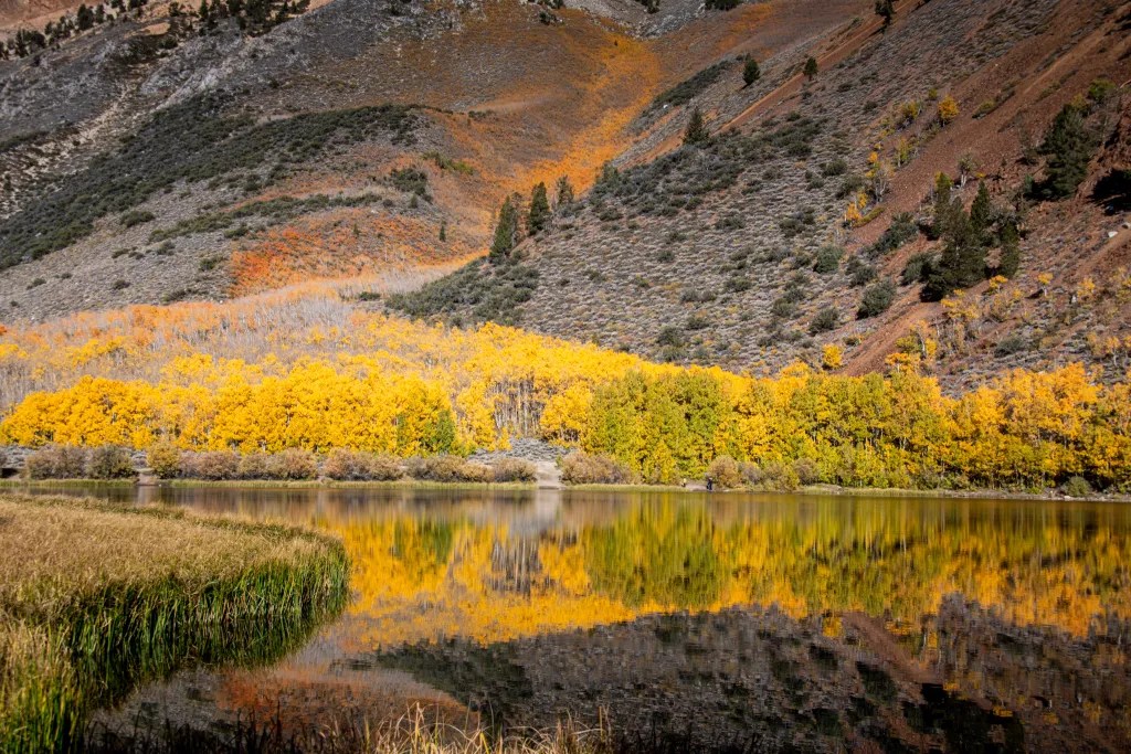
After three days of chasing fall color I was starting to feel overwhelmed. I felt like I had to give my eyes a rest, and yet we’d find another grove of aspen in full splendor, I’d grab my camera and start snapping photos. And then I’d be asking myself how the image I’m capturing differs from the many thousands of photos I’ve captured over the past 50 years. In any event, every photo is another adventure and the magnificence of the changing seasons never gets old. I’m always looking for a way to create unique photos that celebrate the glory of God’s creation.

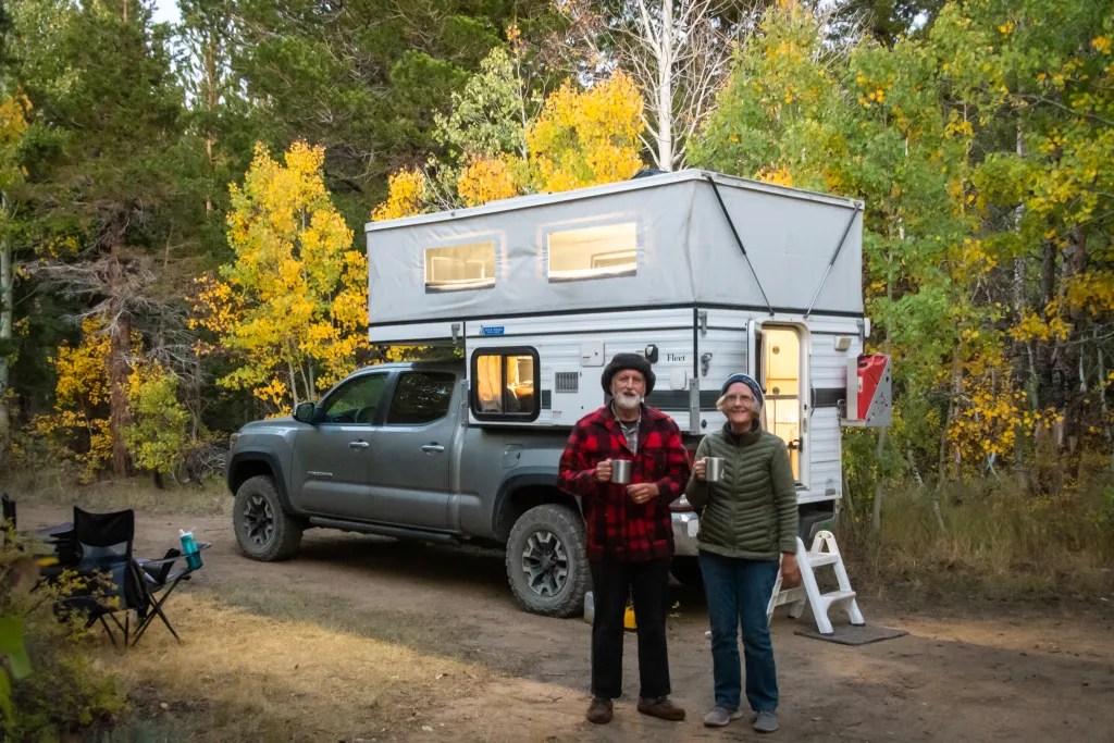
Fall color in the Eastern Sierra usually starts in mid to late September with the aspen at the higher evaluations changing color first, and the color progressing down the canyons over the course of several weeks. I usually start to watch the fall color reports in mid September. This year October 4 was the earliest date we could get away, so we stocked the camper with food for a week and hit the road.

From our home in Albany, CA, we decided to take California State Route 108 over Sonora Pass. After passing the summit we stopped briefly near a grove of aspen, admired the view, and then decided to head to our intended camping destination on Green Creek. We were hoping to camp at the Green Creek Campground. Why? Because we wanted to fire up our Dutch Oven to cook dinner; for that we needed a fire ring in an established campground. The campground was closed. There are plenty of places to boondock along Green Creek so we found a comfortable spot to park our rig. We implemented “plan B” for our menu which did not require a fire ring. I was a little annoyed, though, when campers not too far away from us lit a campfire, something that’s prohibited in the dry conditions. I was too shy to confront them. What would I say?

We were so impressed with the fall color along Green Creek, we decided to spend a second night although we moved our rig a mile down the road. The road into Green Creek is a dirt road. For the most part it is navigable by passenger car, although close to the campground it gets a little rocky.

From Green Creek we headed towards Bishop by way of Dunderberg Meadow Road. We admired the aspen along the way and set up camp at the Sabrina Campground in the afternoon. The fall color was about peak there. In the morning we drove to North Lake where I spent some time with my camera and tripod capturing fall color. We also gave our dog Carson the opportunity to hike with us off-leash.

From Bishop Creek we drove to Bishop where we spent the weekend with family. Then we headed home after a night camping on a ridge overlooking Convict Lake. We had intended to spend more time on the road but the furnace in our camper was not working; getting up in the morning with the temperature in the 30s was wearing on us.

More photos are available in an online gallery.

Pt San Pablo to Pt Pinole

On October 13, seven of us were on the beach at Point San Pablo Harbor ready to launch. Weather and tide conditions were promising for a paddle to Point Pinole with little wind predicted. Slack tide at 9:47 a.m. at Pinole Point meant we would have the current with us in the morning. We launched at 10:30 and headed out towards the shipping channel to pick up the current. As we paddled, we kept our eyes open for ships and ferries.

We had some ship traffic and noted that one of the ferries heading towards us did an about-turn. What was that about? It seemed like several of the ferries were exhibiting some unusual behavior.

When we reached Point Pinole, we decided to paddle around the point landing at the beach on the northeast side. It was shortly before noon when we landed. The beach has a handicap accessible ramp. After lunch it was back on the water, and we used the pilings of the old pier as an obstacle course. Good for practicing boat control.

Since we were still experiencing the incoming flood, we planned paddled closer to shore to take advantage of countercurrent eddies. We were back at our launch site shortly before 3 p.m. having logged 10 miles. More photos are available in an online gallery.

Martinez to Eckley

On September 29 I joined nine other BASK members for a paddle from Martinez to Eckley Pier. We launched from the boat ramp at the Martinez Marina at 10:30 a.m. Once we were out of the Marina, we turned west where we hit a bit of bumpy water. We had the current with us and the wind against us resulting in some wind waves splashing over our decks. Then it was on to the obstacle course of old pilings which are always fun to paddle through, creating an opportunity to practice boat control. Slack water was about noon, so we had little current to contend with as we meandered through the pilings.

We arrived at Eckley Pier at noon, broke out our lunches and watched the train go by as we ate. Then it was back on the water and back through the maze of pilings. Now we had the wind at our back and the current starting to flood so it was a little more challenging to paddle the maze. Some opted to paddle in the open water. With the current pushing us back up the river it was a quick paddle back to Martinez. We were back at the boat ramp at 2 p.m., having logged 9.2 miles.

More photos are available in an online gallery.

Here’s the track of our paddle.

Mendo Madness

We were hardly back from Scotland when it was time to pack up the kayaks to head for Mendocino. On September 20 we pointed our rig to Van Damme State Park to join our kayaking club for our annual Mendo Madness. Each year our kayak club takes over a good part of the campground for a week of paddling and socializing. There were about 70 of us, which makes for plenty of paddling opportunities with skill levels ranging from novice to expert, a great opportunity to get on the water with friends and to advance our skills.

On Wednesday we paddled up the Albion River. It’s such a peaceful feeling paddling on the quiet river past the redwood trees, with a variety of wildlife to view. We saw plenty of birds, but no seals or river otters.

On Thursday conditions were perfect to paddle on the coast, so we joined a group of experienced paddlers, launched from Russian Gulch, and paddled south exploring caves, tunnels and other features on the Mendocino Headlands. I had a GoPro camera mounted on my helmet, so stay tuned for some video of our paddling through caves and tunnels.

Our club has occasionally been referred to an eating club with a kayaking disorder. True to form there was an abundance of food with two pizza ovens and charcoal grills going. We came prepared to cook our own meals, but who wants to cook when you can simply nosh while sharing stories with friends. Friday night was Bourbon and Brine, hosted by two club members who are very creative mixing drinks suitable for the occasion. They were assisted by a half-dozen bartenders.

On Sunday, September 25, we broke camp to head for home. Passing through Cloverdale at noon gave us a good reason to stop for burgers, fries, and shakes at Pick’s Drive in. Great burgers.

More photos are available in an online gallery.

Kayak Around Iona

August 31. Our Wilderness Scotland paddling adventures included several day paddles exploring parts of the Isles of Mull and Iona. The day’s adventures usually started with a briefing by one of the guides. Here’s Howard explaining the route around Iona. Our land base for these outings was Achaban Houses which was a mile from Fionnphort, our launch point for the paddle around Iona. You can see the van with the kayak trailer in the photo.

It was a promising day as we schlepped boats and gear down to the water’s edge. Without much delay we were on the water but since we had the tail end of the ebb against us, we stayed close to shore looking for eddies and paddling inside the rocks that separate the Sound of Iona. Once we were around the rocks and on the sound, we picked up the pace a bit to make the short crossing to Iona where we paddled around the point and into a white sand beach for coffee and tea.

For the rest of the trip we had the current with us. We poked our noses into caves, paddling in and out of rocks admiring the clear and colorful water. Coming back into Fionnphort we had to hold up a few minutes for the ferry. And then it was off to the pub to celebrate.

More photos are available in an online gallery and you can view a video as well.

We logged 11 miles on calm water. An excellent day’s paddle.

Back to Oban

Day 16 of our Scotland Trip. Our plan was to spend the better part of this week at the Iona Abbey as part of the Iona Community. Circumstances have forced us to change our plans. Joann and I both tested positive for COVID-19 a few days ago. At the time we had booked two nights at the Pennygate Lodge in Craignure. We were able to extend our stay to four nights which was fortunate. The hotel has a excellent restaurant, and we were able to hold up in our room with excellent food delivered. Despite our current situation we have had some amazing adventures in the past two weeks. The highlight was kayaking around Iona with Wilderness Scotland. That adventure warrants a blog posting of its own.

So today we left the Pennygate and took the ferry back to Oban. We’ve booked an apartment for several nights. I’m looking forward to using some of the downtime to work through some of the photos and videos and to post more about the trip. While at Pennygate I was sick in bed with no energy to do anything more that sleep and read. The Seabreeze Apartment where we are now feels almost liberating with two bedrooms, living room, and kitchen. Plenty of room for two people to roam around while we rest and recover.

On our previous stay in Oban we celebrated our 49th wedding anniversary. I also spent one evening wandering around town looking for nighttime photo opportunities.

Stay tuned. I have more stories to share.