Martinez to Eckley

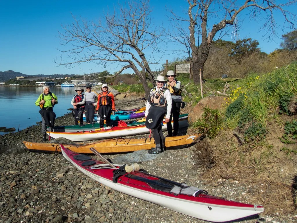
On September 29 I joined nine other BASK members for a paddle from Martinez to Eckley Pier. We launched from the boat ramp at the Martinez Marina at 10:30 a.m. Once we were out of the Marina, we turned west where we hit a bit of bumpy water. We had the current with us and the wind against us resulting in some wind waves splashing over our decks. Then it was on to the obstacle course of old pilings which are always fun to paddle through, creating an opportunity to practice boat control. Slack water was about noon, so we had little current to contend with as we meandered through the pilings.

We arrived at Eckley Pier at noon, broke out our lunches and watched the train go by as we ate. Then it was back on the water and back through the maze of pilings. Now we had the wind at our back and the current starting to flood so it was a little more challenging to paddle the maze. Some opted to paddle in the open water. With the current pushing us back up the river it was a quick paddle back to Martinez. We were back at the boat ramp at 2 p.m., having logged 9.2 miles.

More photos are available in an online gallery.

Here’s the track of our paddle.

Mendo Madness

We were hardly back from Scotland when it was time to pack up the kayaks to head for Mendocino. On September 20 we pointed our rig to Van Damme State Park to join our kayaking club for our annual Mendo Madness. Each year our kayak club takes over a good part of the campground for a week of paddling and socializing. There were about 70 of us, which makes for plenty of paddling opportunities with skill levels ranging from novice to expert, a great opportunity to get on the water with friends and to advance our skills.

On Wednesday we paddled up the Albion River. It’s such a peaceful feeling paddling on the quiet river past the redwood trees, with a variety of wildlife to view. We saw plenty of birds, but no seals or river otters.

On Thursday conditions were perfect to paddle on the coast, so we joined a group of experienced paddlers, launched from Russian Gulch, and paddled south exploring caves, tunnels and other features on the Mendocino Headlands. I had a GoPro camera mounted on my helmet, so stay tuned for some video of our paddling through caves and tunnels.

Our club has occasionally been referred to an eating club with a kayaking disorder. True to form there was an abundance of food with two pizza ovens and charcoal grills going. We came prepared to cook our own meals, but who wants to cook when you can simply nosh while sharing stories with friends. Friday night was Bourbon and Brine, hosted by two club members who are very creative mixing drinks suitable for the occasion. They were assisted by a half-dozen bartenders.

On Sunday, September 25, we broke camp to head for home. Passing through Cloverdale at noon gave us a good reason to stop for burgers, fries, and shakes at Pick’s Drive in. Great burgers.

More photos are available in an online gallery.

Kayak Around Iona

August 31. Our Wilderness Scotland paddling adventures included several day paddles exploring parts of the Isles of Mull and Iona. The day’s adventures usually started with a briefing by one of the guides. Here’s Howard explaining the route around Iona. Our land base for these outings was Achaban Houses which was a mile from Fionnphort, our launch point for the paddle around Iona. You can see the van with the kayak trailer in the photo.

It was a promising day as we schlepped boats and gear down to the water’s edge. Without much delay we were on the water but since we had the tail end of the ebb against us, we stayed close to shore looking for eddies and paddling inside the rocks that separate the Sound of Iona. Once we were around the rocks and on the sound, we picked up the pace a bit to make the short crossing to Iona where we paddled around the point and into a white sand beach for coffee and tea.

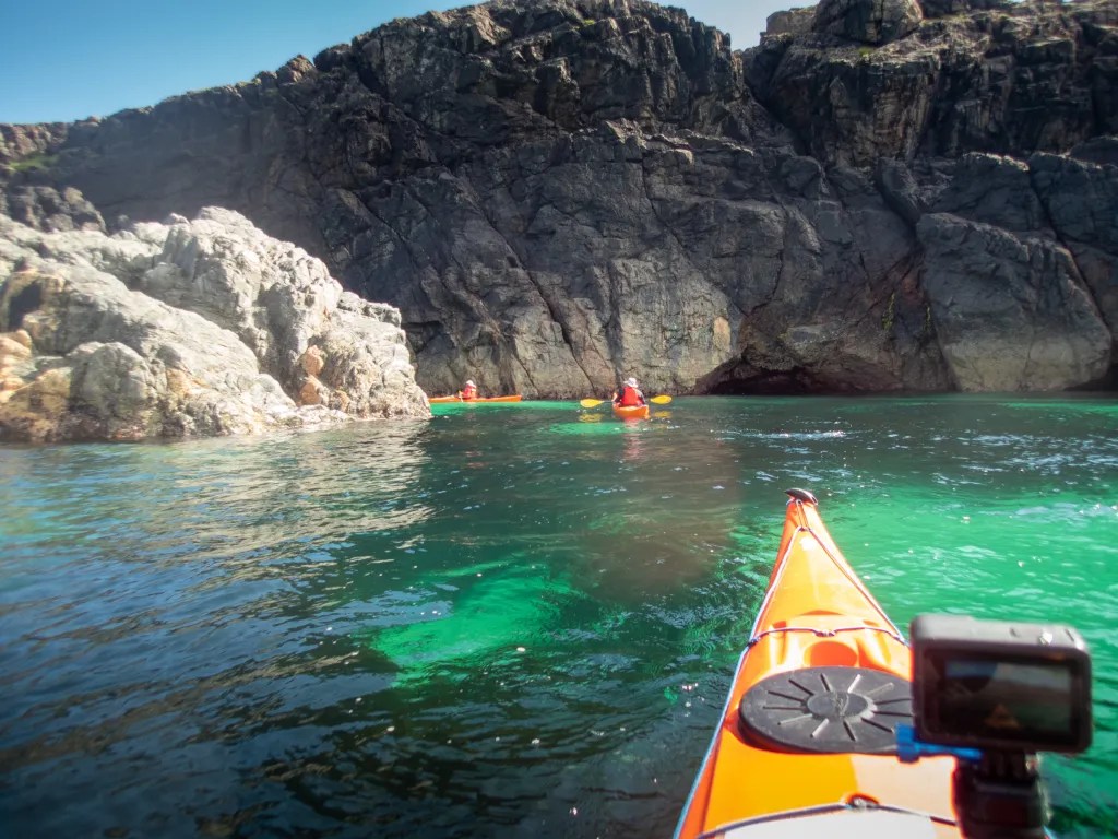
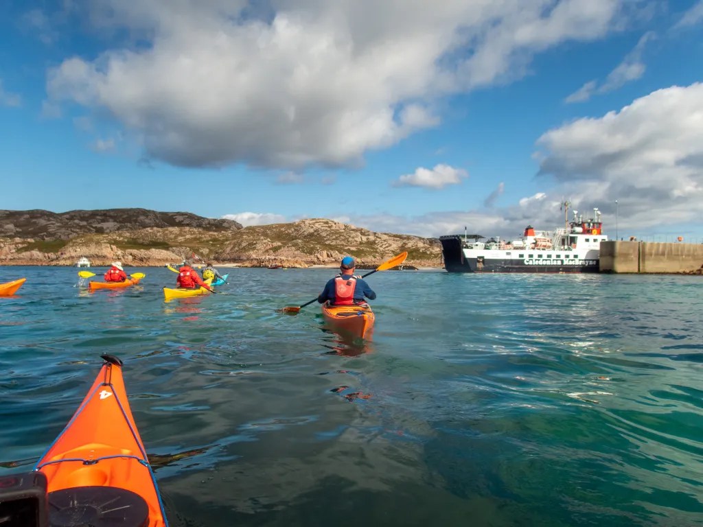
For the rest of the trip we had the current with us. We poked our noses into caves, paddling in and out of rocks admiring the clear and colorful water. Coming back into Fionnphort we had to hold up a few minutes for the ferry. And then it was off to the pub to celebrate.

More photos are available in an online gallery and you can view a video as well.

We logged 11 miles on calm water. An excellent day’s paddle.

Breaking the Curse

For the past six weeks or so we’ve been cursed with contrary winds. It seems we’d plan a paddle and the wind we experience was not what was predicted. It seemed as if the wind gods were playing havoc with us. We’ve been attributing this curse to Alan, one of our paddling buddies, since he was the one that was planning the paddles. We even devised a plan where we would send Alan off in one direction hoping he would serve as a decoy so the rest of us could paddle on calm water.

But on Thursday afternoon July 7, following a lovely paddle, we gathered at the Up and Under Pub where we shared a toast and declared the that we had broken the curse.

Six of us launched from Ferry Point that morning for a paddle around Brooks Island. We paddled in the counterclockwise direction, crossing the open water early in the event that the wind should come up later in the day.

Paddling along the south side of the jetty we encountered quite a bit of eel grass. We had this experience on a previous paddle at this location and it seems this year there is eel grass where we don’t recall seeing it in the past. Then, having spied the remains of the dead whale, we paddled close to take a look. Jaw bones are now exposed where a month ago it looked like a freshly beached whale.

We were also amazed at the number of pelicans we saw, wheeling overhead, diving and fishing. We stopped at Barbara and Jay Vincent Park for lunch, walking to the top of a knoll where we found some rocks on which to sit.

After lunch it was back on the water. The wind had picked up a bit and we were bracing for a slog into the wind. We crossed the channel heading to Brooks Island and admired an Osprey that was feeding its young in a nest on top of the dolphin (pilings) in mid-channel. Then the wind eased up and we had a pleasant paddle back to our launch side, again mystified with the number of pelicans that were about. You can see more photos in an online gallery.

Tomales: Marconi to Chicken Ranch

On June 26, seven of us launched our kayaks from Marconi Beach not knowing quite where we’d end up for lunch. Shortly after 9 a.m. we launched on flat calm water, paddling across to Hearts Desire Beach where one of our fellow BASK members was assisting at an Environmental Traveling Companions kayaking event.

From Hearts Desire we noodled southeast along the Point Reyes Peninsula, taking our time and exploring all the nooks and crannies and even some caves. Paddling through eel grass beds we saw hundreds of jelly fish. Since my Olympus TG5 camera is waterproof I popped it under the surface and started snapping pictures more or less at random. I was amazed I got something useable.

Paddling on, before you know it we were at Chicken Ranch Beach. It was just a few minutes after 11 a.m. and, though it was early, we decided it was lunch time. Our plan was to get an early start and get off the water before the wind came up.

Sure enough, as we were eating lunch the wind started to build and not as predicted. The prediction was for WSW winds 9 kts. What we had was coming straight down the bay. We launched into a stiff wind that was raising whitecaps. Fortunately, we did not have a great distance to travel so we slogged it out powering straight into the wind. We were back at our launch point at 12:30, having logged 5.8 miles. You can view more photos in an online gallery.

A Week at Loon Lake

Nestled high in the Sierra Nevada Mountains at 6,400 feet is a gorgeous lake, Loon Lake. Crystal clear water surrounded by forests, granite boulders, and patches of wildflowers. Twenty-eight miles up a windy road takes you off the main highway deep into the Sierra Nevada mountains not far from the Desolation Wilderness. We anticipated meeting a number of fellow kayakers, members of Bay Area Sea Kayakers (BASK), for a week of paddling, hiking, wildflower hunting, birdwatching, and camaraderie.

We arrived on Sunday evening, June 12, dropping off our boats near the boat ramp and finding campsite 44. We parked, popped the top up on the camper and joined one of our camp buddies, Eoin, who was preparing dinner for our cook group. The next morning, I put my drone in the air to capture a photo of our campsite.

June 13 – Rubicon Trail Hike

Monday we opted to explore the north end of the lake on foot, driving to the Rubicon Trail Staging Area and making our way partly around the lake. The Rubicon Trail is widely recognized as the premiere OHV route in the United States. As hikers, we decided to stay off the jeep trail and try to find a route that was hiker friendly. We ended up off-trail, making our way over bare rock, through thickets of trees and down through a bog. It was spectacular country but slow going as we bushwhacked. After a couple of hours, we managed to cover 2.5 miles.

June 14 – Paddle – North End of Lake

Tuesday morning we were up early to fire up the Dutch Oven and cook a breakfast of mushroom and brie breakfast strada, one of our favorite camping breakfasts. With breakfast out of the way we assembled at the boat ramp. Our route took us along the eastern shore of the lake, noodling along and poking into coves and inlets, passing a small waterfall at one point. We stopped at Pleasant Campground for lunch and then continued exploring the north end of the lake.

With the wind starting to build in the afternoon, we decided to make our way back to our launch point. We covered 10 miles in the five and half hours of our adventure.

June 15 – Paddle – South End of Lake

Having explored much of the north end of the lake, today we explored some of the islands at the south end of the lake, making our way north to a lovely lunch spot on a granite spit. We had fun doing some flatwater rock gardening in a group of rocks. I even managed to get the drone in the air to capture some aerial views, something that I’ve wanted to do for some time, but usually the logistics of paddling take priority over the logistics of flying a drone.

Again, the wind came up after lunch and we made haste back to camp, hugging the shore to avoid the brunt of the wind. We logged 6.9 miles over the course of our paddle.

June 16 – Loon Lake Trail

With two days of paddling behind us it was time for a hike. Our dog Carson had two days in the camper and it was time to give him some off-leash time. We followed the Loon Lake Trail along the east side of the lake, paralleling the route we had paddled two days before. This hike took us through some lovely forests, through glens of freshly sprouted bracken fern, over sections of bare granite rock with occasional views of the lake.

We stopped for lunch just shy of Pleasant Campground on a slab of granite with a view of the lake. There we watched the white caps on the lake and were glad we had done our paddling earlier in the week. We admired many wildflowers along the trail and covered 7.3 miles.

Please view more photos of the trip in an online gallery.

Around Angel Island

April 6. A paddle around Angel Island is always a great adventure. Our original plan was to paddle out the Golden Gate, but with a prediction for a sizeable swell we opted to stay in the bay. Seven of us were on the beach at Ferry Point ready to get on the water at 10:30 a.m. Our plan was to paddle around the island and find a spot for lunch. We had calm water and very little wind.

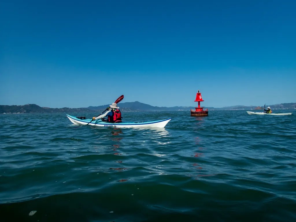
Since this paddle involves crossing shipping lanes, we kept our eyes open for ships, gathering at buoy #8 to make sure we had everybody together. One thing interesting about buoys and similar features is that as the current flows around the buoy, there is a spot on the downstream side where you can basically park your boat and escape the current.

After we gathered up we paddled to the island, compensating for the ebb current with a ferry angle that would keep us close to our intended destination. As we approached the island, we discussed breaking into two pods, one to stop at the immigration station and the second to paddle around the island in a clockwise direction. We left one paddler on the beach and the remaining six of us paddled around the island, returning to the Immigration Station about an hour and a half later.

Back at the Immigration Station, we landed and broke out our lunches. After lunch it was back on the water for the paddle to our launch point. A very pleasant day on the water. We logged 12.1 miles over the course of the day. More photos are available in my online gallery

Gone Paddling

I can’t seem to keep up with my own adventures. To get current, here are three kayak trips I’d like to share: February 4 from Point San Pablo Yacht Harbor, March 17 Windsurfer to Loch Lomond, and March 22 Loch Lomond to some islands.

Point San Pablo Yacht Harbor

On February 4, five of us launched Point San Pablo Yacht Harbor. The idea was to cover some miles as training for a club event we call the Gonzo, an endurance paddle that visits 15 islands in the Bay. Depending on the route you take, this can be 40 miles. No way am I going to paddle that distance, but I did want to stretch my endurance a bit so I joined this training paddle. Our plan was to paddle between The Brothers, then to an island near the San Rafael Bridge which will remain unnamed, then between the Marin Islands, through The Sisters and back. Our plans changed a bit after we reached the Marin Islands. It became clear that going for The Sisters would put us at a strong disadvantage with the current and wind to make it back to our launch. Just getting back to The Brothers took some effort as the current was starting to build. We managed to cover 9.8 miles with a moving speed of 3.8 mph. Check out more photos in my online gallery.

Windsurfer to Loch Lomond

On March 17 five of us launched from Windsurfer Beach. Our original plan was to paddle on Tomales Bay, but the predicted wind did not bode well for that paddle. My wife and I got an early start with the plan to beat the traffic across the Richmond San Rafael Bridge with a stop at the Bovine Bakery for breakfast. We were already on the road when the call was made to cancel the original plan. With a few quick phone calls, we were able to formulate a plan “B” to launch from Windsurfer Beach. No Bovine Bakery, but we did find Rustic Bakery which also has a delectable selection of goods, so that suited us for breakfast. We logged a healthy 8.3 miles with a moving speed of 3.2 mph. Check out more photos in my online gallery.
Loch Lomond and Islands

On March 22 eight of us gathered at Loch Lomond Marina for a paddle around several islands. Since our route included crossing shipping channels and dealing with currents, we had a briefing to discuss the route. Once on the water we paddled out to the Marin Islands. We found some very shallow water on the way to the islands, barely six inches of water in places. If the tide had been any lower we would not have been able to paddle this route. From the Marin Islands we headed to the island near the San Rafael Bridge that will remain unnamed, and from there it was back to our launch point. We logged 8.9 miles with a moving speed of 3.4 mph. Check out more photos in my online gallery.
Seven Celebrate Seventy

A friend of mine retired recently and he asked me if kayaking was a suitable sport for seniors. I’ll answer that question with a report on a recent paddle. On February 10, seven of us launched our kayaks from Windsurfer Beach, a little beach not far from the Larkspur Landing Ferry Terminal. The youngster in our group was celebrating his 70th birthday. The beach was a bit rocky given the tide, and it’s a short carry down the bank from the road.

We were on the water at 10 a.m. on February 10. The current was ebbing for our time on the water, with maximum ebb a little less than one knot at 11:40 a.m. at Point San Quentin. That meant we would be paddling upstream in the morning. We had a calm, sunny, beautiful day. We paddled out around Point San Quentin and turned north under the Richmond-San Rafael Bridge. Then it was north to the Marin Islands. The islands are part of the Marin Islands National Wildlife Refuge, which was established in 1992, named after a Coast Miwok man known as Chief Marin. Access to the islands is restricted, so we rounded the bigger of the two islands and headed west for Loch Lomond Marina.

We landed on the boat ramp and immediately moved our boats off the ramp so that we wouldn’t interfere with any boaters. No cake today, but plenty of chocolate treats including those provided by the birthday boy, Steve. After lunch we were back on the water making a direct line to Point San Quentin. The current was with us going back.

Once around the point we paddled back to our launch site passing San Quentin State Prison, the oldest prison in California. We logged 8.3 miles on an unseasonably warm day. Of course, part of the drill is getting the boats off the beach and on top of our cars–a total body workout. Not bad for seven septuagenarians.

Check out more photos in my online gallery.

Morro Bay

The central coast of California is not an area with which I have much familiarity, so when a fellow BASK (Bay Area Sea Kayakers) member announced a trip to Morro Bay we signed up, eager to paddle with knowledgeable friends. On January 6 we strapped our kayaks on top of our camper and hit the road. We had a campsite reserved at Morro Bay State Park.

No camping trip is complete without firing up the Dutch Oven. So one morning we cooked up a Hash Brown Crusted Quiche, one of our favorite recipes. Mind you, this fed us well for at least a couple of breakfasts.

Our launch site was about half a mile away at the kayak launch next to the Kayak Shack. Eight of us launched and paddled around the Morro Bay State Marine Preserve and up into Los Osos Creek. We paddled until we could go no further. We were hoping that we could connect with a channel that would take us to Chorro Creek, but that effort was futile. We observed plenty of bird life along the paddle. You can tell from the track that we spent a fair amount of time exploring the estuary. We logged 10.7 miles.

The following day, January 8, we were back on the water paddling to the south end of the bay and up Shark Inlet. When we ran out of water, we turned around and paddled north along the sand dunes, stopping on the dunes for lunch. After lunch we continued north exploring the main channel out to the ocean and came back along the waterfront of Morro Bay, watching sea lions and sea otters. We logged 9.6 miles.

After two days of paddling we decided it was time to exercise our legs and explore Montaña de Oro State Park. We enjoyed the walk along the bluffs. There were some powerful waves crashing on the rocks, not a good day to be in a kayak on the coast.

I was surprised to find California Poppies already blooming in early January. After a very pleasant hike we decided a late lunch was in order. Tognazzini’s was recommended by several of our fellow kayakers, so that was our destination. We split an order of whole crab, which was delicious. After lunch we discovered that there are two Tognazzini’s. Tognazzini’s Dockside Restaurant and Tognazzini’s Dockside Too. Tognazzini’s Dockside Too was playing live music. After lunch it was back to camp with a nice walk along the boardwalk and a view of the sunset from the top of the hill. You can view more photos online.