Winter Paddling

People seem to be amazed that we go kayaking in the middle of winter. While much of the country is gripped by cold temperatures, the San Francisco Bay Area is often mild. Even this January with a constant parade of atmospheric rivers and their deluge of rain and wind we’ve had some fine weather for paddling. In the spring the wind comes up and that can be a challenge for kayaking.

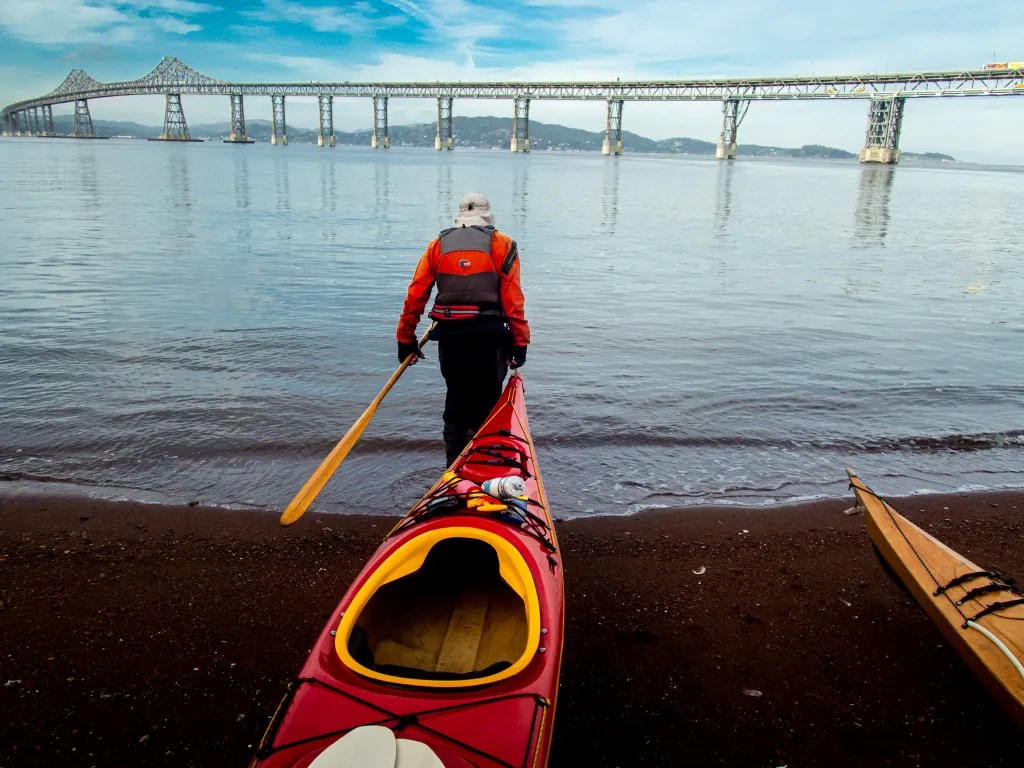
Yesterday we had rain. Tomorrow we’ll have more rain. Today we have a break in the weather. Seven of us launched from Point San Pablo Yacht Harbor. There was some discussion about water quality, given the reports of raw sewage spilling into the bay, as well as debris and who knows what else coming down the river. Even so, we decided the risk was low.

We were on the water at 10:00 a.m., paddled out around Point San Pablo and over to The Brothers.

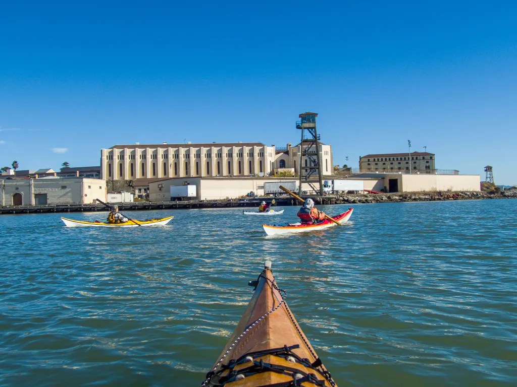
After passing between The Brothers, we picked up the ebb current and headed south towards an island near the Richmond-San Rafael Bridge. Those of you that know the bay will know the location, otherwise you can check the track of the trip on the map below. The island is privately owned and landing on the island is not advised. It was 11:00 a.m. when we rounded the island. We made good time with a 2-knot current giving us an assist.

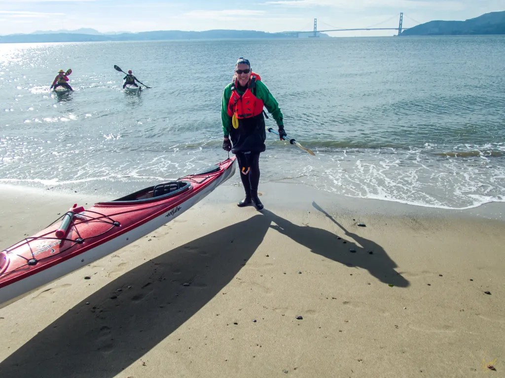
After lunch we made our way back. After passing back through The Brothers, two of our party split off and headed over to The Sisters in order to add a few miles to the day. The remaining five of us headed back to our launch site. The current prediction had slack water at 12:13 at Point San Pablo, although the additional water coming down the river may have had an effect on the currents. We had no current at 1:00 p.m. when we passed back through the islands.

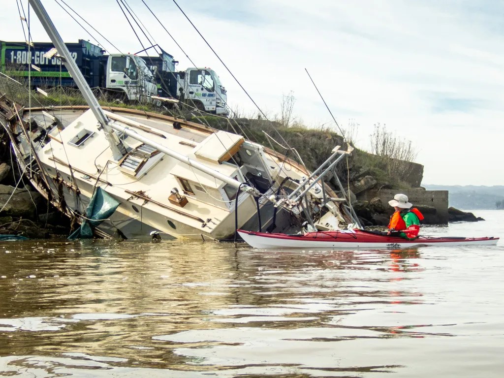
Coming back around Point San Pablo we stopped to look at a sailboat that was on the beach, presumably a casualty of the recent storm activity. We did see a fair amount of debris in the water: driftwood, bottles, and plastic bags. Our paddle covered 6.9 miles, with a maximum speed of 7 mph when we had the ebb current with us. We were back on the beach at 1:25 p.m.

More photos are available in an online gallery.

Roof Rack Failure & Windsurfer

Sometimes it seems that the hardest part about kayaking is getting the boat to the water. Getting the boat on top of the car and getting it off and to the water at the launch site can be a challenge. Today I had an added challenge. As I tugged on one of the straps to cinch the boat into the saddles on the car top carrier the cross bar came loose. On inspection I discovered that the support tower that secures the crossbar to the roof was broken. It would be easy enough to just pack it in, but a little voice in my head was saying, “Treve, if you really want to go paddling you have another vehicle you can use.” The racks for the truck were sitting in the driveway, so I accepted the challenge to see if I could get the kayak on the truck in time to make it to the launch site. Our intended launch time was 10:00 a.m. Google Maps was telling me that it was a 21-minute drive, which meant I might just make it. Sure enough, I was able to get the kayak on the camper and on the road in a timely fashion. It was 10:03 when the six of us pushed off from the beach.

With a constant parade of storms coming our way, we found a weather window with perfect conditions for paddling. Our course took us past San Quentin State Prison, then under the Richmond San Rafael Bridge and on to Loch Lomond Marina. Just for fun we tried squeezing our boats through a narrow gap in the pilings at the end of the Yacht Harbor’s breakwater.

Time for lunch…but in my haste to get on the road after the rooftop debacle, I did not have time to make a lunch. Andy’s Market has a fine selection of deli foods; a bowl of Italian Wedding Soup and a loaf of Judy’s bread hit the spot. And don’t forget the chocolate that seems to be ubiquitous on our paddles.

On our return paddle we had calm water and building clouds. We paddled out around the Marin Islands and then back to our launch site, watching for ferry traffic since Windsurfer Beach is close to the Larkspur Ferry Terminal.

My story starts with car top racks, so it’s only appropriate to end with a photo of my boat on top of my camper after the paddle. We covered 8.5 miles over the course of our paddle. Here’s a map that shows our track.

More photos are available in an online gallery.

Gone Paddling x 4

Here are four more paddling adventure which deserve to be documented. I consider this blog to be a diary of my adventures. If I don’t record the adventures, I may forget they ever happened. And for the past few years, as the new year turns over, I have turned my blog entries into a coffee table book.

So here are four paddles: 10/27 Richmond to Albany, 11/03 Eckley Pier, 11/10 Gallenas Creek, and 11/28 Windsurfer.


Richmond to Albany

On October 27 there were just two of us with two wooden Pygmy Boats. We launched from Ferry Point in Richmond, paddled out past the end of the breakwater and then past Brooks Island. We poked into the basin northeast of Caesar Chavez Park thinking we might find a spot to land, but we didn’t see much so we paddled to Albany Beach where we stopped for lunch.

After lunch we returned to our launch site by way of the Richmond waterfront, stopping to admire the Red Oak Victory. We logged 11 miles.

More photos are available in an online gallery.


Eckley Pier

November 3. Seven of us gathered at Eckley Pier for a paddle to Martinez. The pilings of several abandoned piers provide an obstacle course to practice boat control. I had my GoPro camera running to capture the action. It remains to be seen when that footage will be available. From Eckley Pier we paddled out towards the shipping channel to take advantage of the flooding current.

Once we reached the Martinez Marina, we hauled our boats up the boat ramp and off to the side to keep the ramp free for boaters. We logged 8.8 miles over the course of the day.


Gallenas Creek

November 10. Up the creek, Gallenas Creek. We launched from China Camp and took advantage of the high tide to paddle up the creek. When we could no longer make forward progress, we returned to the McInnis Canoe and Kayak Dock where we hauled out our boats and had lunch. Our course covered 10 miles.

More photos are available in an online gallery.


Windsurfer Beach

November 29. Loch Lomond to Windsurfer Beach. This paddle takes us under the Richmond San Rafael Bridge and past San Quentin State Prison. At lunch on Windsurfer Beach, we watched the ferries and a dredge. We paddled around the Marin Islands on the return leg, a total of 8.2 miles.

More photos are available in an online gallery.

Angel Island

Thursday morning, November 17. A chilly morning, and climbing into my wet, clammy dry suit seemed quite rude. Wet inside and out. I had been out the previous evening for a rolling clinic. The suit was wet on the outside from being upside down in the cold water of San Francisco Bay, and damp on the inside from condensation. I contemplated adding a layer of insulation but figured once I was on the water I would warm up.

Six of us assembled on the beach at Ferry Point. The predicted weather and tides were favorable for a paddle around Angel Island. After a quick safety talk and radio check we were on the water at 10 a.m. Shortly after leaving the protection of the Richmond Shipping Channel, we encountered a breeze and some wind waves out of the northwest. We watched several ferries zipping up and down the bay, and then we held up for a barge that was crossing our path in the shipping lane. We had a couple of harbor seals check us out also.

Our radios were handy for staying in touch and keeping the pod together in the midst of ship traffic. Once we were across the shipping lane we opted to continue our way around the island in a clockwise direction. We landed on Perles Beach a little after noon. Perles Beach faces the Golden Gate with a panoramic view that includes San Francisco as well.

There was just enough breeze to create a bit of a wind chill, so after a brief lunch we were happy to get back in our boats to continue our journey. Back on the water we continued around the island. After rounding Point Stewart, we paddled close to shore to check out the beach at Kayak Camp. One of the photos shows a fellow kayaker with his boat pointed to the trail that leads up from the beach to the campground. There was no trail visible from the water. The trail is presumably overgrown. Once we were back around to the eastern side of the island, we again held up for shipping traffic and then continued on our way back to Ferry Point.

We were back on the beach at 2:20 p.m. after a perfect paddle around Angel Island logging 12 miles. You can see more photos in an online gallery. Here’s the track of our paddle.

Pt San Pablo to Pt Pinole

On October 13, seven of us were on the beach at Point San Pablo Harbor ready to launch. Weather and tide conditions were promising for a paddle to Point Pinole with little wind predicted. Slack tide at 9:47 a.m. at Pinole Point meant we would have the current with us in the morning. We launched at 10:30 and headed out towards the shipping channel to pick up the current. As we paddled, we kept our eyes open for ships and ferries.

We had some ship traffic and noted that one of the ferries heading towards us did an about-turn. What was that about? It seemed like several of the ferries were exhibiting some unusual behavior.

When we reached Point Pinole, we decided to paddle around the point landing at the beach on the northeast side. It was shortly before noon when we landed. The beach has a handicap accessible ramp. After lunch it was back on the water, and we used the pilings of the old pier as an obstacle course. Good for practicing boat control.

Since we were still experiencing the incoming flood, we planned paddled closer to shore to take advantage of countercurrent eddies. We were back at our launch site shortly before 3 p.m. having logged 10 miles. More photos are available in an online gallery.

Martinez to Eckley

On September 29 I joined nine other BASK members for a paddle from Martinez to Eckley Pier. We launched from the boat ramp at the Martinez Marina at 10:30 a.m. Once we were out of the Marina, we turned west where we hit a bit of bumpy water. We had the current with us and the wind against us resulting in some wind waves splashing over our decks. Then it was on to the obstacle course of old pilings which are always fun to paddle through, creating an opportunity to practice boat control. Slack water was about noon, so we had little current to contend with as we meandered through the pilings.

We arrived at Eckley Pier at noon, broke out our lunches and watched the train go by as we ate. Then it was back on the water and back through the maze of pilings. Now we had the wind at our back and the current starting to flood so it was a little more challenging to paddle the maze. Some opted to paddle in the open water. With the current pushing us back up the river it was a quick paddle back to Martinez. We were back at the boat ramp at 2 p.m., having logged 9.2 miles.

More photos are available in an online gallery.

Here’s the track of our paddle.

Mendo Madness

We were hardly back from Scotland when it was time to pack up the kayaks to head for Mendocino. On September 20 we pointed our rig to Van Damme State Park to join our kayaking club for our annual Mendo Madness. Each year our kayak club takes over a good part of the campground for a week of paddling and socializing. There were about 70 of us, which makes for plenty of paddling opportunities with skill levels ranging from novice to expert, a great opportunity to get on the water with friends and to advance our skills.

On Wednesday we paddled up the Albion River. It’s such a peaceful feeling paddling on the quiet river past the redwood trees, with a variety of wildlife to view. We saw plenty of birds, but no seals or river otters.

On Thursday conditions were perfect to paddle on the coast, so we joined a group of experienced paddlers, launched from Russian Gulch, and paddled south exploring caves, tunnels and other features on the Mendocino Headlands. I had a GoPro camera mounted on my helmet, so stay tuned for some video of our paddling through caves and tunnels.

Our club has occasionally been referred to an eating club with a kayaking disorder. True to form there was an abundance of food with two pizza ovens and charcoal grills going. We came prepared to cook our own meals, but who wants to cook when you can simply nosh while sharing stories with friends. Friday night was Bourbon and Brine, hosted by two club members who are very creative mixing drinks suitable for the occasion. They were assisted by a half-dozen bartenders.

On Sunday, September 25, we broke camp to head for home. Passing through Cloverdale at noon gave us a good reason to stop for burgers, fries, and shakes at Pick’s Drive in. Great burgers.

More photos are available in an online gallery.

Breaking the Curse

For the past six weeks or so we’ve been cursed with contrary winds. It seems we’d plan a paddle and the wind we experience was not what was predicted. It seemed as if the wind gods were playing havoc with us. We’ve been attributing this curse to Alan, one of our paddling buddies, since he was the one that was planning the paddles. We even devised a plan where we would send Alan off in one direction hoping he would serve as a decoy so the rest of us could paddle on calm water.

But on Thursday afternoon July 7, following a lovely paddle, we gathered at the Up and Under Pub where we shared a toast and declared the that we had broken the curse.

Six of us launched from Ferry Point that morning for a paddle around Brooks Island. We paddled in the counterclockwise direction, crossing the open water early in the event that the wind should come up later in the day.

Paddling along the south side of the jetty we encountered quite a bit of eel grass. We had this experience on a previous paddle at this location and it seems this year there is eel grass where we don’t recall seeing it in the past. Then, having spied the remains of the dead whale, we paddled close to take a look. Jaw bones are now exposed where a month ago it looked like a freshly beached whale.

We were also amazed at the number of pelicans we saw, wheeling overhead, diving and fishing. We stopped at Barbara and Jay Vincent Park for lunch, walking to the top of a knoll where we found some rocks on which to sit.

After lunch it was back on the water. The wind had picked up a bit and we were bracing for a slog into the wind. We crossed the channel heading to Brooks Island and admired an Osprey that was feeding its young in a nest on top of the dolphin (pilings) in mid-channel. Then the wind eased up and we had a pleasant paddle back to our launch side, again mystified with the number of pelicans that were about. You can see more photos in an online gallery.

Tomales: Marconi to Chicken Ranch

On June 26, seven of us launched our kayaks from Marconi Beach not knowing quite where we’d end up for lunch. Shortly after 9 a.m. we launched on flat calm water, paddling across to Hearts Desire Beach where one of our fellow BASK members was assisting at an Environmental Traveling Companions kayaking event.

From Hearts Desire we noodled southeast along the Point Reyes Peninsula, taking our time and exploring all the nooks and crannies and even some caves. Paddling through eel grass beds we saw hundreds of jelly fish. Since my Olympus TG5 camera is waterproof I popped it under the surface and started snapping pictures more or less at random. I was amazed I got something useable.

Paddling on, before you know it we were at Chicken Ranch Beach. It was just a few minutes after 11 a.m. and, though it was early, we decided it was lunch time. Our plan was to get an early start and get off the water before the wind came up.

Sure enough, as we were eating lunch the wind started to build and not as predicted. The prediction was for WSW winds 9 kts. What we had was coming straight down the bay. We launched into a stiff wind that was raising whitecaps. Fortunately, we did not have a great distance to travel so we slogged it out powering straight into the wind. We were back at our launch point at 12:30, having logged 5.8 miles. You can view more photos in an online gallery.

A Week at Loon Lake

Nestled high in the Sierra Nevada Mountains at 6,400 feet is a gorgeous lake, Loon Lake. Crystal clear water surrounded by forests, granite boulders, and patches of wildflowers. Twenty-eight miles up a windy road takes you off the main highway deep into the Sierra Nevada mountains not far from the Desolation Wilderness. We anticipated meeting a number of fellow kayakers, members of Bay Area Sea Kayakers (BASK), for a week of paddling, hiking, wildflower hunting, birdwatching, and camaraderie.

We arrived on Sunday evening, June 12, dropping off our boats near the boat ramp and finding campsite 44. We parked, popped the top up on the camper and joined one of our camp buddies, Eoin, who was preparing dinner for our cook group. The next morning, I put my drone in the air to capture a photo of our campsite.

June 13 – Rubicon Trail Hike

Monday we opted to explore the north end of the lake on foot, driving to the Rubicon Trail Staging Area and making our way partly around the lake. The Rubicon Trail is widely recognized as the premiere OHV route in the United States. As hikers, we decided to stay off the jeep trail and try to find a route that was hiker friendly. We ended up off-trail, making our way over bare rock, through thickets of trees and down through a bog. It was spectacular country but slow going as we bushwhacked. After a couple of hours, we managed to cover 2.5 miles.

June 14 – Paddle – North End of Lake

Tuesday morning we were up early to fire up the Dutch Oven and cook a breakfast of mushroom and brie breakfast strada, one of our favorite camping breakfasts. With breakfast out of the way we assembled at the boat ramp. Our route took us along the eastern shore of the lake, noodling along and poking into coves and inlets, passing a small waterfall at one point. We stopped at Pleasant Campground for lunch and then continued exploring the north end of the lake.

With the wind starting to build in the afternoon, we decided to make our way back to our launch point. We covered 10 miles in the five and half hours of our adventure.

June 15 – Paddle – South End of Lake

Having explored much of the north end of the lake, today we explored some of the islands at the south end of the lake, making our way north to a lovely lunch spot on a granite spit. We had fun doing some flatwater rock gardening in a group of rocks. I even managed to get the drone in the air to capture some aerial views, something that I’ve wanted to do for some time, but usually the logistics of paddling take priority over the logistics of flying a drone.

Again, the wind came up after lunch and we made haste back to camp, hugging the shore to avoid the brunt of the wind. We logged 6.9 miles over the course of our paddle.

June 16 – Loon Lake Trail

With two days of paddling behind us it was time for a hike. Our dog Carson had two days in the camper and it was time to give him some off-leash time. We followed the Loon Lake Trail along the east side of the lake, paralleling the route we had paddled two days before. This hike took us through some lovely forests, through glens of freshly sprouted bracken fern, over sections of bare granite rock with occasional views of the lake.

We stopped for lunch just shy of Pleasant Campground on a slab of granite with a view of the lake. There we watched the white caps on the lake and were glad we had done our paddling earlier in the week. We admired many wildflowers along the trail and covered 7.3 miles.

Please view more photos of the trip in an online gallery.