Mendocino Tunnel Vision

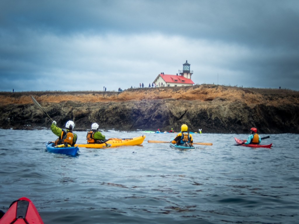
Seven of us gathered on the beach at Russian Gulch to explore the coast north to Point Cabrillo. When paddling around rocks we wear helmets and prefer plastic boats that are more forgiving when banging into rocks. We also wear wetsuits or drysuits should we end up going for a swim. We were on the water about 9 a.m. After a few days of rough water, we had calm conditions with little wind and wave action. This afforded us the opportunity to explore just about every cave and arch between Russian Gulch Beach and Point Cabrillo.

We did have one person go for a swim early in our paddle. A good opportunity to practice a T-rescue.

We paddled north along the coast noodling into every feature we could find. I had a GoPro camera attached to my helmet and was able to record much of our cave exploration.

We did find a couple of channels that offered some dynamic water. A few members of our pod opted to avoid the surging and sloshing water by paddling outside the rocks where conditions were calmer. Those of us that paddled inside the rocks had some fun bracing and practicing boat control.

We arrived at Point Cabrillo just before noon and found a very protected beach on which to land for lunch. After lunch we noodled our way back down the coast, once again taking advantage of the conditions to paddle in and out of the many caves and tunnels.

We were back on the beach a little after 3 p.m., having logged 7.7 miles. You can see the track of our paddle on the map. An excellent day on the water with some good paddling friends.

To Lopez Island and Back

On June 29 we loaded our kayaks on our rig and headed north for the San Juan Islands in the Pacific Northwest. We gave ourselves five days to make our way to Spencer Spit campground. There we rendezvoused with fellow members of our kayaking club, Bay Area Sea Kayakers (BASK), for the biannual Casey Walker Memorial Campout. The night of June 29 we camped near Greenhorn Reservoir just outside of Yreka in a space we found on Hipcamp, one of the resources we use for locating camping sites. Then it was on to Portland, Oregon, where we spent the night at Rossi Farms. At Rossi Farms we gorged ourselves on the raspberries that were growing next to our campsite.

From Portland we made our way to Whidbey Island where we spent two days with my brother, feasting on fresh seafood including crab and oysters.

From Whidbey it was on to Anacortes where we caught the ferry to Lopez Island. It wasn’t too surprising to have Brad, a fellow BASK member pull up right behind us while waiting for the ferry.

We arrived on the island on July 3, so for the 4th we went into town to enjoy the Independence Day festivities.

The focus of the trip was kayaking with fellow BASK members. I’ve already written about a couple of those adventures, Lopez Island: Makaye and Ice Cream Paddle. Of course, eating together is a big part of any group camping adventure. BASK is sometimes referred to as an eating club with a kayaking disorder. We feasted on a finger-licking-good potluck dinner one evening. We also took time to do some hiking, including a wonderful outing to Iceberg Point, and we enjoyed a whale watching expedition.

On July 10 we started our return journey, getting an early start in order to be at the ferry terminal for the 8:30 a.m. ferry. We were just two cars short of making that ferry. We pulled out our camp chairs and spent the wait visiting with fellow kayakers and reading. With some ferry mishaps, it was 4 p.m. when we finally rolled onto the ferry, bringing to mind a common acronym we’d been seeing: FTF (where’s the ferry). It was 6:10 p.m. when we arrived back at my brother’s place on Widbey Island. Fortunately, he had dinner ready with freshly caught prawns.

From Whidbey Island we took the Port Townsend Ferry and headed south where we spent the night at Scenic Beach State Park on the Hood Canal. There I got up early and captured an image that I’m calling Morning View from Scenic Beach (fine art prints are available in my art store). From Scenic Beach our drive took us through Raymond where we stopped for a quick picnic lunch and a walk around town to admire the town’s metal people.

Then on to Cape Disappointment where we watched the setting sun sink into the sea. From Cape Disappointment we decided to follow the Columbia River Gorge as far as The Dalles where we turned south. We found a campsite at Prairie Camp near the town of La Pine. In the morning, we discovered that we were close to a little lake, East Lake, where we managed to get our kayaks on the water for one last paddle. We were not too anxious to head south into California’s Central Valley where extreme temperatures were predicted.

Our last night we boondocked, locating a site near Mount Shasta that iOverlander identified at Shasta View in the Trees. This site had a spectacular view of Mount Shasta. Our trip covered 1065 miles over 16 days. More photos are available in an online gallery.

Ice Cream Paddle

The Lopez Island BASK (Bay Area Sea Kayakers) trip is a biennial event, with the exception of a break during the Covid pandemic. We spent a week camping at Spencer Spit Campground; over the course of the week, we did a number of day paddles. One of the traditions is to paddle over to Blakely Island for ice cream. So today is our ice cream paddle. There were 11 of us on the beach at Spencer Spit ready to launch at 9 a.m. We had clear skies and no wind, a marvelous start for the day. We paddled out to Frost Island and then set course for Bald Bluff with the intention of minimizing our time crossing the ferry route.

We kept a keen eye out for ferry and other boating traffic as we made our crossing. Once we were across, we paddled just far enough offshore to stay out of any eddies and to take advantage of the current.

We landed on the beach at the Blakely Marina at 10:30, too early for lunch but not too early for ice cream.

We took our time eating ice cream and lunch, waiting for the current to change so that we could enjoy an easy paddle back. You can see the 11 of us in the photo below. Once we were back in our boats, we poked our noses out into Peavine Pass where the current was running strong, and we made a quick turn to enter the “express” lane for a fast ride. On the return trip we held up for ferry traffic to pass with ferries going in both directions.

We were back on the beach at Spencer Point a little after 2 p.m. We logged 9.4 miles on the day’s paddle. An excellent outing with a fun group of friends.

Lopez Island: Makaye

This is day four on our Lopez Island adventure. Today we met with a few of our fellow kayak club members (BASK, Bay Area Sea Kayakers) at the Makaye Harbor Boat ramp for a paddle around the southern points of the island.

From the boat ramp we headed south and around Iceberg Point, noodling along the coast, paddling through kelp beds and poking into caves. We conintued to noodle along the coast until we got to Blackie Brady County Park.

There we landed and broke out our lunches. After lunch we were back on the water retracing our route back to our launch site.

Over the course of the day, we logged 11.6 miles on calm water with very little wind. It was a grand experience paddling along the rugged coast where one can imagine what the currents and water conditions might be like in less favorable conditions. We even saw a Bald Eagle sitting on a rock close to where we were paddling. Unfortunately, I wasn’t fast enough with my camera to capture the magnificent bird.

Rescue Practice

So here’s the scenario. You’re out paddling your kayak along with some of your buddies and one of your paddling buddies ends up unconscious floating face down in the water. And this happens under the Golden Gate Bridge in some lumpy water. What do you do?

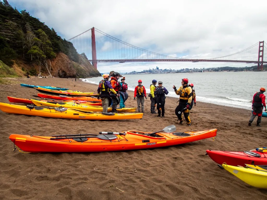
This is one of the scenarios we acted out with members of our kayaking club, Bay Area Sea Kayakers (BASK) recently. We gathered in the morning at Horseshoe Bay, on the North side of the Golden Gate Bridge. We broke into two groups, those that wanted to practice basic rescue skills and those that wanted something more challenging, including incident management.

I joined the more advanced group. We launched our boats and headed out to the Golden Gate Bridge. It was just off Lime Point where we had our first execution of a T-rescue. With practice, this is an efficient and quick way to get someone back in a boat. After the morning’s practice sessions, we landed at Kirby Cove for lunch. As you can see, it was a gorgeous day to be on the water.

After lunch we were back on the water. This is where we had a more complicated scenario. Just what do you do when you have an unconscious kayaker in the water? Someone needs to go in the water to assist the person, get them face up, and perhaps provide rescue breathing. Someone else needs to get on the radio to call for help. In our practice, we did get the person back in the kayak and upright, with some cooperation from our “unconscious” victim. The kayak was now full of water and unstable, so two kayakers came alongside to stabilize the boat and the paddler. Two other kayakers used an inline two to get the swamped boat and victim to safety. We were now surfing breaking waves with white caps. I can’t say our “victim” would have survived if this was a real situation, but we all agreed that practicing this scenario gave us a better understanding of what we would do in a real situation. And messing about in boats with good friends and well-accomplished paddlers is always fun.

BahĂ­a ConcepciĂłn

Today we arrived at Playa Santipac. At the gate we paid 200 pesos for one night thinking we would move on the next day, but we ended up spending two nights. The campground was fairly busy, but we did find a suitable site with a palapa about 1/2 mile down the beach.

Playa Santipac is a popular spot for big rigs but also suitable for smaller rigs and tents. We had fun visiting with fellow campers who were walking along the beach, many of them from Canada and other northern locations that come down to Baja for several weeks or more. One of the joys of traveling is hearing people’s stories. Everybody on the road seems to be quite friendly and happy to share information.

There is no running water at the campsites, but vendors drive along the beach in the morning and provide you with a blue barrel with as much water as you wish for a small fee. There are also vendors selling fresh fish and a variety of other things. We bought water to use for washing since we wanted to conserve the water we had on board for drinking and cooking. We also bought some fresh halibut which served us for a couple of dinners as well as a hammock and some carrot cake.

We did manage to get our boats on the water, paddling out from the beach and around several islands. In one of the photos, you can see Joann in the little wooden boat with a line of RVs on the beach in the background. The beach at our campsite was quite shallow at low tide, so we ended up dragging the boats until we had enough water to paddle. If I had been paying attention, I would have given priority to a campsite further west where the beach wasn’t quite so shallow.

After a few days of dry camping, it was nice to have a shower even if it was just pouring a bucket of cold water over my head. For lunch we walked down the beach to Armando’s, a rustic shack on the beach with delicious seafood tacos.

After a couple of days at Playa Santipac we moved on to Playa Coyote. This is a popular spot. We pulled into the campground at 10:30 in the morning and found the last open site. We were surprised to discover that the campers next to us were kayakers, fellow members of BASK (Bay Area Sea Kayakers). We pooled our resources for dinner. I fired up the Dutch Oven and baked up some Halibut. In the morning we paddled together around Isle Coyote. It was a gorgeous day to be on the water and the flat calm gave us the opportunity to look below the surface. We saw many sting rays.

And talking about sting rays, I managed to step on one. Ouch! Before we launched our kayaks, I was tossing the ball for Carson and the ball went in the water. Carson wouldn’t go in the water to get it, and while the water was only six inches deep, I forgot to do the sting ray shuffle. Fortunately, I was wearing sandals and after a little first aid I was on the water paddling. I think I was quite lucky, since sting ray wounds can be very painful.

While we did have thoughts of driving further south to Loreto, Playa Coyote was such an idyllic spot we decided to spend time there rather than adding more miles to our trip.

More photos of Bahia Conception are available in an online gallery.

Ferry Point to Point Isabel

When we arrived at the parking lot at Ferry Point, we were amazed at how many of our fellow BASK members were getting ready to paddle. It looked like a record turnout for a Thursday lunch paddle. We were on the water at 10 a.m. I counted 12 boats on the water. We paddled out a short distance to the shipping channel and held up waiting for a tugboat with a barge to pass. Shortly thereafter we broke into two pods. One paddler was trying a new boat and discovered that it was not working for him. Fortunately, he was able to paddle back to the beach accompanied by several others and swapped the boat for something more stable. That left the remainder of us waiting. Using our radios to communicate, one pod opted to continue on. The second pod would follow.

We paddled around the end of the breakwater and headed for Brooks Island. On the way we noticed flocks of Cormorants flying about. I don’t recall seeing Cormorants in such numbers. With calm water and no wind, we had an easy paddle. We landed at the Point Isabel boat ramp at 11:40 and with the low tide we had plenty of exposed beach. The second pod was not far behind. They landed about the time we got our boats up above the tide line.

When we arrived on the beach, we were delighted to be greeted by one of our members who had arrived by car, taking a break from paddling due to a back issue. Given the fact that many of us are past 70, I’m about to turn 73, it’s amazing that we can get on the water as often as we do. I keep telling myself to go paddling when I can. My paddling days are numbered. In the morning I will find myself questioning whether I’m up for paddling, given various aches and pains and the desire to just take it easy. But after a paddle I feel ten years younger. I consider paddling part of my physical and mental health regime.

After lunch we were back on the water, taking the inside route back to Ferry Point, landing on the beach about 2:30. Our day’s paddle covered 8 miles.

More photos are available in an online gallery.

Winter Paddling

People seem to be amazed that we go kayaking in the middle of winter. While much of the country is gripped by cold temperatures, the San Francisco Bay Area is often mild. Even this January with a constant parade of atmospheric rivers and their deluge of rain and wind we’ve had some fine weather for paddling. In the spring the wind comes up and that can be a challenge for kayaking.

Yesterday we had rain. Tomorrow we’ll have more rain. Today we have a break in the weather. Seven of us launched from Point San Pablo Yacht Harbor. There was some discussion about water quality, given the reports of raw sewage spilling into the bay, as well as debris and who knows what else coming down the river. Even so, we decided the risk was low.

We were on the water at 10:00 a.m., paddled out around Point San Pablo and over to The Brothers.

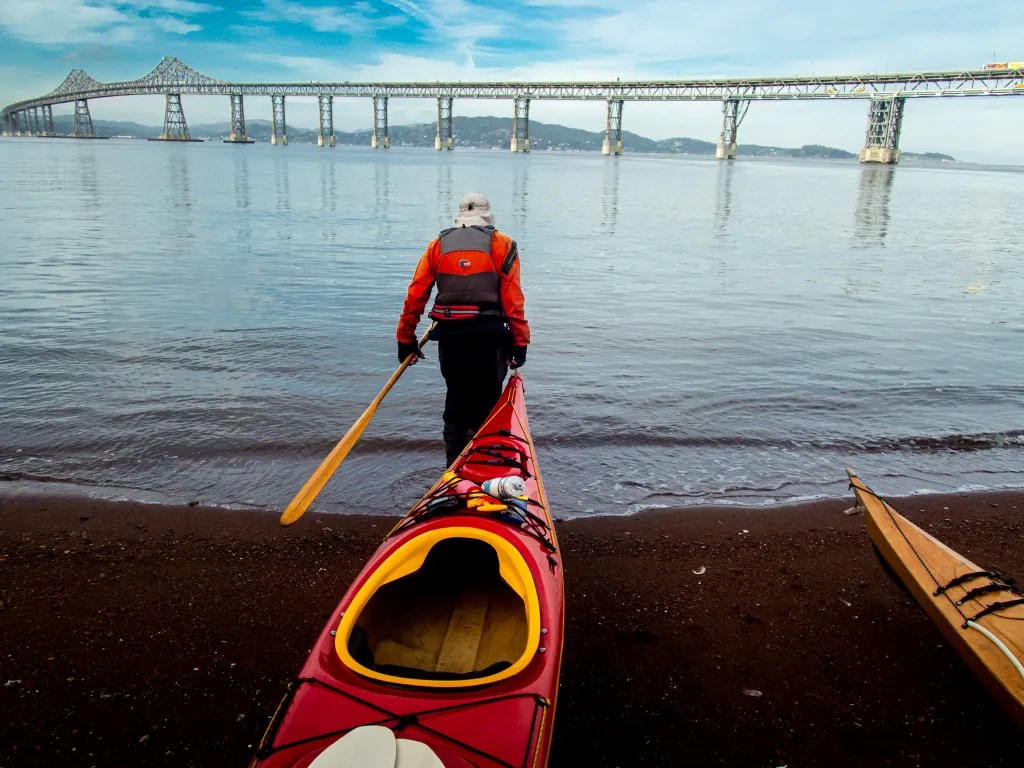
After passing between The Brothers, we picked up the ebb current and headed south towards an island near the Richmond-San Rafael Bridge. Those of you that know the bay will know the location, otherwise you can check the track of the trip on the map below. The island is privately owned and landing on the island is not advised. It was 11:00 a.m. when we rounded the island. We made good time with a 2-knot current giving us an assist.

After lunch we made our way back. After passing back through The Brothers, two of our party split off and headed over to The Sisters in order to add a few miles to the day. The remaining five of us headed back to our launch site. The current prediction had slack water at 12:13 at Point San Pablo, although the additional water coming down the river may have had an effect on the currents. We had no current at 1:00 p.m. when we passed back through the islands.

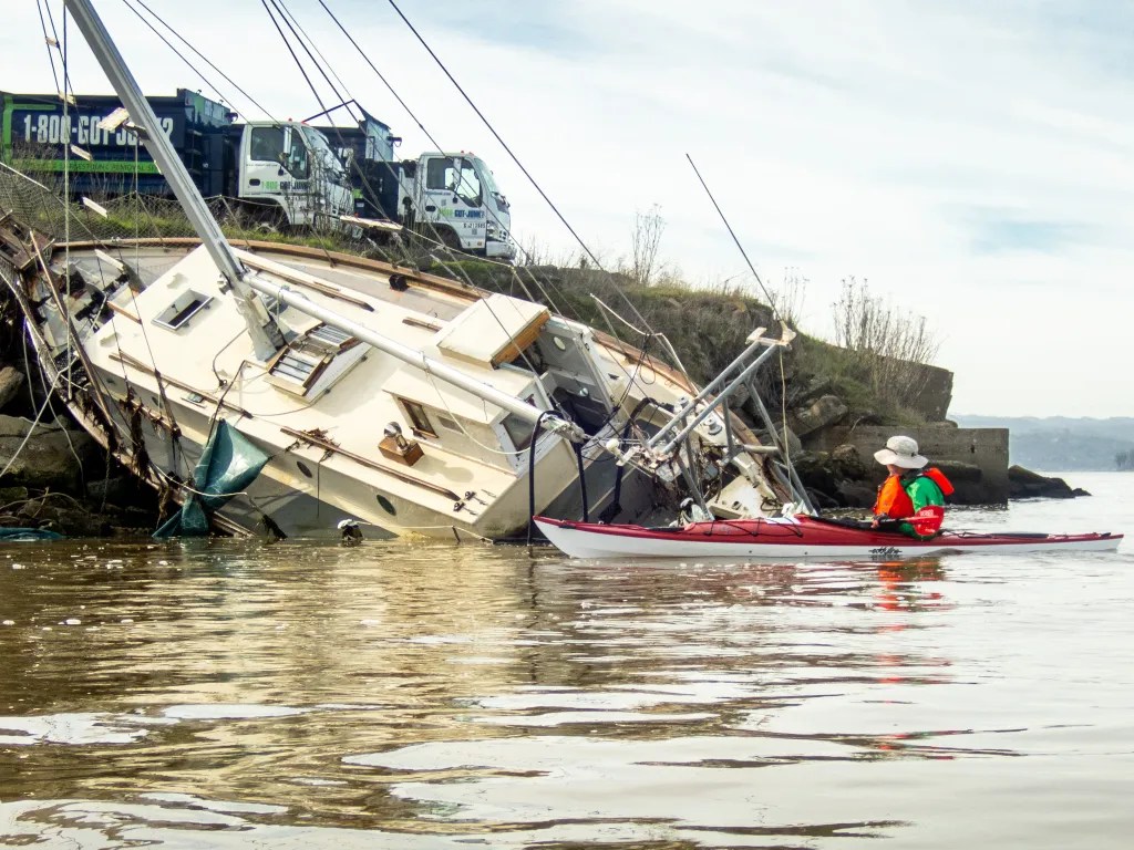
Coming back around Point San Pablo we stopped to look at a sailboat that was on the beach, presumably a casualty of the recent storm activity. We did see a fair amount of debris in the water: driftwood, bottles, and plastic bags. Our paddle covered 6.9 miles, with a maximum speed of 7 mph when we had the ebb current with us. We were back on the beach at 1:25 p.m.

More photos are available in an online gallery.

Roof Rack Failure & Windsurfer

Sometimes it seems that the hardest part about kayaking is getting the boat to the water. Getting the boat on top of the car and getting it off and to the water at the launch site can be a challenge. Today I had an added challenge. As I tugged on one of the straps to cinch the boat into the saddles on the car top carrier the cross bar came loose. On inspection I discovered that the support tower that secures the crossbar to the roof was broken. It would be easy enough to just pack it in, but a little voice in my head was saying, “Treve, if you really want to go paddling you have another vehicle you can use.” The racks for the truck were sitting in the driveway, so I accepted the challenge to see if I could get the kayak on the truck in time to make it to the launch site. Our intended launch time was 10:00 a.m. Google Maps was telling me that it was a 21-minute drive, which meant I might just make it. Sure enough, I was able to get the kayak on the camper and on the road in a timely fashion. It was 10:03 when the six of us pushed off from the beach.

With a constant parade of storms coming our way, we found a weather window with perfect conditions for paddling. Our course took us past San Quentin State Prison, then under the Richmond San Rafael Bridge and on to Loch Lomond Marina. Just for fun we tried squeezing our boats through a narrow gap in the pilings at the end of the Yacht Harbor’s breakwater.

Time for lunch…but in my haste to get on the road after the rooftop debacle, I did not have time to make a lunch. Andy’s Market has a fine selection of deli foods; a bowl of Italian Wedding Soup and a loaf of Judy’s bread hit the spot. And don’t forget the chocolate that seems to be ubiquitous on our paddles.

On our return paddle we had calm water and building clouds. We paddled out around the Marin Islands and then back to our launch site, watching for ferry traffic since Windsurfer Beach is close to the Larkspur Ferry Terminal.

My story starts with car top racks, so it’s only appropriate to end with a photo of my boat on top of my camper after the paddle. We covered 8.5 miles over the course of our paddle. Here’s a map that shows our track.

More photos are available in an online gallery.

Starting the New Year with a Splash

Once again, we started the new year by going kayaking. This year it was a paddle sponsored by California Canoe and Kayak (CCK). They offered to provide boats for any of us that wanted to invite friends, so we invited two friends. You can see Kristina here on the dock getting help adjusting the foot pegs.

You can also see Kathryn getting outfitted with a sit-on-top kayak. Not having any experience in a kayak, a sit-on-top seemed to be appropriate given its stability. Now it’s time to get on the water. A couple of us enthusiastic paddlers thought it would be appropriate to assist Kristina in a “seal launch,” guiding her boat as we pushed it off the low dock. Not a good idea; she went bottom side up as soon as her boat hit the water. To stay right side up for this kind of launch you need to be able to use the paddle as a brace, not a technique a novice paddler would know.

Kristina, being dressed in a wetsuit and a good sport, was back in her boat and on the water with a smile. Kathryn found her boat a bit slow compared to the more experienced paddlers in touring boats. When some more energetic BASK members offered to give her a tow, she was happy to accept.

Our destination was the Tidewater Boating Center about 2-1/2 miles from our launch site at Brooklyn Basin. Once we reached the boating center, we got out of our boats for snacks and a break. A couple of experienced paddlers were eager to give some instruction on technique for an efficient forward stroke, something that’s quite valuable for covering distances in a kayak.

After the break we climbed in our boats and headed back to our launch site. Our route took us under three bridges, and we had the opportunity to watch the Park Street Bridge open to let a few sailboats through. You can see Kathryn under the bridge. If you look closely, you can see that she is being towed by another paddler. We returned to our launch site where we enjoyed an extravagant potluck meal. A great way to start the new year. Our paddle covered 4.7 miles.

More photos are available in an on-line gallery.