To Lopez Island and Back

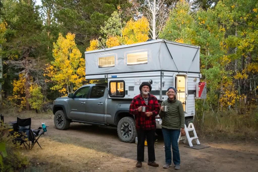
On June 29 we loaded our kayaks on our rig and headed north for the San Juan Islands in the Pacific Northwest. We gave ourselves five days to make our way to Spencer Spit campground. There we rendezvoused with fellow members of our kayaking club, Bay Area Sea Kayakers (BASK), for the biannual Casey Walker Memorial Campout. The night of June 29 we camped near Greenhorn Reservoir just outside of Yreka in a space we found on Hipcamp, one of the resources we use for locating camping sites. Then it was on to Portland, Oregon, where we spent the night at Rossi Farms. At Rossi Farms we gorged ourselves on the raspberries that were growing next to our campsite.

From Portland we made our way to Whidbey Island where we spent two days with my brother, feasting on fresh seafood including crab and oysters.

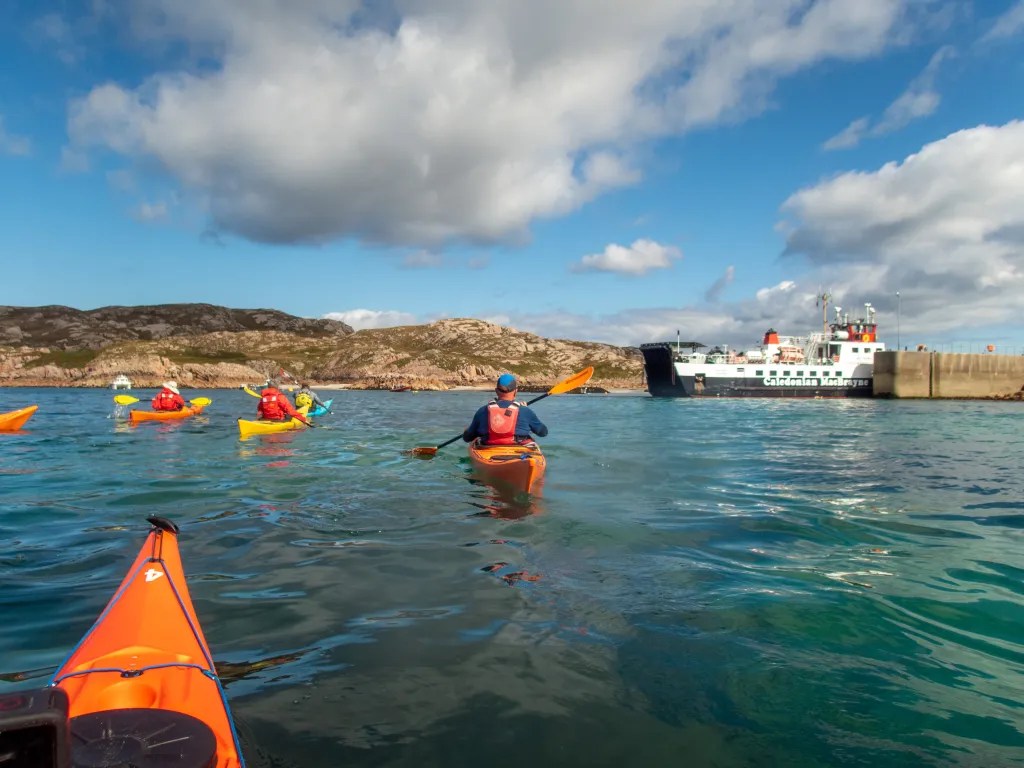
From Whidbey it was on to Anacortes where we caught the ferry to Lopez Island. It wasn’t too surprising to have Brad, a fellow BASK member pull up right behind us while waiting for the ferry.

We arrived on the island on July 3, so for the 4th we went into town to enjoy the Independence Day festivities.

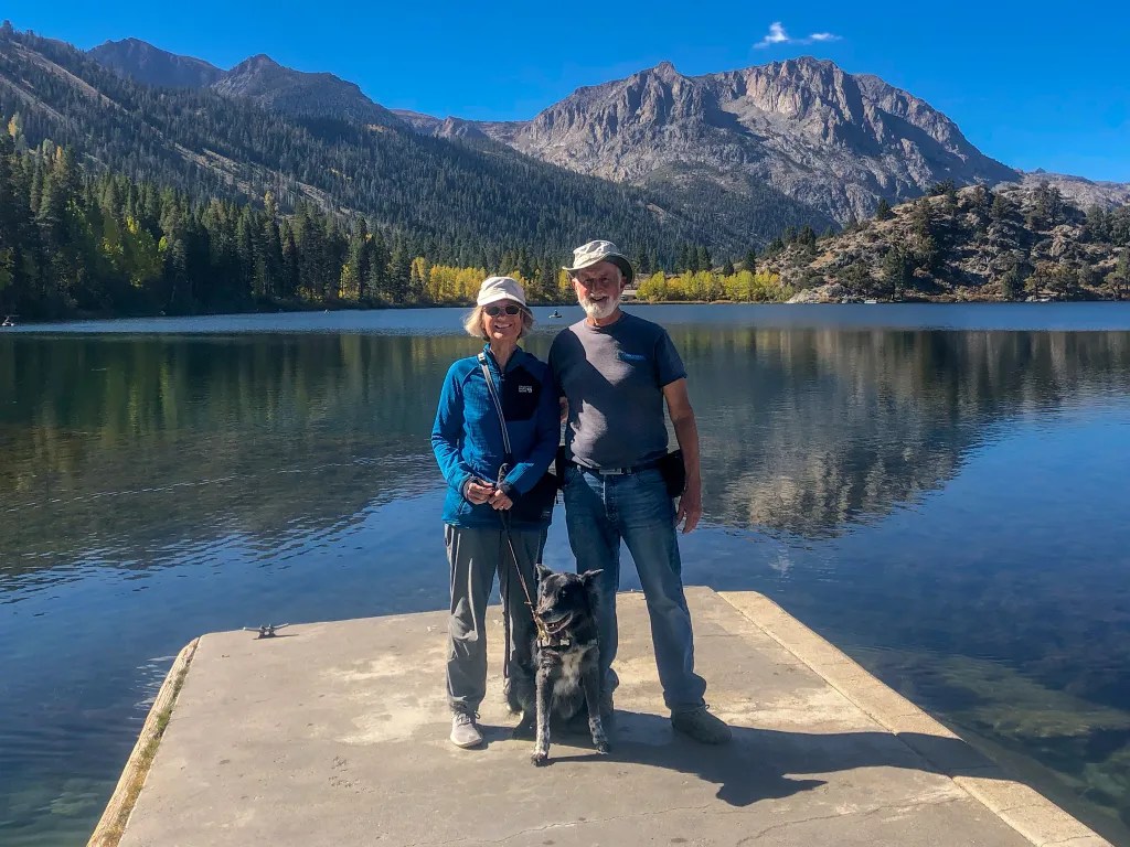
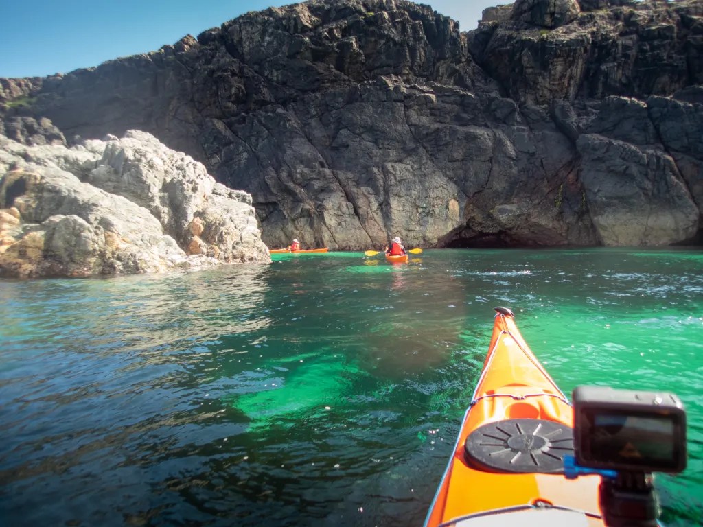
The focus of the trip was kayaking with fellow BASK members. I’ve already written about a couple of those adventures, Lopez Island: Makaye and Ice Cream Paddle. Of course, eating together is a big part of any group camping adventure. BASK is sometimes referred to as an eating club with a kayaking disorder. We feasted on a finger-licking-good potluck dinner one evening. We also took time to do some hiking, including a wonderful outing to Iceberg Point, and we enjoyed a whale watching expedition.

On July 10 we started our return journey, getting an early start in order to be at the ferry terminal for the 8:30 a.m. ferry. We were just two cars short of making that ferry. We pulled out our camp chairs and spent the wait visiting with fellow kayakers and reading. With some ferry mishaps, it was 4 p.m. when we finally rolled onto the ferry, bringing to mind a common acronym we’d been seeing: FTF (where’s the ferry). It was 6:10 p.m. when we arrived back at my brother’s place on Widbey Island. Fortunately, he had dinner ready with freshly caught prawns.

From Whidbey Island we took the Port Townsend Ferry and headed south where we spent the night at Scenic Beach State Park on the Hood Canal. There I got up early and captured an image that I’m calling Morning View from Scenic Beach (fine art prints are available in my art store). From Scenic Beach our drive took us through Raymond where we stopped for a quick picnic lunch and a walk around town to admire the town’s metal people.

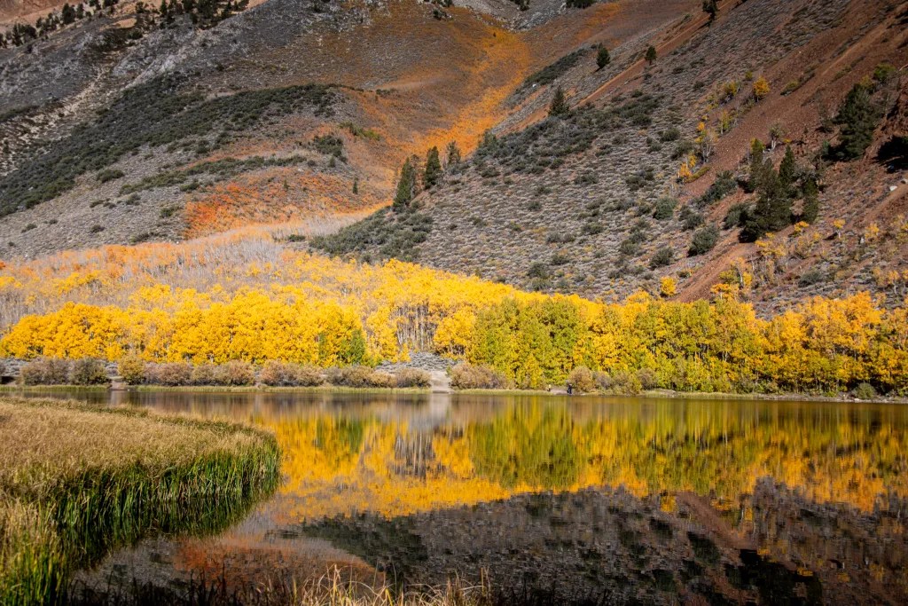
Then on to Cape Disappointment where we watched the setting sun sink into the sea. From Cape Disappointment we decided to follow the Columbia River Gorge as far as The Dalles where we turned south. We found a campsite at Prairie Camp near the town of La Pine. In the morning, we discovered that we were close to a little lake, East Lake, where we managed to get our kayaks on the water for one last paddle. We were not too anxious to head south into California’s Central Valley where extreme temperatures were predicted.

Our last night we boondocked, locating a site near Mount Shasta that iOverlander identified at Shasta View in the Trees. This site had a spectacular view of Mount Shasta. Our trip covered 1065 miles over 16 days. More photos are available in an online gallery.

Going on a Lupine Hunt

June 7. Time to go on a wildflower hunt. I had seen photos of some amazing Lupine blooms, so we set off to see what we could find. Following the suggestion that we explore North Oak Creek Road, we ended up at the Baxter Pass Trail Head. It was a chilly day with drizzles of rain off and on, but the dark sky added drama and some nice soft light for interesting photos.

We found quite a bit to photograph including wild roses, prickly poppy, and paintbrush.

There seemed to be endless photo opportunities with the dark and stormy clouds and the patches of color. Eventually we grew hungry, so we headed back down the mountain to the Old Mount Whitney Fish Hatchery where we found a picnic table to break out our lunch.

There’s always something to see in the Eastern Sierra, and Carson enjoyed some off-leash time in the mountains.

Over the Mountain

June 4. Grandma and Grandpa are on the road, heading over the mountains to spend a week in the Eastern Sierra. Three of us, my wife Joann, Carson our dog and me. We planned to make the trip over the mountains a two-day outing since we often look for the road less traveled and we like to take our time to view the sights.

Our route over the mountains took us up Highway 50. By mid-afternoon we started looking for a campsite along the South Fork of the American River. At 4:30 we popped up the camper top at a site in the Sand Flat Campground. The river was a raging torrent with all the snow melt. I was eager to try some new tricks I had learned with my iPhone, so I started experimenting with the long exposure option on the Live View. This prompted me to get out the big camera and tripod to take advantage of the overcast sky and the soft light to capture some more intentional images.

The next morning we broke camp and continued, making a stop on Highway 89 to admire the view over the Walker River Valley and the mountains to the east. By noon we were in the little town of Walker, and the Walker Burger restaurant looked quite inviting. We split a burger and fries.

Then it was on to Bishop to rendezvous with family. We wanted to be in Bishop to see our granddaughter graduate from preschool.

Ansel Adams at the de Young Museum

In the summer of 1980, I had to opportunity to participate in the last photography workshop Ansel Adams taught in Yosemite. Needless to say that was a key steppingstone in the path that led to where I am today. So, when I saw the announcement that the show Ansel Adams in Our Time was up at the de Young Museum in San Francisco through July 23, I put a date on my calendar.

This turned out to be quite an extensive exhibit with over 100 of Adam’s prints. It also included the work of other 19th-century landscape photographers, such as Carleton Watkins and Eadweard Muybridge, and contemporary artists like Trevor Paglen, Will Wilson, and Catherine Opie. It is interesting to see how contemporary artists treat some of the grand landscapes of Yosemite. We spent a good 2-1/2 hours in the exhibit, and that didn’t even seem like enough. Well worth the visit.

Whale Watching: San Ignacio Lagoon

We made reservations ahead of time to go whale watching on San Ignacio Lagoon with Antonio’s Ecotours. We arrived on the afternoon of March 14 and set up camp, which simply means putting the top up on the camper. The drive from San Ignacio is 48 km with 17 of it on gravel. Our rig handled the gravel road just fine, although we did hear comments about the washboard road from people in passenger vehicles.

Our campsite was on a bluff overlooking the lagoon. There was one other campsite occupied when we arrived. We had reservations for two nights camping and a whale watching tour. We had reserved an afternoon whale watching tour on the 15th. Upon arriving, though, we discovered that we could join an earlier tour, so we signed up for 8 a.m.

Camping facilities at Antono’s are rather spartan. There is no electricity or water at the sites. There are composting toilets and a solar heated bucket shower. The staff is very friendly and accommodating. There are also a number of small cottages available to rent. We had dinner in the restaurant with live music before dinner.

While enjoying the view from our campground, we were entertained by a pair of Osprey that were wheeling around just overhead.

In the morning we were at camp headquarters at 7:40 to get outfitted with life jackets. Then we climbed aboard one of the pangas for the 20-minute ride to the whale watching location. I had both my Sony RX100 and a GoPro with me to document the event. Here’s a short video:

It’s just simply amazing to be sitting in one of these small boats with the Grey Whales cruising by, most often pairs with mothers and calves. They will occasionally come so close to the boat that you can reach out and touch them. In the morning, with the sun shining, the spouts would create rainbows. We spent 90 minutes with the whales, and then it was back to land. It’s astounding to think that while we were here as friendly observers, 150 years ago these animals were hunted.

Watching the sun set over the lagoon was beautiful.

Cataviña: Cactus Wonderland

We wanted to spend two nights in the vicinity of Cataviña. The Cirios and cactus here are fascinating and, along with the rock formations, I thought this would be rich with photo opportunities. I figured two nights would give us opportunity to experience two sunsets and two sunrises and time to explore the cave paintings.

There are plenty of places to boondock in the desert here. We picked a spot that iOverlander identified as “Cactus Wonderland.” We found one other camper here, but we simply drove around to the other side of a rock outcrop and found a quiet spot to camp.

The next morning we walked to the cave paintings. Rather than walk on the highway, we decided to follow a dirt road that appeared to parallel the highway. This worked for a while until we started heading away from the highway. Using a GPS track on my phone from a previous trip, we were able to make our way over some rocks and head in the direction of the cave. Going over the rocks we encountered a rattlesnake hidden in the rocks. He let his presence be known with an alarming rattle.

We kept our distance and continued on to the cave. The cave is a bit of a climb up from the road and the parking area. We were happy to spend a few minutes in the cool respite of the cave since we were feeling the heat of the desert on the hike. As the crow flies, the walk to the cave was just over a mile. We managed to turn that into a 4-mile round trip hike with our meanderings.

True to expectations, this area provided many fascinating photo opportunities. The Cirios or Boojum trees, sometimes called Doctor Seus trees, were quite interesting and fanciful. More photos are available in an online gallery.

Hot Creek

East of the Sierra Nevada Mountains, not far from Mammoth Lakes, is an area known as the Long Valley Caldera. This is a geologically active area with steam vents, geysers, and hot springs, the remnants of an ancient volcano. I’ve been visiting the Eastern Sierra for several decades and only this year decided to check out the area known as the Hot Creek Geologic Site.

My plan was to scout the location with the intention of returning in the morning when the steam from the many vents would be visible in the cool morning air. As it turned out, we had some dramatic weather with rain and hail and that was enough to appease my photographer’s eye.

There are a number of trails you can hike in the area with signs warning you to stay out of the water. Some of the pools are boiling hot. Despite the warnings we did see several people in the creek.

From the Hot Creek site, we decided to head for camp. Our intended camping site was a spot referred to as Laurel Springs on iOverlander, a “wild” campsite site just off of Highway 395. In trying to locate the site we apparently drove past it. Rather that turn around, we decided to follow the forest service road to see if we could find another suitable spot to park our rig. It wasn’t long before the road deteriorated a bit and I shifted into four-wheel drive. Then as the road got a bit rockier it was four-wheel low. You can see a photo of my shadow on the road looking east with Crowley Lake in the distance. We climbed up a valley to a ridge and there at the end of the road was a campsite with a picnic table and an incredible view. On one side of the ridge we could look east with a view of Crowley Lake, on the other side was a view of Convict Lake. In the morning I put the drone in the air to capture a view of our rig with Laurel Mountain and Convict Lake in the background.

That morning, October 11, we broke camp and continued our journey home. We made a quick tour of the June Lake Loop, stopping at Gull Lake to walk the dog and admire the view. We found quite a few pockets of fall color, but for the most part the aspens were still green.

Our route home took us over Tioga Pass on highway 120. Near the summit we stopped for one last peek at the fall color on the mountainside. Then we drove down into Yosemite Valley thinking there might be a remote chance of camping. We were impressed by how busy the valley was. No luck finding camping, so we headed home. More photos are available online.

Dazzled by Yellow

After three days of chasing fall color I was starting to feel overwhelmed. I felt like I had to give my eyes a rest, and yet we’d find another grove of aspen in full splendor, I’d grab my camera and start snapping photos. And then I’d be asking myself how the image I’m capturing differs from the many thousands of photos I’ve captured over the past 50 years. In any event, every photo is another adventure and the magnificence of the changing seasons never gets old. I’m always looking for a way to create unique photos that celebrate the glory of God’s creation.

Fall color in the Eastern Sierra usually starts in mid to late September with the aspen at the higher evaluations changing color first, and the color progressing down the canyons over the course of several weeks. I usually start to watch the fall color reports in mid September. This year October 4 was the earliest date we could get away, so we stocked the camper with food for a week and hit the road.

From our home in Albany, CA, we decided to take California State Route 108 over Sonora Pass. After passing the summit we stopped briefly near a grove of aspen, admired the view, and then decided to head to our intended camping destination on Green Creek. We were hoping to camp at the Green Creek Campground. Why? Because we wanted to fire up our Dutch Oven to cook dinner; for that we needed a fire ring in an established campground. The campground was closed. There are plenty of places to boondock along Green Creek so we found a comfortable spot to park our rig. We implemented “plan B” for our menu which did not require a fire ring. I was a little annoyed, though, when campers not too far away from us lit a campfire, something that’s prohibited in the dry conditions. I was too shy to confront them. What would I say?

We were so impressed with the fall color along Green Creek, we decided to spend a second night although we moved our rig a mile down the road. The road into Green Creek is a dirt road. For the most part it is navigable by passenger car, although close to the campground it gets a little rocky.

From Green Creek we headed towards Bishop by way of Dunderberg Meadow Road. We admired the aspen along the way and set up camp at the Sabrina Campground in the afternoon. The fall color was about peak there. In the morning we drove to North Lake where I spent some time with my camera and tripod capturing fall color. We also gave our dog Carson the opportunity to hike with us off-leash.

From Bishop Creek we drove to Bishop where we spent the weekend with family. Then we headed home after a night camping on a ridge overlooking Convict Lake. We had intended to spend more time on the road but the furnace in our camper was not working; getting up in the morning with the temperature in the 30s was wearing on us.

More photos are available in an online gallery.

Carnassarie Castle

Today, September 11, marks our 22nd day of travel in Scotland. We’ve had many adventures over the past three weeks. Some of those adventures will eventually make their way into this blog, but for today, I’ll share our walk to Carnassarie Castle. And, of course, at the top of the news is the passing of Queen Elizabeth II. That caused us to revise our plans for returning to the Edinburgh airport for our flight home. Nevertheless, it didn’t stop us from lacing up our hiking boots and going on a walk after a hearty Scottish Breakfast at our B&B here in Kilmartin, Old Manse.

Our track led us along several country paths, up into the hills, through woods and past babbling streams. Then we climbed a hill to the castle where we spent quite some time going up and down many flights of narrow circular stairs to admire the view. The castle was built between 1565 and 1572 by John Carswell who had been granted the land by the Earl of Argyll. Carswell would become the Bishop of the Isles and was instrumental in translating the Book of Common Order into Gaelic, which became the earliest book to be translated into Scots Gaelic.

The overcast sky with threat of rain provided some nice soft lighting to set the castle in a surrounding landscape of green rolling hills and woods.

After climbing all the stairs and poking into rooms and windows, we found a spot to break out our lunch of cheese and crackers.

We returned to the town of Kilmartin by retracing our steps, walking by an apparently abandoned caravan which seems to have a picturesque spot along the track. Back in town we stopped at the museum café for a bowl of hot lentil soup, muffins and coffee. The museum is closed at the moment for renovation, but that didn’t deter us from enjoying a cool pleasant day in the area of Scotland known for its archeological significance, with ruins going back over 5,000 years.

Kayak Around Iona

August 31. Our Wilderness Scotland paddling adventures included several day paddles exploring parts of the Isles of Mull and Iona. The day’s adventures usually started with a briefing by one of the guides. Here’s Howard explaining the route around Iona. Our land base for these outings was Achaban Houses which was a mile from Fionnphort, our launch point for the paddle around Iona. You can see the van with the kayak trailer in the photo.

It was a promising day as we schlepped boats and gear down to the water’s edge. Without much delay we were on the water but since we had the tail end of the ebb against us, we stayed close to shore looking for eddies and paddling inside the rocks that separate the Sound of Iona. Once we were around the rocks and on the sound, we picked up the pace a bit to make the short crossing to Iona where we paddled around the point and into a white sand beach for coffee and tea.

For the rest of the trip we had the current with us. We poked our noses into caves, paddling in and out of rocks admiring the clear and colorful water. Coming back into Fionnphort we had to hold up a few minutes for the ferry. And then it was off to the pub to celebrate.

More photos are available in an online gallery and you can view a video as well.

We logged 11 miles on calm water. An excellent day’s paddle.