Back from Baja

We arrived home on the afternoon of March 28 having logged 3012 miles over the course of 23 days: three of us, Joann, me and our dog Carson. We were a little concerned about taking our dog, but Baja turned out to be quite dog friendly. Along the way we had some amazing adventures, and I captured many photos to sort through and share.

Before we could obtain our Mexican Tourist Cards (FMMs) we had to make a stop in San Diego to renew our passports. If you are planning on traveling to Mexico, check your passport. You need to have at least three months on your passport to apply for an FMM. We discovered this just a few weeks before our trip and we had to scramble to get our passports renewed.

On the trip south we decided to take a quick detour to Anza Borrego to check out the wildflowers. We were not disappointed.

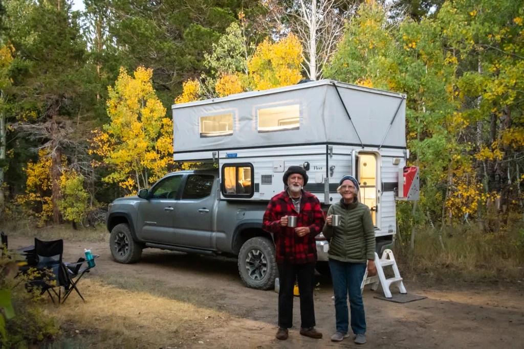
Our traveling rig consists of a pop-up Four Wheel Camper on our Toyota Tacoma. The camper is outfitted with a refrigerator, heater and cooktop. There is no toilet or shower on board, but we’re comfortable taking a shovel out in the woods (or desert) if we are boondocking or taking advantage of facilities including showers in established campgrounds. We also have the rig set up to carry two kayaks.

For planning both prior to the trip and on the road, we used the app iOvelander for locating facilities and Maps.Me for route planning. We discovered a hack that let us import the iOverlander pins into Maps.Me, which proved to be quite useful when we were offline without cell phone signal or Wi-Fi. We also found the Baja California Road and Recreation Atlas from Benchmark Maps useful, as well as Google Maps when we had a cell phone signal.

And of course, sharing travel information with fellow travelers is also fun and informative.

Some of the highlights along the trip included a fabulous lunch with a bottle of wine at Encuentro Guadalupe shortly after crossing the border, camping in the cactus gardens near Catavina, and whale watching in San Ignacio Lagoon.

We had our share of fabulous sunsets and sunrises and we managed to get our kayaks on the water at Bahia Conception and Gonzaga Bay.

Over the course of the trip, we spent 23 nights in our camper. On a couple nights, we were happy to have the camper as protection from fierce winds. The southern-most point in our trip was Playa Coyote on Bahia Conception. Three weeks is just not enough time to see much of Baja. We’re already thinking about our next trip.

Bahía Concepción

Today we arrived at Playa Santipac. At the gate we paid 200 pesos for one night thinking we would move on the next day, but we ended up spending two nights. The campground was fairly busy, but we did find a suitable site with a palapa about 1/2 mile down the beach.

Playa Santipac is a popular spot for big rigs but also suitable for smaller rigs and tents. We had fun visiting with fellow campers who were walking along the beach, many of them from Canada and other northern locations that come down to Baja for several weeks or more. One of the joys of traveling is hearing people’s stories. Everybody on the road seems to be quite friendly and happy to share information.

There is no running water at the campsites, but vendors drive along the beach in the morning and provide you with a blue barrel with as much water as you wish for a small fee. There are also vendors selling fresh fish and a variety of other things. We bought water to use for washing since we wanted to conserve the water we had on board for drinking and cooking. We also bought some fresh halibut which served us for a couple of dinners as well as a hammock and some carrot cake.

We did manage to get our boats on the water, paddling out from the beach and around several islands. In one of the photos, you can see Joann in the little wooden boat with a line of RVs on the beach in the background. The beach at our campsite was quite shallow at low tide, so we ended up dragging the boats until we had enough water to paddle. If I had been paying attention, I would have given priority to a campsite further west where the beach wasn’t quite so shallow.

After a few days of dry camping, it was nice to have a shower even if it was just pouring a bucket of cold water over my head. For lunch we walked down the beach to Armando’s, a rustic shack on the beach with delicious seafood tacos.

After a couple of days at Playa Santipac we moved on to Playa Coyote. This is a popular spot. We pulled into the campground at 10:30 in the morning and found the last open site. We were surprised to discover that the campers next to us were kayakers, fellow members of BASK (Bay Area Sea Kayakers). We pooled our resources for dinner. I fired up the Dutch Oven and baked up some Halibut. In the morning we paddled together around Isle Coyote. It was a gorgeous day to be on the water and the flat calm gave us the opportunity to look below the surface. We saw many sting rays.

And talking about sting rays, I managed to step on one. Ouch! Before we launched our kayaks, I was tossing the ball for Carson and the ball went in the water. Carson wouldn’t go in the water to get it, and while the water was only six inches deep, I forgot to do the sting ray shuffle. Fortunately, I was wearing sandals and after a little first aid I was on the water paddling. I think I was quite lucky, since sting ray wounds can be very painful.

While we did have thoughts of driving further south to Loreto, Playa Coyote was such an idyllic spot we decided to spend time there rather than adding more miles to our trip.

More photos of Bahia Conception are available in an online gallery.

Whale Watching: San Ignacio Lagoon

We made reservations ahead of time to go whale watching on San Ignacio Lagoon with Antonio’s Ecotours. We arrived on the afternoon of March 14 and set up camp, which simply means putting the top up on the camper. The drive from San Ignacio is 48 km with 17 of it on gravel. Our rig handled the gravel road just fine, although we did hear comments about the washboard road from people in passenger vehicles.

Our campsite was on a bluff overlooking the lagoon. There was one other campsite occupied when we arrived. We had reservations for two nights camping and a whale watching tour. We had reserved an afternoon whale watching tour on the 15th. Upon arriving, though, we discovered that we could join an earlier tour, so we signed up for 8 a.m.

Camping facilities at Antono’s are rather spartan. There is no electricity or water at the sites. There are composting toilets and a solar heated bucket shower. The staff is very friendly and accommodating. There are also a number of small cottages available to rent. We had dinner in the restaurant with live music before dinner.

While enjoying the view from our campground, we were entertained by a pair of Osprey that were wheeling around just overhead.

In the morning we were at camp headquarters at 7:40 to get outfitted with life jackets. Then we climbed aboard one of the pangas for the 20-minute ride to the whale watching location. I had both my Sony RX100 and a GoPro with me to document the event. Here’s a short video:

It’s just simply amazing to be sitting in one of these small boats with the Grey Whales cruising by, most often pairs with mothers and calves. They will occasionally come so close to the boat that you can reach out and touch them. In the morning, with the sun shining, the spouts would create rainbows. We spent 90 minutes with the whales, and then it was back to land. It’s astounding to think that while we were here as friendly observers, 150 years ago these animals were hunted.

Watching the sun set over the lagoon was beautiful.

Cataviña: Cactus Wonderland

We wanted to spend two nights in the vicinity of Cataviña. The Cirios and cactus here are fascinating and, along with the rock formations, I thought this would be rich with photo opportunities. I figured two nights would give us opportunity to experience two sunsets and two sunrises and time to explore the cave paintings.

There are plenty of places to boondock in the desert here. We picked a spot that iOverlander identified as “Cactus Wonderland.” We found one other camper here, but we simply drove around to the other side of a rock outcrop and found a quiet spot to camp.

The next morning we walked to the cave paintings. Rather than walk on the highway, we decided to follow a dirt road that appeared to parallel the highway. This worked for a while until we started heading away from the highway. Using a GPS track on my phone from a previous trip, we were able to make our way over some rocks and head in the direction of the cave. Going over the rocks we encountered a rattlesnake hidden in the rocks. He let his presence be known with an alarming rattle.

We kept our distance and continued on to the cave. The cave is a bit of a climb up from the road and the parking area. We were happy to spend a few minutes in the cool respite of the cave since we were feeling the heat of the desert on the hike. As the crow flies, the walk to the cave was just over a mile. We managed to turn that into a 4-mile round trip hike with our meanderings.

True to expectations, this area provided many fascinating photo opportunities. The Cirios or Boojum trees, sometimes called Doctor Seus trees, were quite interesting and fanciful. More photos are available in an online gallery.

Baja Bound

Today is my birthday. Birthday number 73. We’re headed to Baja California, the three of us: my wife Joann, our dog Carson and myself. My birthday wish is to see a rainbow. So, as we are headed south on I5 near Firebaugh, there it is, a rainbow off to the east. That has to be a good omen for the start of our 23 day trip. Of course, we have to find a highway off-ramp to take a photo.

We make our first overnight stop at Buena Vista Aquatic Recreational Area. Not a bad spot for an overnight given the lack of camp sites along our route. This time of year, finding a site in not a problem, but in summer this can be quite a popular spot.

The next morning, we broke camp and hit the road. We needed to stop in San Diego to renew our passports; since our appointment with the passport agency is on March 8, we discovered that we have an extra day. This gave us the opportunity check out the wildflowers at Anza Borrego. The campground at Borrego Palm Canyon was full, but we managed to boondock at Peg Leg Smith, a popular spot for boondocking, which turned out to be quite close to some of the better flower displays.

Also enjoying the flowers was painter Stephen Stauffer who spends his time traveling the country and painting.

From Anza Borrego it’s a two-hour drive to San Diego, where we had booked two nights at Campland on the Bay. Campland turned out to be quite a comfortable place to camp even though it is an RV park.

On the morning of March 8, it was an easy matter to break camp and head to downtown San Diego. We were at the San Diego Passport Authority well ahead of our 8:00 a.m. appointment and already there was a line. With our applications submitted, we drove over to Fiesta Island to take Carson for a walk at the Fiesta Island Dog Park and then launch our kayaks for a paddle on Mission Bay. Later in the afternoon we returned to the passport agency to pick up our passports. Rather than go back to our campground for dinner, we discovered the Pacific Beach Fish Shop that had excellent fresh fish. Then it was back to camp to get an early start crossing the border the next day.

Yosemite

On February 7, we made our way to Yosemite, with reservations to stay in Upper Pines Campground, site #46. We arrived in time to get set up before dark. With bear warnings posted about not leaving food in the car, we were concerned about what to do with the food in the camper. We certainly weren’t going to move our entire pantry to the bear box. A ranger assured us that food in the camper would be fine, but food in the cab was an issue.

In the morning we were in no hurry to get out of our cozy sleeping bags. The outside temperature was 32, but we had the heater going in the camper. Since we need the sun to charge our camper battery we drove to a sunny location where we could leave the camper and go for a hike, parking near Yosemite Falls.

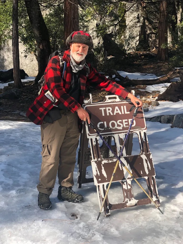
We discovered that the trail to the base of the falls was closed and, since we had our dog Carson with us, we were limited to trails that were paved or marked for bicycles. Even so we found plenty of places to walk. We did find that ice cleats, the kind that you can slip on over your boots were quite helpful for walking on icy trails and around camp.

On the second night the heater went out. I woke up at 4 a.m. feeling cold. The heater had shut down. Apparently, the battery went dead. This is a mystery. We should have had ample battery capacity to keep the heater fan going, but here we were with no power. We were prepared for the cold, so while we missed the comfort of a heated camper, we had our winter clothes and we carried on. After some hot coffee, eggs, and sausage we took a hike to Happy Isles.

While Yosemite Valley is an awesome location any time of year, I was not inspired with the iconic views of Yosemite Falls, Bridalveil Falls, Half Dome and El Capitan. It’s hard to beat the drama I’ve captured on previous trips.

What did capture my attention was more intimate landscapes, snowcapped rocks and flowing water at Happy Isles, a leaf in the snow, and Fern Spring.

After a day of exploring a variety of locations – Happy Isles, Swinging Bridge, and a few other sights – the plan was to stay out taking photos until dinner time and then have a nice meal before popping up the camper for the night. We were surprised to find the Ahwahnee closed for renovations, and the restaurant in Curry Village was closed as well. We ended up eating at the Base Camp at Yosemite Lodge. While it served our needs, it was not on par with our previous experiences.

On Friday, February 10, we had a very pleasant hike to Mirror Lake, even if it was a bit chilly. We were on the road heading home shortly after noon. As we left the park, we noted the arrangements that were being made to accommodate the throngs of people who would be coming to photograph the fire fall, a phenomenon that happens with the setting sun shines on Horsetail Falls making it look like it’s on fire. This phenomenon happens in mid to late February.

Hot Creek

East of the Sierra Nevada Mountains, not far from Mammoth Lakes, is an area known as the Long Valley Caldera. This is a geologically active area with steam vents, geysers, and hot springs, the remnants of an ancient volcano. I’ve been visiting the Eastern Sierra for several decades and only this year decided to check out the area known as the Hot Creek Geologic Site.

My plan was to scout the location with the intention of returning in the morning when the steam from the many vents would be visible in the cool morning air. As it turned out, we had some dramatic weather with rain and hail and that was enough to appease my photographer’s eye.

There are a number of trails you can hike in the area with signs warning you to stay out of the water. Some of the pools are boiling hot. Despite the warnings we did see several people in the creek.

From the Hot Creek site, we decided to head for camp. Our intended camping site was a spot referred to as Laurel Springs on iOverlander, a “wild” campsite site just off of Highway 395. In trying to locate the site we apparently drove past it. Rather that turn around, we decided to follow the forest service road to see if we could find another suitable spot to park our rig. It wasn’t long before the road deteriorated a bit and I shifted into four-wheel drive. Then as the road got a bit rockier it was four-wheel low. You can see a photo of my shadow on the road looking east with Crowley Lake in the distance. We climbed up a valley to a ridge and there at the end of the road was a campsite with a picnic table and an incredible view. On one side of the ridge we could look east with a view of Crowley Lake, on the other side was a view of Convict Lake. In the morning I put the drone in the air to capture a view of our rig with Laurel Mountain and Convict Lake in the background.

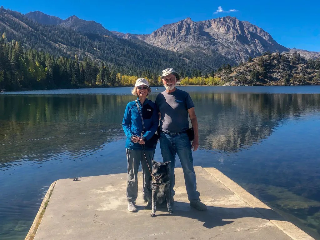
That morning, October 11, we broke camp and continued our journey home. We made a quick tour of the June Lake Loop, stopping at Gull Lake to walk the dog and admire the view. We found quite a few pockets of fall color, but for the most part the aspens were still green.

Our route home took us over Tioga Pass on highway 120. Near the summit we stopped for one last peek at the fall color on the mountainside. Then we drove down into Yosemite Valley thinking there might be a remote chance of camping. We were impressed by how busy the valley was. No luck finding camping, so we headed home. More photos are available online.

Dazzled by Yellow

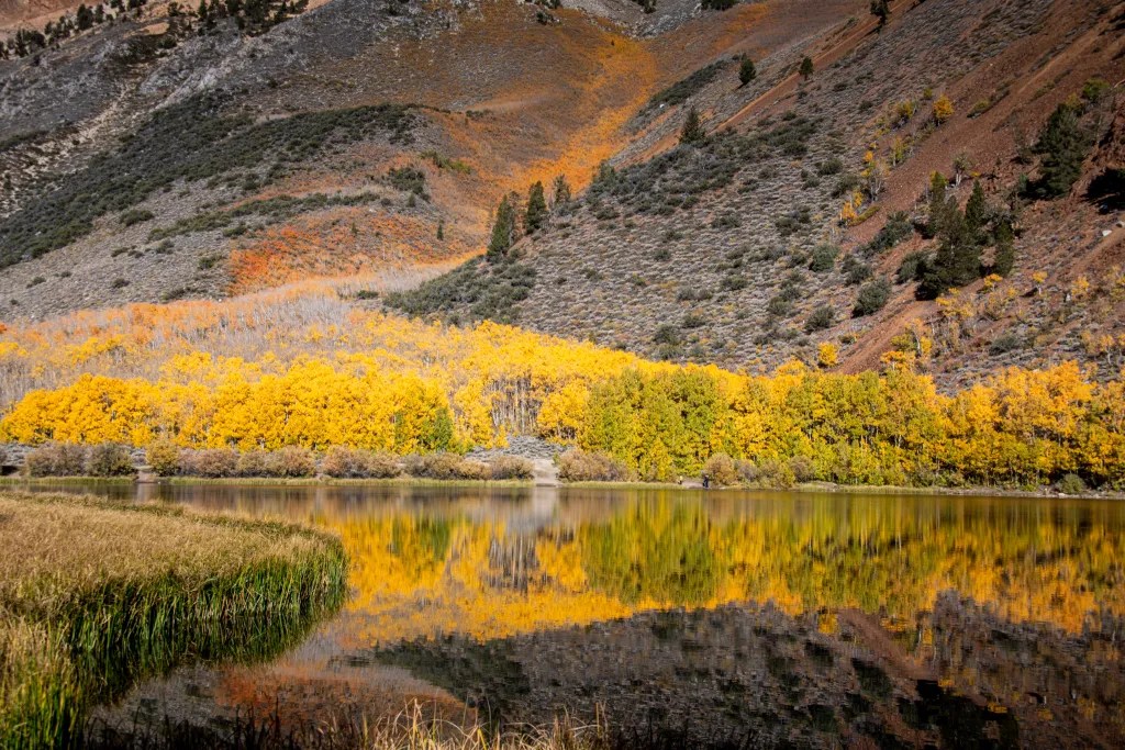
After three days of chasing fall color I was starting to feel overwhelmed. I felt like I had to give my eyes a rest, and yet we’d find another grove of aspen in full splendor, I’d grab my camera and start snapping photos. And then I’d be asking myself how the image I’m capturing differs from the many thousands of photos I’ve captured over the past 50 years. In any event, every photo is another adventure and the magnificence of the changing seasons never gets old. I’m always looking for a way to create unique photos that celebrate the glory of God’s creation.

Fall color in the Eastern Sierra usually starts in mid to late September with the aspen at the higher evaluations changing color first, and the color progressing down the canyons over the course of several weeks. I usually start to watch the fall color reports in mid September. This year October 4 was the earliest date we could get away, so we stocked the camper with food for a week and hit the road.

From our home in Albany, CA, we decided to take California State Route 108 over Sonora Pass. After passing the summit we stopped briefly near a grove of aspen, admired the view, and then decided to head to our intended camping destination on Green Creek. We were hoping to camp at the Green Creek Campground. Why? Because we wanted to fire up our Dutch Oven to cook dinner; for that we needed a fire ring in an established campground. The campground was closed. There are plenty of places to boondock along Green Creek so we found a comfortable spot to park our rig. We implemented “plan B” for our menu which did not require a fire ring. I was a little annoyed, though, when campers not too far away from us lit a campfire, something that’s prohibited in the dry conditions. I was too shy to confront them. What would I say?

We were so impressed with the fall color along Green Creek, we decided to spend a second night although we moved our rig a mile down the road. The road into Green Creek is a dirt road. For the most part it is navigable by passenger car, although close to the campground it gets a little rocky.

From Green Creek we headed towards Bishop by way of Dunderberg Meadow Road. We admired the aspen along the way and set up camp at the Sabrina Campground in the afternoon. The fall color was about peak there. In the morning we drove to North Lake where I spent some time with my camera and tripod capturing fall color. We also gave our dog Carson the opportunity to hike with us off-leash.

From Bishop Creek we drove to Bishop where we spent the weekend with family. Then we headed home after a night camping on a ridge overlooking Convict Lake. We had intended to spend more time on the road but the furnace in our camper was not working; getting up in the morning with the temperature in the 30s was wearing on us.

More photos are available in an online gallery.

Golden Rose Ranch

On July 18 we found our way to Golden Rose Ranch where we spent the night in some beautiful red rock country. This was another camping find we discovered through Hipcamp. Definitely off the beaten track. Dry camping with no facilities which suits us just fine.

There are three campsites on the ranch but we had the place to ourselves. In the evening the cliffs catch the late afternoon light, which was cause to bring out my big camera (the Nikon D850) and tripod to capture some long exposures. In the morning we broke camp and spent some time exploring the petroglyphs and wildflowers. Golden Rose Ranch was a delightful overnight stop on our return from New Mexico.

The Turquoise Trail

On July 17 our route took us through Taos, where we stopped at Ranchos de Taos to see the San Francisco de Asis Catholic Mission Church; always a notable stop with the abode buttresses and surrounding architecture providing plenty of photo opportunities in both color and black and white.

Then we passed through Santa Fe, making a brief stop for ice cream. Consulting the map we noticed an alternate route, so rather than blasting through on I25 we headed for Highway 14, also known as the Turquoise Trail. The drive took us through several small towns. We stopped Los Cerrillos, where we explored the grounds of the church and some of the colorful buildings around town. The town was very quiet during our visit, but it was clear that a number of art galleries and artists would make this a busy spot when tourists are out.

We had to do a double take as we passed a herd of colorful origami horses. Having driven past, we made do a U-turn to take a closer look; something that’s not uncommon, and one of the reasons we like the less travelled routes. I wouldn’t even think about doubling back if we were on a four-lane divided highway. The Outside the Box Studio was closed, but we had a clear view to look over the barbed wire fence.

Continuing on we were struck by a small church near Golden, and again stopped to take a few photos.

Then it was back on the main highway, I25, to make our way through Albuquerque and on to our campsite at The Golden Rose Ranch near Prewitt, New Mexico.