16-Day Road Trip Highlights: Scenic Stops and Adventures

On February 11 we climbed in our rig and headed off on a 16 day road trip. On February 27 we returned home after logging 2508 miles and having seen some amazing places. We tend to take our time on road trips. We don’t like to spend more than four or five hours on the road on any given day. There are so many things along the way that catch our attention. And traveling with a dog and a rig that can get us off the beaten track, we tend to avoid busy places like national parks. Suffice it to say that we found some wonderful locations to park our rig and our dog Carson had plenty of off leash time.

Our first destination was Bishop to spend a couple of days with family and to play grandparents. We took our time getting to Bishop, stopping one night at Kern River Campground just east of Bakersfield, and another night at the Alabama Hills.

Here’s a photo of our camp in the Alabama Hills. We timed our trip to avoid a storm that was predicted to play havoc with mountain travel. The storm caught up with us at the Alabama Hills dumping rain on us in the middle of the night.

Our kids like to camp, so after a couple of nights in Bishop we all packed our gear and headed to Goodale Creek Campground. Here’s a photo of us around the campfire in the morning drinking coffee. The third photo shows Joann hiking in a slot canyon at Valley of Fire State Park, one of our destinations on our trip.

From Valley of Fire, we headed to Monument Valley. Using HipCamp, one of the apps we use for locating camping, we found HummingBird Campsite, a private campground.

The highlight of Monument Valley was a tour led by Carl Phillips, a guide who specializes in taking photographers on tours. Being in the Valley at sunrise was a magical moment.

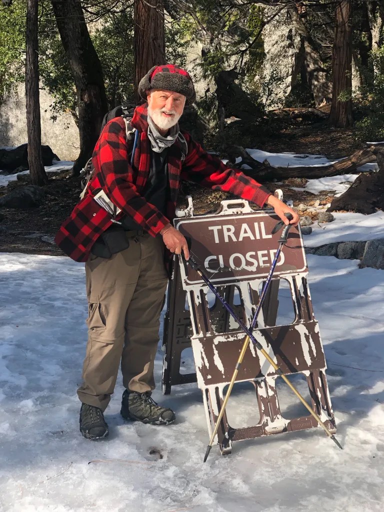
Then it was time to start making our way home. We had no planned itinerary; we were just playing it one day at a time. Taking our time, we discovered the ghost town of Stanton, explored Indian ruins, and walked in the footsteps of dinosaurs.

We did find that mid-February was a bit of a challenge. Nighttime temperatures were a bit low on the first half of the trip, in the low 20s. Many campgrounds were still closed for winter. Having captured over 1000 photos and with many stories to tell, I’ll be posting more details about the trip in separate posts.

Winter Road Trip to Bishop: Memories and Challenges

We missed the Bishop contingent of our family over Thanksgiving since they were hunkered down with Covid. This prompted us to clear our calendars to make the trek over the mountains for a visit. Since the camper had been sitting idle in the driveway for three months, it was no surprise that the battery was dead. A quick trip to the local auto parts store and we were ready to roll. We decided we’d break the drive up over two days.

We like to take our time. It was 10:30 am when we rolled out of the driveway. Highway 89 was open, so we drove over Echo Summit on Highway 50 and then took 89 over Luther Pass and down through Markleeville. It was 5:30 pm when we parked the rig for the night on National Forest land near Mono Lake. It was dark, but we found a spot to camp without much trouble. Four-wheel drive is recommended here since there is soft sand. This is dispersed camping, boondocking if you like. No services. We cooked dinner, turned the heater on and hunkered down for the night. It was 18 degrees when I stepped out of the camper at 7 am the next morning. I wandered around with my camera, fascinated by the stark beauty of our location.

We arrived in Bishop at 10:30 am with plenty of time to get settled before the evening Winter Tradition program at granddaughter Annabelle’s school.

Holiday activities also included a visit the Laws Railroad Museum, where we rode the train and sang Christmas carols with Santa. Daughter-in-law Serena got to show off a quilt project that she participated in.

On December 15 it was time to head home. A winter storm had dumped snow on the mountains, leaving the roads icy. We started our return journey by heading north on 395, but the ice on the roads was intimidating even with four-wheel drive and snow tires.

We turned around and headed south, arriving back in Bishop about noon where we rendezvoused with family for lunch at the Pupfish Cafe. This is one of our favorite local restaurants, noted for their Belgian waffles. From there we continued south going over Walker Pass. We found a gorgeous little campground, Sandy Flat Camp, on the Kern River and spent the night there. We were the only campers in the campground. More photos are available in an online gallery.

Cactus and Red Rock

We recently returned from a 19-day road trip that took us to the heart of the Sonoran Desert near Ajo Arizona, and then north into the red rocks of the Vermillion Cliffs. We covered 1778 miles leaving on February 8 and returning on February 26. The focus of our trip was to travel a bit off the beaten track, to see some natural wonders and to visit places that were dog friendly. Dog friendly meaning, when we park the rig for the night, we can let Carson run free, off-leash. Here’s a glimpse of some of the highlights of our trip. I’ll be posting more about specific portions of the trip so stay tuned.

The Saguaro cactus is the keystone species in the Sonoran Desert, it’s just amazing to see these huge plants growing like they do, up to 50 feet tall.

One of our camping locations near Ajo was on the Barry M Goldwater Range. The range consists of 1.9 million acres of relatively undisturbed Sonoran Desert. While this is a military range, there are some areas that are open to the public. We found this site through iOverlander, one of the resources we use for locating camping.

Camping here requires a permit which is easy to obtain online. Once you have successfully obtained the permit you are given a gate code to unlock a gate. We accessed this location through Gate 15, area B. We boondocked here for two nights. A beautiful spot, although the silence was occasionally punctuated by the sound of fighter jets.

After a few days in the Ajo area we drove north to the Vermillion Cliffs National Monument. There are no paved roads in the Monument, and we put our four-wheel drive to good use driving through deep sand and rough roads. We drove into the Monument to explore the White Pocket, and amazing geologic formation of twisted colorful sandstone. We also explored the Maze Rock Art Site, with several large panels of rock art.

From the Vermillion Hills we made a quick foray into the Escalante Grand Staircase National Monument to explore the old Paria Townsite.

Over the course of the trip, we managed to vary our accommodations a bit. We spent four nights with family and friends, one night in a motel, four nights in paid camp sites, although one of those was essentially dry camping on private property, with a location we found on Hipcamp and we spent 11 nights boondocking. It was refreshing to visit places of natural wonder away from the crowds of so many of the popular locations. While most of the driving was on paved roads we did put our four-wheel drive to good use in several locations. Temperatures ranged from a low of 28 degrees near Joshua Tree to 79 degrees at the visitor center in Death Valley National Park.

White Pocket

One of the destinations for our trip is the Vermillion Cliffs National Monument in Northern Arizona. The website the monument says This remote and unspoiled 280,000-acre monument is a geologic treasure with some of the most spectacular trails and views in the world. We spent several days here. The first night we found an amazing spot to boondock in Marble Canyon right on the edge of a cliff overlooking the Colorado River. This is a location we found using iOverlander.

This is one of those situations where when you think you’ve found a good spot to camp, it’s nice to see what’s further down the road. We had this place all to ourselves. In fact, we felt so isolated I fired up the water heater and hooked up the outside shower.

There are no paved roads within the monument and with deep sand, high clearance and four-wheel drive is essential. I was intrigued with the area called White Pocket so we set off the explore that area.

From US Highway 89A, which skirts the southern edge of the preserve we left the paved road and headed north on House Rock Road. Our first stop along this route was a condor viewing station. We scanned the skies. No Condors. Driving on we found the White Pocket Road. I had downloaded the maps for GaiaGPS, my favorite app for navigation, and we found this quite useful in navigating. We followed the dirt road, and it wasn’t long before we put the Tacoma in four-wheel low and dialed the Multi-Terrain control for sand. That provided a confident ride through the sand.

It was a bumpy. When we opened the back door of the camper to fix lunch, we discovered that all of our silverware had disappeared, and even the drawer which is designed to stay secure had bounced out of the cabinet.

Hiking around White Pocket is basically walking over slick rock. There are no trails, but we had no problem hiking around and exploring various features. These formations consist of twisted and convoluted layers of colorful sandstone which are simply astounding.

After exploring the White Pocket, we found an alternate route, a route that was marked one-way on some maps. I wouldn’t want to meet somebody on these narrow deep sand roads. As the sun was getting lower in the sky, we started to look for a place to boon dock and we found a suitable place to pull the rig off the road and set up camp.

More photos are available in an online gallery.

2023 In Print!

Here it is! All the blog entries from 2023 in a book. This marks the ninth year for my blog and the eighth book. In 2023 I posted 35 times.

Where’s Treve 2023

Travels included Baja California to Lopez Island in the Pacific Northwest. We also make a trip to England. We made good use of our Four Wheel Camper, carrying our kayaks to Baja and Lopez Island.

It’s such a great feeling to pick up the book off the coffee table and browse through last year’s adventures, remembering travels and details that have already grown faint.

The book is 85 pages long. There’s no point in showing much of the book since you can simply view all the original posts on this website. We’ve been using the service Intorealpages.com which makes turning a blog into a book a breeze.

Adventure is worthwhile – Aesop

Back from Bishop

Our adventures recently took us over the Sierra to visit family and celebrate birthdays. We left Bishop on the afternoon on July 29 for our return trip, with a stop at Donna the Dog Lady to pick up our dog Carson. Carson spent the night there since we were involved in some activities where Carson was not welcome.

With daytime temperatures of 100 degrees, we were hoping to gain elevation and find some trees for shade. Green Creek near Bridgeport seemed to offer a good bet for the night. We turned off onto Green Creek Road and followed the well-graded dirt road for a little over six miles, finding a level spot to park the rig for the night at 7900 feet. Carson was happy to wander around camp off-leash. Having set up camp, we discovered that the mosquitos were quite abundant, so we did our best to cover any exposed skin and break out the repellent.

Green Creek is a gorgeous spot with Jeffrey pines, aspen and willows. The California Department of Fish and Game maintains the Green Creek Wildlife Area, a 720-acre protected area that includes habitat for mule deer migration and fawning. It’s also home to black bear, beaver, bald eagle, grouse, mountain quail and various waterfowl. We decided to camp outside of the wildlife area, which is marked with signs.

I wandered around our camp in the evening and again in the morning with my camera, in this case an iPhone 14. I was intrigued by the lush green vegetation, the aspen trees and the wildflowers. We saw lupine, penstemon, and prickly poppies. Once the mosquitos became annoying, it was nice to take refuge in the camper with its screened windows that still offer a view.

Back from Baja

We arrived home on the afternoon of March 28 having logged 3012 miles over the course of 23 days: three of us, Joann, me and our dog Carson. We were a little concerned about taking our dog, but Baja turned out to be quite dog friendly. Along the way we had some amazing adventures, and I captured many photos to sort through and share.

Before we could obtain our Mexican Tourist Cards (FMMs) we had to make a stop in San Diego to renew our passports. If you are planning on traveling to Mexico, check your passport. You need to have at least three months on your passport to apply for an FMM. We discovered this just a few weeks before our trip and we had to scramble to get our passports renewed.

On the trip south we decided to take a quick detour to Anza Borrego to check out the wildflowers. We were not disappointed.

Our traveling rig consists of a pop-up Four Wheel Camper on our Toyota Tacoma. The camper is outfitted with a refrigerator, heater and cooktop. There is no toilet or shower on board, but we’re comfortable taking a shovel out in the woods (or desert) if we are boondocking or taking advantage of facilities including showers in established campgrounds. We also have the rig set up to carry two kayaks.

For planning both prior to the trip and on the road, we used the app iOvelander for locating facilities and Maps.Me for route planning. We discovered a hack that let us import the iOverlander pins into Maps.Me, which proved to be quite useful when we were offline without cell phone signal or Wi-Fi. We also found the Baja California Road and Recreation Atlas from Benchmark Maps useful, as well as Google Maps when we had a cell phone signal.

And of course, sharing travel information with fellow travelers is also fun and informative.

Some of the highlights along the trip included a fabulous lunch with a bottle of wine at Encuentro Guadalupe shortly after crossing the border, camping in the cactus gardens near Catavina, and whale watching in San Ignacio Lagoon.

We had our share of fabulous sunsets and sunrises and we managed to get our kayaks on the water at Bahia Conception and Gonzaga Bay.

Over the course of the trip, we spent 23 nights in our camper. On a couple nights, we were happy to have the camper as protection from fierce winds. The southern-most point in our trip was Playa Coyote on Bahia Conception. Three weeks is just not enough time to see much of Baja. We’re already thinking about our next trip.

Whale Watching: San Ignacio Lagoon

We made reservations ahead of time to go whale watching on San Ignacio Lagoon with Antonio’s Ecotours. We arrived on the afternoon of March 14 and set up camp, which simply means putting the top up on the camper. The drive from San Ignacio is 48 km with 17 of it on gravel. Our rig handled the gravel road just fine, although we did hear comments about the washboard road from people in passenger vehicles.

Our campsite was on a bluff overlooking the lagoon. There was one other campsite occupied when we arrived. We had reservations for two nights camping and a whale watching tour. We had reserved an afternoon whale watching tour on the 15th. Upon arriving, though, we discovered that we could join an earlier tour, so we signed up for 8 a.m.

Camping facilities at Antono’s are rather spartan. There is no electricity or water at the sites. There are composting toilets and a solar heated bucket shower. The staff is very friendly and accommodating. There are also a number of small cottages available to rent. We had dinner in the restaurant with live music before dinner.

While enjoying the view from our campground, we were entertained by a pair of Osprey that were wheeling around just overhead.

In the morning we were at camp headquarters at 7:40 to get outfitted with life jackets. Then we climbed aboard one of the pangas for the 20-minute ride to the whale watching location. I had both my Sony RX100 and a GoPro with me to document the event. Here’s a short video:

It’s just simply amazing to be sitting in one of these small boats with the Grey Whales cruising by, most often pairs with mothers and calves. They will occasionally come so close to the boat that you can reach out and touch them. In the morning, with the sun shining, the spouts would create rainbows. We spent 90 minutes with the whales, and then it was back to land. It’s astounding to think that while we were here as friendly observers, 150 years ago these animals were hunted.

Watching the sun set over the lagoon was beautiful.

Catavina: Cactus Wonderland

We wanted to spend two nights in the vicinity of Catavina. The Cirios and cactus here are fascinating and, along with the rock formations, I thought this would be rich with photo opportunities. I figured two nights would give us opportunity to experience two sunsets and two sunrises and time to explore the cave paintings.

There are plenty of places to boondock in the desert here. We picked a spot that iOverlander identified as “Cactus Wonderland.” We found one other camper here, but we simply drove around to the other side of a rock outcrop and found a quiet spot to camp.

The next morning we walked to the cave paintings. Rather than walk on the highway, we decided to follow a dirt road that appeared to parallel the highway. This worked for a while until we started heading away from the highway. Using a GPS track on my phone from a previous trip, we were able to make our way over some rocks and head in the direction of the cave. Going over the rocks we encountered a rattlesnake hidden in the rocks. He let his presence be known with an alarming rattle.

We kept our distance and continued on to the cave. The cave is a bit of a climb up from the road and the parking area. We were happy to spend a few minutes in the cool respite of the cave since we were feeling the heat of the desert on the hike. As the crow flies, the walk to the cave was just over a mile. We managed to turn that into a 4-mile round trip hike with our meanderings.

True to expectations, this area provided many fascinating photo opportunities. The Cirios or Boojum trees, sometimes called Doctor Seus trees, were quite interesting and fanciful. More photos are available in an online gallery.

Yosemite

On February 7, we made our way to Yosemite, with reservations to stay in Upper Pines Campground, site #46. We arrived in time to get set up before dark. With bear warnings posted about not leaving food in the car, we were concerned about what to do with the food in the camper. We certainly weren’t going to move our entire pantry to the bear box. A ranger assured us that food in the camper would be fine, but food in the cab was an issue.

In the morning we were in no hurry to get out of our cozy sleeping bags. The outside temperature was 32, but we had the heater going in the camper. Since we need the sun to charge our camper battery we drove to a sunny location where we could leave the camper and go for a hike, parking near Yosemite Falls.

We discovered that the trail to the base of the falls was closed and, since we had our dog Carson with us, we were limited to trails that were paved or marked for bicycles. Even so we found plenty of places to walk. We did find that ice cleats, the kind that you can slip on over your boots were quite helpful for walking on icy trails and around camp.

On the second night the heater went out. I woke up at 4 a.m. feeling cold. The heater had shut down. Apparently, the battery went dead. This is a mystery. We should have had ample battery capacity to keep the heater fan going, but here we were with no power. We were prepared for the cold, so while we missed the comfort of a heated camper, we had our winter clothes and we carried on. After some hot coffee, eggs, and sausage we took a hike to Happy Isles.

While Yosemite Valley is an awesome location any time of year, I was not inspired with the iconic views of Yosemite Falls, Bridalveil Falls, Half Dome and El Capitan. It’s hard to beat the drama I’ve captured on previous trips.

What did capture my attention was more intimate landscapes, snowcapped rocks and flowing water at Happy Isles, a leaf in the snow, and Fern Spring.

After a day of exploring a variety of locations – Happy Isles, Swinging Bridge, and a few other sights – the plan was to stay out taking photos until dinner time and then have a nice meal before popping up the camper for the night. We were surprised to find the Ahwahnee closed for renovations, and the restaurant in Curry Village was closed as well. We ended up eating at the Base Camp at Yosemite Lodge. While it served our needs, it was not on par with our previous experiences.

On Friday, February 10, we had a very pleasant hike to Mirror Lake, even if it was a bit chilly. We were on the road heading home shortly after noon. As we left the park, we noted the arrangements that were being made to accommodate the throngs of people who would be coming to photograph the fire fall, a phenomenon that happens with the setting sun shines on Horsetail Falls making it look like it’s on fire. This phenomenon happens in mid to late February.