
So here we are on July 9 ready to hit the road for our 17-day road trip to New Mexico. Check out my Stars and Stripes hat. Our motivation for the trip was to attend a family reunion in Angel Fire, New Mexico. We decided to take our time making our way to our destination. I decided since we’d be hobnobbing with cowboys at the reunion, I needed an appropriate hat, and with the Fourth of July recently passed this seemed to be an appropriate statement for driving across Nevada, Utah, and New Mexico.


We covered 3,000 miles on the trip, and I’ll be breaking up some of the highlights into several blog posts. I’d like to start with some thoughts about trip planning. While I’m quite happy to hop in the truck and see where we end up at the end of the day, my wife, Joann, likes to plan ahead. For this trip Joann spent hours and hours of research and prepared a folder with our itinerary, copies of all the camping reservations including photos of the facilities. Much of the trip was planned using Google Maps and a host of other online resources such as iOverlander, The Dyrt, Hipcamp, and other such resources. All of these are great.
Then a day or two before the trip we pulled out some printed maps and we discovered all the places we were missing. I had a flashback to the days when we used to spend hours pouring over maps looking at the sights along the way. Google Maps is great for getting from point A to point B efficiently, but it won’t suggest you make a quick detour to check out Mesa Verde or take the Turquoise Trail. And for much of the trip we were out of range of cell service, which meant that trying to use an iPhone to look up camping, or even use Google Maps for routes, was futile. What do you do when you come to a fork in the road, and Google Maps is silent and you don’t have a map of the area? Another reason to have printed maps available while on the road.
Our first night we stayed at Logger Camp on the Stampede Reservoir not far from Truckee. This was a lively camp full of families enjoying summer fun. Since our route would take us through some hot country, we planned our stops be at elevations where we would not suffer from heat; we do not have air-conditioning in the camper.


When we travel, I like to have occasional access to the internet. I don’t want my clients thinking I’ve abandoned them, so an occasional stop at a coffee shop with WiFi was in order. And then in Mancos we visited with a good friend, Kayla, a neighbor that our daughter grew up with. We foraged in her garden and, as a professional cook and caterer, she hosted an exquisite dinner.

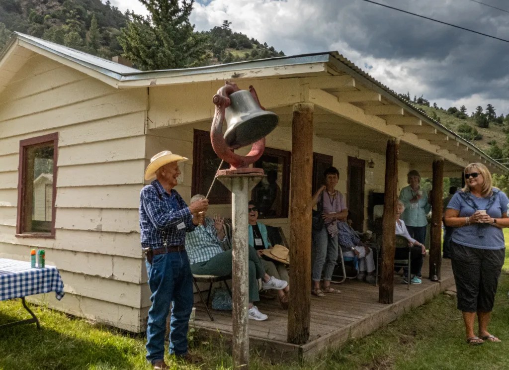

Once we were in Angel Fire, it was time for the reunion. And no Sundt family reunion would be complete without watermelon and the dinner bell’s call to eat on the C and S Cattle Company Ranch. By the time we reached Angel Fire it was also time to replenish our water supply. We were looking forward to taking showers with our outdoor shower.


Our return trip took us through Taos and Flagstaff. We spent one night Boondocking in the Coconino National Forest just outside of Flagstaff. There we were treated to a spectacular thunder and lightning storm that dumped rain and hail on us. We also stopped at the Petrified Forest National Park which turned out to be quite interesting. I’ve never seen so much petrified wood in such a large area. And, of course, we had to venture on to a section of Route 66 where we encountered Burma Shave signs. Stay tuned for more episodes of our trip.